
Flash flooding and hail wreaks havoc on east coast
Wild weather has lashed the country’s east coast, bringing giant hail stones, snow, flash flooding, huge surf and dangerous winds.
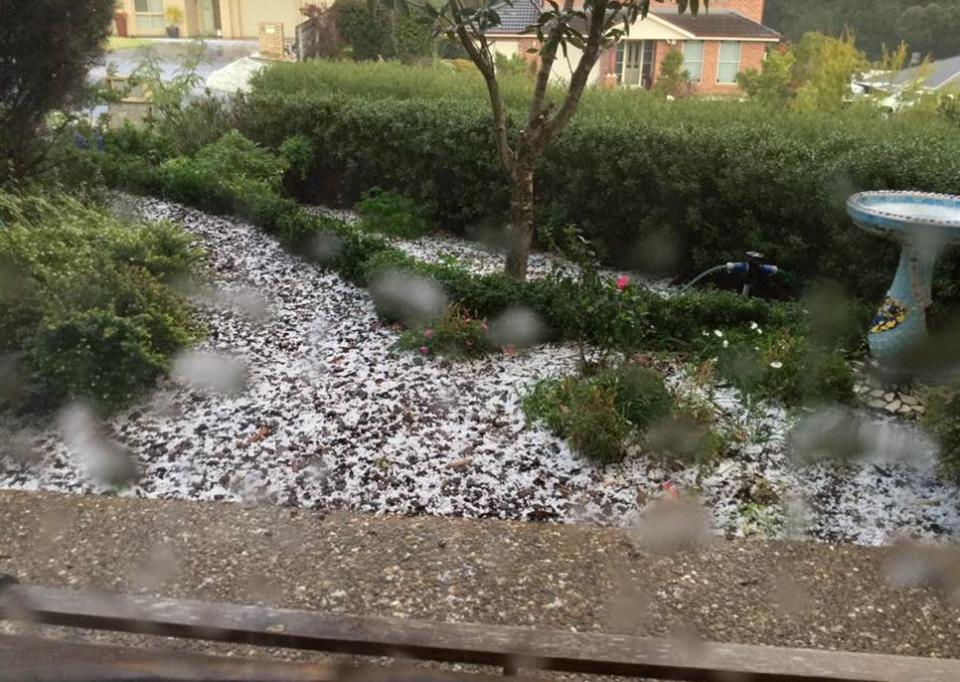
Sydney’s affluent suburb of Mosman experienced hail the size of marbles on Monday afternoon, while giant waves and powerful gusts hit other parts of the city.
Authorities have warned the public to steer clear of the water, with swells up to six metres expected to slam into the coast as a low-pressure system crossed the state.
Gusts up to 90km/h are expected in far southeasterly parts of the state, while gale force winds and snowfalls could lead to blizzard conditions in the Alpine region.
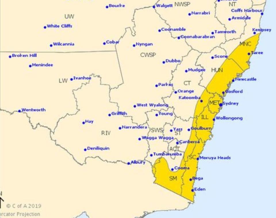
Severe weather likely to continue for rest of today and tomorrow for parts of NSW/VIC as a low pressure system deepens over the Tasman Sea.
Get the latest warnings at https://t.co/uxW3JWfwiW pic.twitter.com/NXLPtBe8gk— Bureau of Meteorology, Australia (@BOM_au) June 3, 2019
Winds are expected to develop in the far southeast from late Monday, then extend north on Tuesday.
The worst of the gusts will affect central parts of the coast including the Sydney Metro area throughout Tuesday morning, according to the Bureau of Meteorology.
“Areas most affected by the damaging winds will be the coastal fringes and the higher parts of the ranges,’ BoM’s weather warning stated.
“Wind gusts across the Alpine peaks may reach 125 km/h late Monday and early Tuesday. Winds then are expected to gradually ease from the south during Tuesday afternoon.”
Orange, in the Central Tablelands, experienced freezing temperatures and a widespread dusting of snow on Monday.
On the south coast in Ulladulla, residents posted video and photos of heavy hail blanketing their properties in a snow-like form.
Ski resorts in Perisher and Thredbo also had snow, with an icy minimum of -3 degrees.
The State Emergency Service has warned people to move their cars undercover and away from tress, and to secure loose items around the home.
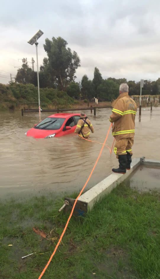
In the Melbourne suburb of Altona Meadows, firefighters responded to a driver trapped inside a car in flood waters on Monday afternoon.
The driver was safely removed from the car, prompting a stern warning to never drive through “incredibly dangerous” flood water.
BoM said severe weather was likely to continue throughout Monday evening and Tuesday for parts of New South Wales and Victoria as a low-pressure system deepened over the Tasman Sea.
The weather system however will move over NSW on Wednesday, leaving us with a relatively dry rest of the week.
Brisbane can expect a relatively dry week, with 15mm of rain only expected on Saturday.
It will be a wet end of the week in Perth, with 15mm predicted on Thursday with rain continuing until Sunday.
This week will be mostly sunny in Adelaide, Hobart and Darwin.
Do you have a story tip? Email: newsroomau@yahoonews.com.
You can also follow us on Facebook, download the Yahoo News app from iTunes or Google Play and stay up to date with the latest news with Yahoo’s daily newsletter. Sign up here.

