
Damaging winds, torrential rain and hail: Severe weather warning for southeast coast
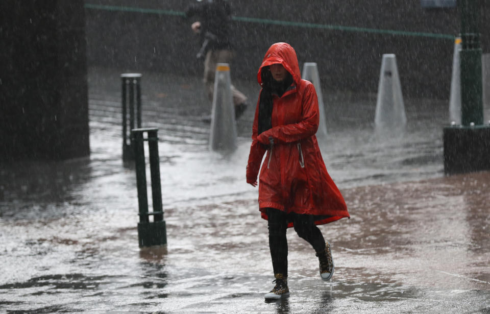
Melbourne is copping heavy showers and Sydney is expected to be lashed with torrential rain as winter well and truly arrives.
Up to 25mm is expected to fall in Melbourne today, with showers likely during the morning and afternoon, the Bureau of Meteorology says.
The city could also be hit with hail and thunder this morning with strong wind gusts of up to 50km/h predicted.
A nice band of rain across the outer western suburbs at the moment! #Melbourne CBD saw some heavy rain before sunrise, looking clearer at the moment but should see rain and showers redevelop this morning https://t.co/g7qJ6g2esx pic.twitter.com/3mBjyplybI
— Bureau of Meteorology, Victoria (@BOM_Vic) June 2, 2019
Today is expected to be the coldest of the week in Melbourne, with a maximum temperature of just 12 degrees forecast.
Damaging winds of up to 120km/h are predicted across the alpine area and heavy rain could lead to flash flooding across parts of Victoria’s central district.
Blizzard conditions are predicted in the Victorian alps with gale force winds and snowfall likely.
Sydneysiders are also bracing for wild weather on Tuesday, with up to 50mm rain expected to lash the city.
Tuesday will also be the city’s coldest day this week with a top of just 17.
Strong winds of up to 55km/h will hit the city throughout tomorrow morning.
“The main day for rain in Sydney will be tomorrow with a current forecast of 30 to 50mm of rain over the day,” Bureau of Meteorologist forecaster Elli Blandford told Yahoo News Australia.
“There’s a very high chance of showers most likely in the morning but we are expecting rainfall throughout the whole day.”
The heavy rain will ease tomorrow evening but light showers are still expected on Wednesday.
Ms Blandford said a weather system in the Tasman Sea was responsible for the torrential rain, strong winds and colder temperatures.

The rain for Sydney comes after water restrictions began in the region on June 1 due to falling dam levels.
The NSW Central West will also receive some much needed rain on Monday night and Tuesday while damaging surf will pound the NSW coast. Snow will fall in areas above 1000m.
The Bureau of Meteorology has issued a severe weather warning with peak damaging winds in excess of 90km/h expected to develop along the coastal fringe of the state.
NSW’s south coast will cop it even worse than Sydney tomorrow, with up to 60mm of rain to fall.
The BoM says large and powerful surf conditions are expected to be hazardous for coastal activities like rock fishing, swimming and surfing.
The Central Coast will be lashed with 45mm of rain on Tuesday and Newcastle will be hit with 40mm.
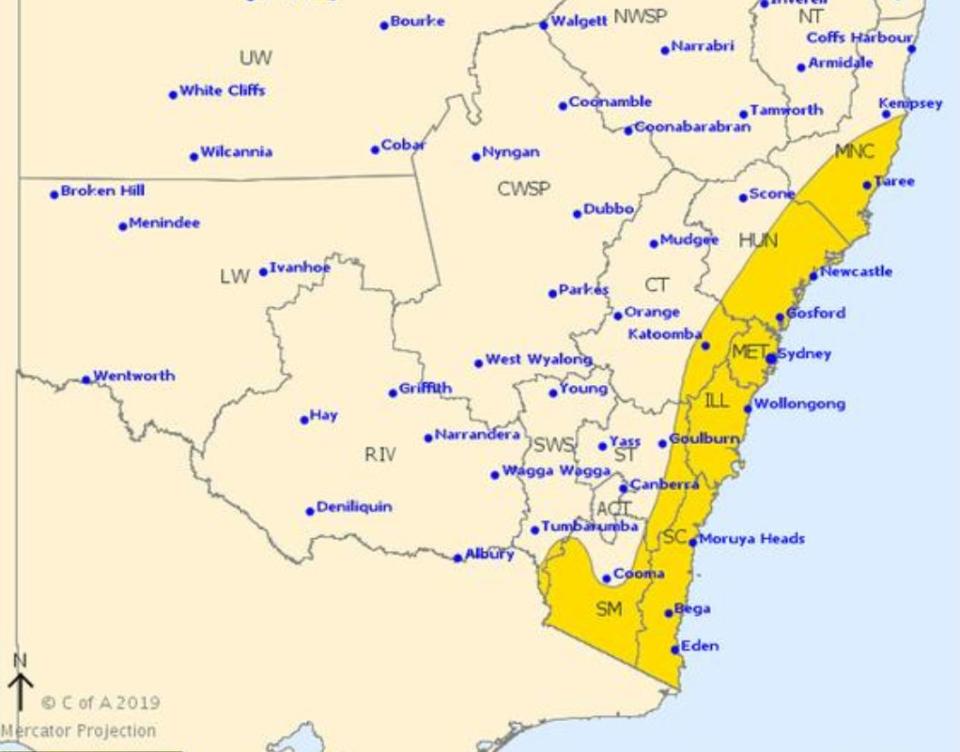
The weather system however will move over NSW on Wednesday, leaving us with a relatively dry rest of the week.
Brisbane can expect a relatively dry week, with 15mm of rain only expected on Saturday. It will be a wet end of the week in Perth, with 15mm predicted on Thursday with rain continuing until Sunday.
This week will be mostly sunny in Adelaide, Hobart and Darwin.
Do you have a story tip? Email: newsroomau@yahoonews.com.
You can also follow us on Facebook, download the Yahoo News app from iTunes or Google Play and stay up to date with the latest news with Yahoo’s daily newsletter. Sign up here.

