
Ferocious cold front set to bring damaging winds and heavy downpours to Australia's south east
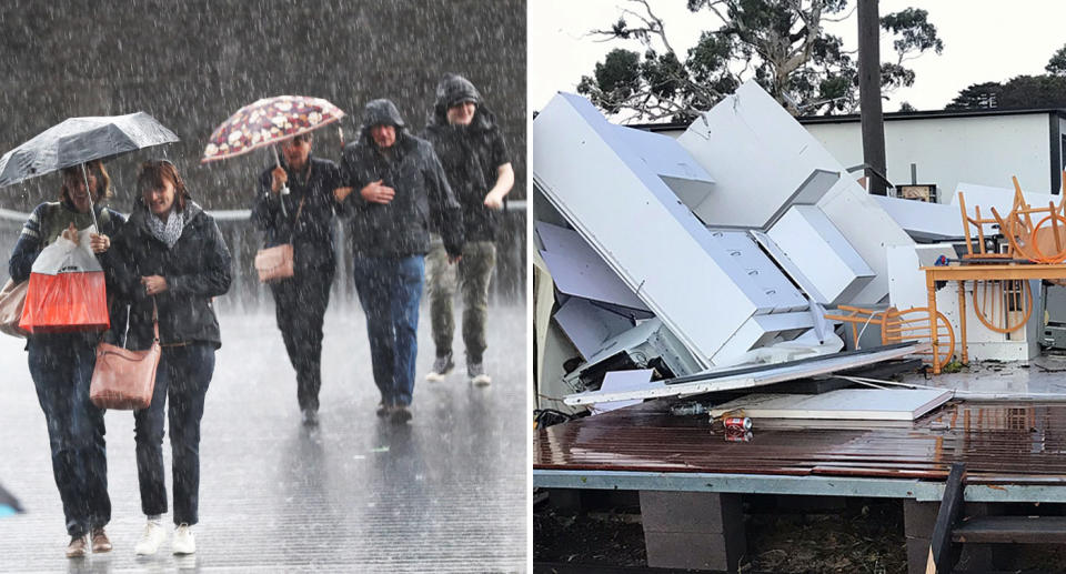
A powerful cold front surging towards south eastern parts of the country will bring damaging winds and dangerous downpours, sparking a severe weather warning.
The worst of the weather will strike Wednesday and blast a significant part Victoria with wind gusts up to 120km/h, according to the Bureau of Meteorology.
“A cold front coming into the state early tomorrow will bring another good bout of rain. We’re predicting about 20-30mils across quite a bit of Victoria,” forecaster Tony Bannister told Yahoo News Australia.
Mr Bannister said a severe weather warning for strong wind gusts had been issued for a large part of the state, including east and south Gippsland, north west areas, and Melbourne.
He added the worst of the wind would affect Alpine regions and be strongest at a significant elevation above sea level.
“The gusts will mainly be elevated above 1200m with winds getting stronger during the day in the breezy alpine areas and northeast alps,” Mr Bannister said.
“Those areas will see up to 120km/h gusts, in the central ranges up to 110km/h, and up to 100km/h gusts in westerly areas.”
He said damaging winds would impact on hilly areas the most, but warned people in more highly populated suburbs should also keep their wits about them.
Mr Bannister said conditions would ease after Wednesday, with some isolated fronts expected for later on Thursday and Sunday.
Melbourne will have its warmest day of the week on Tuesday with a top of 18 degrees, then have its temperature drop a degree each day until next week.
Those in Sydney can expect widespread showers and up to 10ml of rain on Thursday, with temperatures expecting to continue hovering around 22-23 degrees.
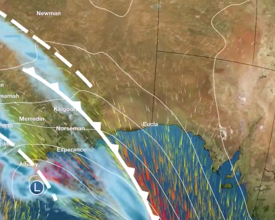
The Western Australian coast has continued to be battered with powerful storms for the fifth consecutive day, with a severe weather warning remaining in place for south west parts of the state.
Strong cold front bringing damaging winds and damaging surf to parts of SW #WA. Cloudband across the southeast producing rain areas, showers and isolated storms. Highest totals have been over northern Tasmania. Very windy in the alps. Latest at https://t.co/mnRFIbllYv pic.twitter.com/wMefY7Vxz1
— Bureau of Meteorology, Australia (@BOM_au) June 10, 2019
People in Bunbury and Albany are bracing for gale force winds, massive surf, and unseasonably high tides as wild weather continues to bear down on the state.
Adelaide can also expect heavy rainfall with up to 20ml on the cards for South Australia’s capital city, and Tasmania’s Launceston is also due for a 25ml dumping on Wednesday and Thursday.
Northern parts of the east coast will avoid wet and windy weather with Brisbane set for a dry week and a top of 27, and Darwin expecting a high of 32.
Canberra remains chilly, but in comparison to last week’s freezing low of -6, is set for a relatively mild low this weekend with -2 expected.
Do you have a story tip? Email: newsroomau@yahoonews.com.
You can also follow us on Facebook, download the Yahoo News app from iTunes or Google Play and stay up to date with the latest news with Yahoo’s daily newsletter. Sign up here.

