
Early winter blast to bring coldest April days in 60 years

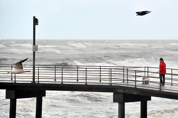
The lockdown restrictions may be easing up but unfortunately the weather “is all downhill from here”, says the Bureau of Meteorology.
BOM meteorologist Dr Kyle Morgan said rain, wind and thunderstorms are “all on the way” in southern parts of the country over the second-half of this week.
Maximum temperatures are forecast to be eight to 14 degrees below the average for this time of the year.
“This is a very strong and widespread cold outbreak across the southeast on the kind of scale we haven’t seen around April since 2008,” Dr Morgan said.
The cold front clipped the south of Western Australia on Tuesday morning and moved east. It’s expected to strengthen as it links up with clouds over South Australia.
“Rain will be a main feature over the next few days,” Dr Morgan said.
“Welcome in many areas but causing riverine and flash flooding in others.
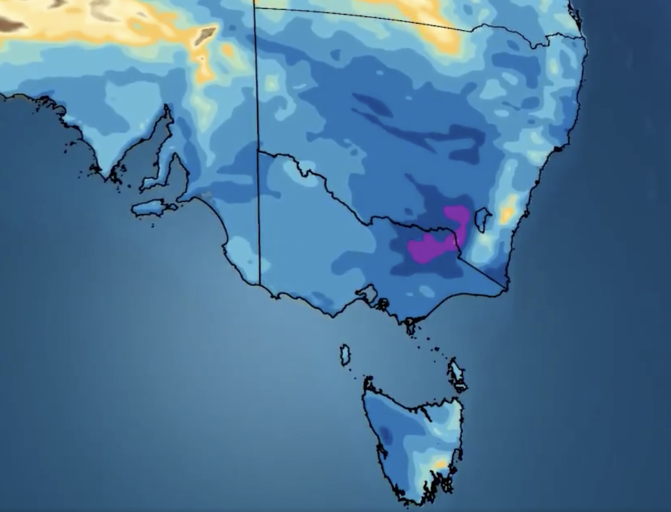
Widespread falls over more than 15mm should hit across the southeast from southern parts of South Australia through to Victoria from Thursday afternoon.
The coldest air will move into the southeast on Thursday, Dr Morgan said.
“For some parts of northern South Australia, northwest NSW and southwest Queensland, it will be their coldest April day since the 1960s or 1970s,” he said.
Victoria’s coldest May day in 20 years
Melbourne’s rain will mostly come down on Wednesday with up to 25mm forecast with most of it to fall on Wednesday afternoon.
Expect a maximum of 19 degrees before it drops to a maximum of just 13 on both Thursday and Friday. Showers will somewhat ease on Thursday but Friday could see as much as 15mm fall.
Dr Morgan said Friday’s temperature is about six degrees lower than the average for this time of the year and Thursday potentially the coldest April day since 1996.
“Some parts (of Victoria and NSW) will see their coldest May day since the year 2000,” he said.
Light rain is forecast for the weekend but shouldn’t be any more than 2-5mm.
Lows are forecast for between 7 to 10 leading into next week.
Corryong, which sits south of the state border with NSW, is in for far more of a drenching with up to 35mm forecast on Thursday and 20mm on Friday before easing on the weekend.
It’s forecast for a top of 18 on Wednesday, but the maximum could get as low as 9 on Friday with a low of 3.
Albury-Wodonga, on the state border, could also get as much as 60mm on Wednesday with similar temperatures to its eastern neighbour in Corryong.
BOM said flood watches remain in place for parts of North East and Central Victoria and Gippsland, with between 15-40mm recorded for the 24 hours leading up to 9am on Wednesday.
In the 24 hours leading up to 10.30am on Wednesday, 107.2mm of rain was recorded at Falls Creek, 78.4mm at Hunters Hill and 67.2mm at Mongans Bridge.
At 2am, Mt Hotham recorded wind gusts of up to 107km/h.
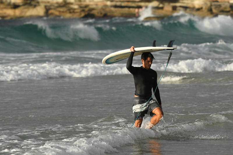
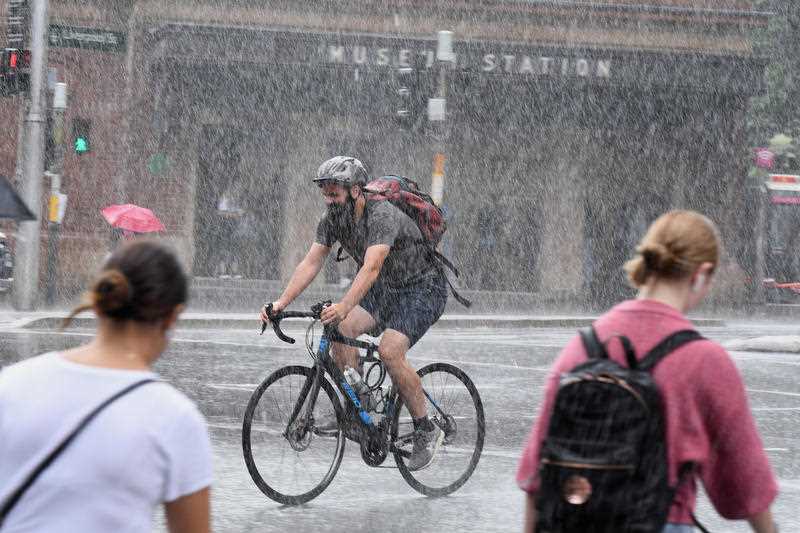
Bondi Beach open but Sydney set for rain
Areas across NSW are in for a temperature drop and a downpour.
Thredbo in the Snowy Mountains is set for snow on Thursday but not before a lashing of between 120-150mm of rain on Wednesday.
Temperatures will fall as low as zero on Thursday, followed by lows of -4 across the weekend.
A severe weather warning remains in place for the Southern Slopes with winds forecast between 80-120km/h on Wednesday and early Thursday.
Dr Morgan said it is possible blizzards might occur in alpine areas.
Eden, on the NSW Far South Coast, has rain developing on Wednesday with up to 30mm expected on Thursday.
From a maximum of 23 on Wednesday, temperatures are forecast to only hit as high as between 15 to 17 from Thursday through to next week.
Showers will clear but expect lows between 8-10.
Bondi Beach has reopened but the surf and the sand might not be the best place for Sydneysiders on Thursday with 10-25mm of rain forecast with a high of 25.
It’ll get chillier from there though, with Sydney residents in for a top of 16 on Friday and then 20 through Saturday to Monday. Expect lows of about 11.
Similar temperatures are expected for Byron Bay but Northern NSW will miss out on the heavy rain with just 4-8mm forecast for Thursday.
South Australia set to cool with Adelaide Hills drenched
Adelaide’s metro area is forecast for temperatures as low as 9 and high as 19 from Thursday right across the weekend.
Wednesday’s when most of the rain will hit with up to 15mm. Up to 10mm is forecast for Thursday before light rain hits Friday and Saturday with about 4mm.
However, up to 60mm of rain is forecast to hit the Adelaide Hills on Wednesday.
Oodnadatta and Marla in South Australia’s north will cool from Thursday with temperatures dropping from highs in the low 20s to about 18.
Canberra set for earliest winter’s day since 1952
Canberra residents will want a warm jumper for Friday with a maximum of 7 and low of 3 forecast.
“It would make it its earliest sub-10 degree day this side of winter since 1952,” Dr Morgan said.
Wednesday will bring rain with more on Thursday, expects falls of between 15-25mm in the nation’s capital on Thursday.
Saturday and Sunday will bring drier conditions and warmer temperatures with tops of about 12-14.
However, Sunday will bring a bone-chilling low of 1.
Tasmania chills
Parts of southern Tasmania won’t receive the deluge but will have a temperature drop.
From a high of 20 on Wednesday, Saturday could only see a top of just 10 in Hobart.
Expect sporadic rain throughout the rest of the week too but nothing heavier than about 8-10mm.
Launceston can expect more rain on Thursday than its southern neighbours with up to 20mm forecast.
It’ll be slightly warmer though with tops of 13-15 for the rest of the week.
Sun shines in the Sunshine state
They don’t call it the sunshine state for nothing and Queenslanders should avoid most of the heavy rain with light showers forecast on Thursday.
Max temperatures will decrease as the week’s go on though – it’s expected to drop from a high of 28 on Wednesday to a top of 23 on Friday.
That max should hold up across the weekend, but the low of 13 on Friday is forecast to drop to a low of 9 on the weekend.
Expect similar conditions on the Gold Coast.
Stanthorpe in the state’s Granite Belt is in for a big chill.
From light rain and a top of 24 on Thursday, the maximum is expected to plummet by 10 degrees on Friday.
That should hold through the weekend but the lows could sit as cold as -3.
BOM predicts some “morning frost”.
Anywhere north of and including Central Queensland shouldn’t expect any dramatic changes in temperature with highs in the high-20s.
Business as usual in Western Australia
Western Australia won’t feel the brunt of the cold front with southern parts of the state unaffected by the rain.
Perth will warm from Friday onwards with a top of 22 on Thursday heating up to 27 by Saturday.
Further north and Exmouth and Coral Bay can expect top temperatures in the low 30s for the rest of the week through to the weekend.
Alice Springs set for temperature drop
The cold front’s too far away to impact much of the Northern Territory.
Temperatures in Darwin should stay around the mid-30s through to next week.
However, Alice Springs will drop from a high of 32 on Wednesday to a max of between 18-19 for the rest of the week.
Lows across the weekend are forecast for about 5 degrees in the Alice.
Do you have a story tip? Email: newsroomau@yahoonews.com.
You can also follow us on Facebook, Instagram and Twitter and download the Yahoo News app from the App Store or Google Play.


