
'Unpredictable' thunderstorms drenching Australia's east coast

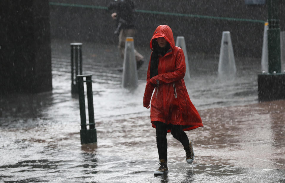
Australia’s east coast has copped a drenching, with some drought-affected areas hit with their heaviest rainfall in months.
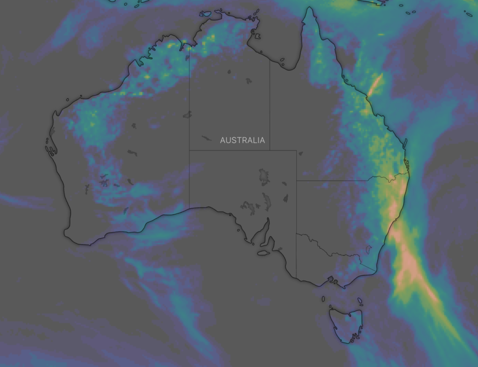
Most of NSW is expected to welcome much-needed rainfall, with parts of the state already receiving almost 50mm in the past 24 hours as of 9am Thursday morning.
Some of the areas worst hit by bushfires, such as parts of the Blue Mountains have been soaked, with Mount Boyce receiving 20mm and Linden and Falconbridge 48mm, but the rainfall won’t be enough to extinguish all of the fires.
According the the Bureau of Meteorology, this week will be a wetter than average week in Australia, particularly in southeast Queensland and northern parts of NSW.
Armidale, in the Northern Rivers region, has been hit with 25mm while Mount Seaview, about an hour from Port Macquarie, copped 39mm.
Penrith recorded the highest amount of rainfall in the Sydney Basin, with 20mm falling on Thursday morning.
Hey #Sydney! You're looking mighty fine under that #rain this morning! Best fall overnight in the metro 18mm at #Penrith. Today the chance of a #thunderstorm in the Sydney basin, mainly this afternoon and evening, with possible heavy rain. Latest forecast: https://t.co/6WjMBCQ4e1 pic.twitter.com/QYYsOYeBQe
— Bureau of Meteorology, New South Wales (@BOM_NSW) January 15, 2020
Thunderstorms are forecast around NSW on Thursday afternoon but the bureau says the storms will be “hit and miss”, meaning it is difficult to predict exactly where the heaviest rain would fall.
“Thunderstorms are unpredictable and we will be following the development from the eastern part of the state today and tomorrow,” BoM forecaster Abrar Shabren told Yahoo News Australia.
Up to 35mm is predicted in Sydney on Thursday, with a further 20mm expected on Friday.
Rainfall will continue into the weekend, with up to 25mm forecast for Sydney on Saturday and just 3mm on Sunday.

Areas around the South Coast and Southern Tablelands are predicted to receive up to 30mm but the Bureau of Meteorology says the rain will be patchy and exact falls are difficult to predict.
Melbourne cops heavy rain, flash flooding
Heavy rain, flash flooding and thunderstorms swept through Melbourne on Wednesday night but did little to extinguish bushfires in the alpine and East Gippsland regions.
While most of the city received between 10 to 25mm of rain since Wednesday afternoon, just 5 to 10mm fell in fire regions – not enough to suppress blazes, some of which have been burning since late November.
Gelantipy, about 50km north of Buchan in East Gippsland, was an exception with about 20mm as of Thursday morning.
In Melbourne's west, more than 77mm fell at St Albans and Avalon saw 49mm with wind gusts of 133km/h.
The State Emergency Service received more than 580 calls for help with building damage, trees down and flash flooding. The district of Brimbank, in the northwest, was worst hit.
The storm helped clear the hazardous bushfire smoke blanketing the city on Wednesday, which had caused the closure of a runway at Melbourne Airport and delayed some flights.
The Environment Protection Authority has rated the air quality in Melbourne as moderate, though in East Gippsland and the northeast of the state it is still very poor.
The smoke also hindered efforts to help the 857 homes and business still without power in fire-affected towns in the regions.
AusNet crews from Melbourne joined a police escort into Mallacoota via NSW on Wednesday and are expected to begin restoration works by next week.
"We are working tirelessly to assess and inspect the damage to our network and restore their power as soon as is safely possible," Managing Director Tony Narvaez said in a statement.
"In doing this our absolute priority is the safety of these communities and of our crews."
There are 19 active fires across the state with eight watch and act alerts in place.
Significant rainfall in drought-stricken Queensland town
Stanthorpe, in Queensland’s southeast, has been experiencing seriously desperate times in the drought, with some children only bathing every three days in an attempt to preserve water.
Locals have been forced to buy water from the council and pay to have it carted home.
It is the biggest dry spell to affect the community, about 200km southwest of Brisbane, since 1873.
But according to BoM, a much-needed 15mm had fallen by 9am on Thursday morning.
Up to 20mm is forecast in the area on Friday and 15mm on Saturday.
Already 25mm of rain has also fallen in the drought-affected community of Cunnamulla, in southwest Queensland.
With AAP
Do you have a story tip? Email: newsroomau@yahoonews.com.
You can also follow us on Facebook, Instagram and Twitter and download the Yahoo News app from the App Store or Google Play.


