
Polar blast brings snow, wild winds

Many Aussies are in for another chilly weekend as a cold front sends temperatures plunging, with damaging winds and showers forecast.
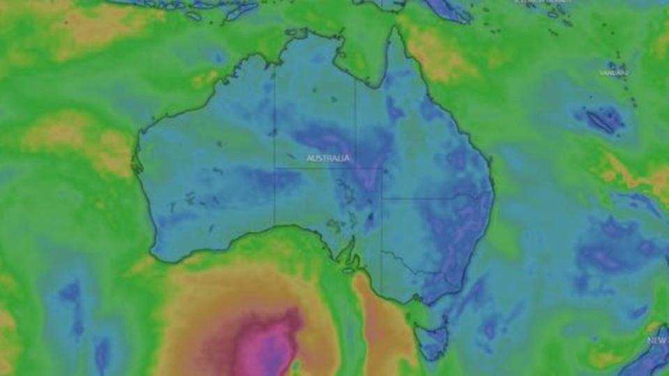
An Antarctic air mass is tracking towards southeast Australia, bringing chilly and damp conditions to widespread areas.
The system is predicted to link up with a northwest cloud band which will bring thick cloud and rain.
Melburnians will be reaching for their winter woolies on Saturday and Sunday as the mercury looks to set to remain under 12C.
Cold front sweeping across SE Aus brings rain, gusty winds and cold to Tas, Vic, SA
Severe Weather Warnings are current for damaging winds and blizzard conditions for alpine areas of Vic and NSW.
Latest forecasts, warnings, https://t.co/R682vIKRsk
or the BOM Weather app pic.twitter.com/gyvBssXiZs— Bureau of Meteorology, Australia (@BOM_au) June 29, 2024
There’s a high chance of rain in Melbourne for both days, meteorologists also expect northerly winds of 35 to 50 km/h.
Sydneysiders are in luck as temperatures look set to reach a high on 20C on Saturday, with a slight chance of fog in the morning.

Temperatures will drop slight on Sunday, as there is a high chance of showers in the morning.
Light winds are expected to become south to south-westerly during the day then becoming light during the evening.
The weather system will move into Queensland on Sunday.
Bureau of Meteorology (BOM) meteorologist Angus Hines said there was a broad spray of rain across the state, but it would not have much of an impact or cause any flooding, with rain in the northeast thinning out.
The northeast could see between 40 to 80mm in a number of places in eastern and central Queensland including the northern goldfields, coalfields and highlands.
The Capricornia coast, Whitsundays and lower vertical coast through the middle of the state could expect a few showers.
Rainfall around Brisbane and the southeast should receive about 5 to 10mm.
He said a cold front is going to reach Tasmania “very early” on Saturday morning.
“Hobart will pick up some wet weather,” he said.
BOM forecasts that alpine areas will see wind, showers and snow across the weekend, as a strong front forecast to move across southeast Australia.
“Saturday night and Sunday we’re likely to see a decent dump of snow in elevated Tasmania as well as the mountains in Victoria,” he said.
“It’s to be the most significant dump of snow this winter.”


BOM forecasts there will be about 15-30 cm of snow is expected in those areas.
Strong winds are likely across the resorts and surrounding areas for Saturday and Sunday as school holidays kick off.
Western facing parts of South Australia including Mount Gambier and Adelaide and parts of the Peninsula should receive up to 10 to 20mm of rain.
The Antarctic air mass will cause temperatures to drop even further over the weekend in Adelaide, with the mercury hitting just 14C for a five-day stretch.

