
Millions to shiver through coldest morning
Sydney and Melbourne are set to shiver through their coldest mornings of the year as a widespread frost band cripples parts of the eastern states.
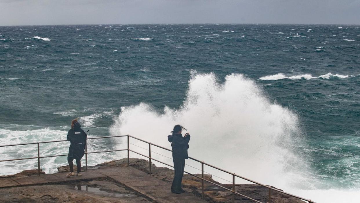
The mercury has already plunged to record lows for multiple capital cities as a cold front moves across the eastern third of the country, bringing with it icy mornings and even colder nights.
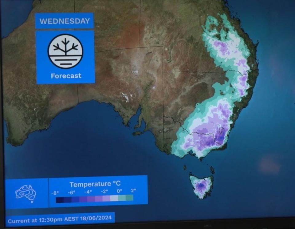
Widespread frost has also been forecast across central Queensland, down the eastern seaboard into NSW and Victoria, and ending in Tasmania.
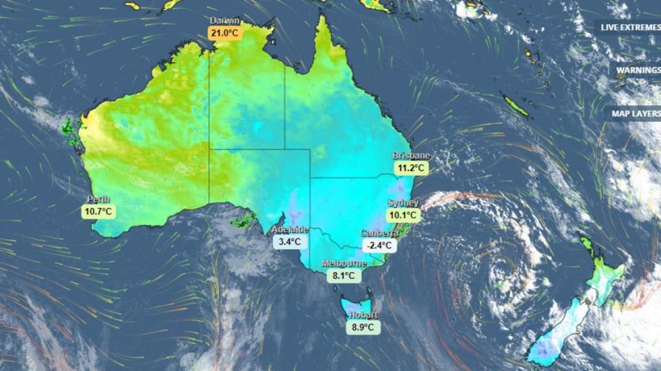
The Bureau of Meteorology (BOM) says Wednesday will be the coldest morning of the year for Sydney and Melbourne – with minimum temperatures clawing to only 6 degrees and 2 degrees respectively.
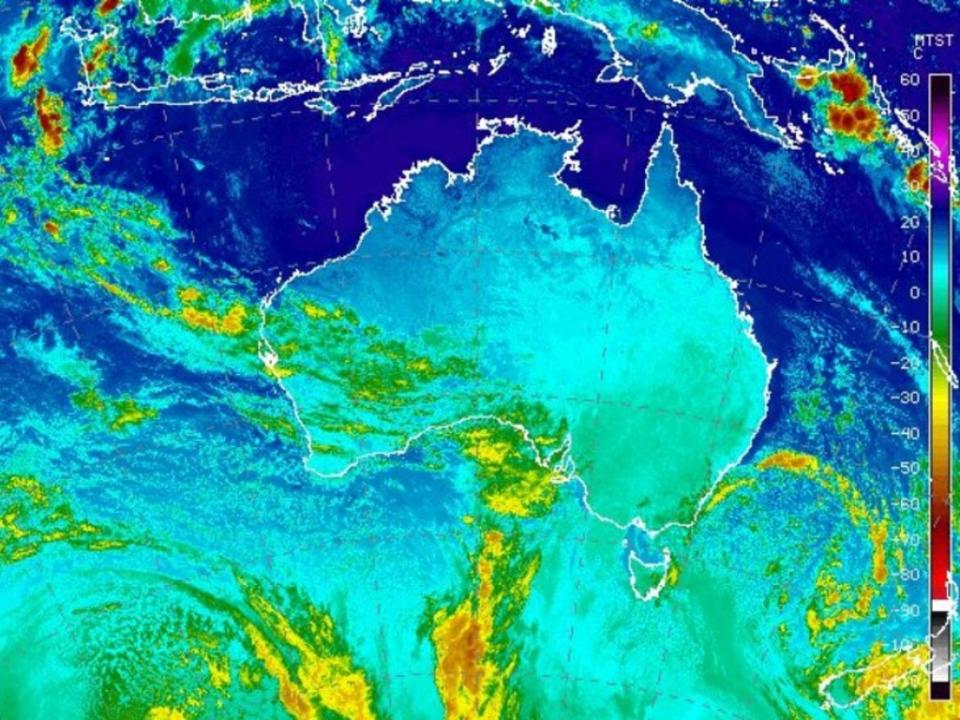
BOM meteorologist Christie Johnson said a large, low-pressure system out in the Tasman Sea was driving cold, polar air over eastern Australia, up from the southern ocean.
Overnight, Canberra’s mercury is forecast to plunge to -3 degrees.
The outback Queensland town of Roma and Launceston in Tasmania will shiver through minimum temperatures of -1 degrees.
Ms Johnson said the risk of cold temperatures amplified the risk of frost, revealing the BOM had forecast a wide frost band over parts of central Queensland, extending through NSW and Victoria and into Tasmania.
“Over Tasmania last night, we saw quite a lot of black ice, particularly through inland parts,” she said.
“That’s likely to be a risk again tonight.
“If you’re in that part of the world, please take care while you’re travelling on the roads.”
Widespread frost is expected to redevelop over the weekend, covering much of eastern Australia and even extending into South Australia and the southern part of the Northern Territory.
Earlier, Sky News Weather meteorologist Alison Osborne said daytime temperatures were still close to average for June.
“We have quite a cold southerly wind over the eastern third of the country, it’s pretty cloud free as well.
“This time of year, when you have a clear sky overnight it generally translates to very cold conditions in the morning because the heat escapes very quickly.”
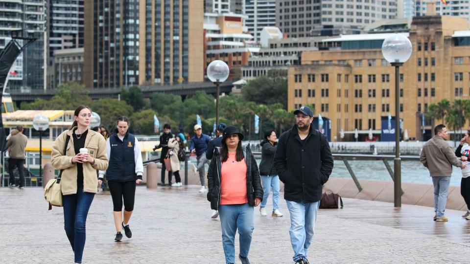
Sydneysiders will have to rug up as the harbour city is set to shiver through a low of just five degrees on Wednesday.
However, the mercury is expected to rise towards to end of the week as a band of clouds moves west through to South Australia.
“For Sydneysiders, there will be lovely winter sunshine Tuesday and Wednesday afternoon,” Ms Osbourne said.
“It’s almost like the price we pay for our beautiful winter afternoons is we do get those bitterly cold mornings.”
South Australia felt the chill on Monday as the state recorded its coldest morning of the year on Monday, with the mercury falling to just 4C.
Brisbane is also experiencing cooler than average temperatures for June with a low of 8C expected on Tuesday.
Hobart will see its warmest day on Thursday with a high of 17C.
Minimum temperatures will linger around 4C and 5C throughout the week.

