
Polar blast headed for eastern Australia states
Millions of Australians will shiver through wild winds and rain with an icy start to the weekend as temperatures are expected to drop again.
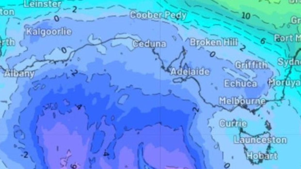
Fierce winds, snow and wind will sweep into the south-east over the coming days, with the Bureau of Meteorology citing an Antarctic airmass responsible for the chilly weather.
The low-pressure system is tracking towards south-east Australia, bringing chilly and damp conditions to widespread areas.
The system is predicted to link up with a north-west cloud band which will bring thick cloud and rain.
South Australia will see the brunt of the weather on Friday before it moves into Victoria and NSW into the weekend.
Many southeast regions of the country will suffer through cold nights throughout next week, with clear skies causing temperatures to plummet.
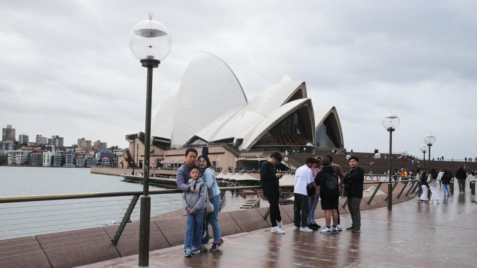
BOM meteorologist Angus Hines said NSW is expecting an icy start on Friday morning, but a pleasant afternoon with Sydney reaching 18C and many areas in the south hitting 13C.
But the sunshine isn’t forecast to hang around for long, with heavy rain expected to return to the city on Sunday.
Temperatures will drop in Sydney, with the maximum temperature to reach a high of just 16C.
The weather system will move into Queensland on Sunday.
Mr Hines said there was a broad spray of rain across the state, but it would not have much of an impact or cause any flooding, with rain in the northeast thinning out.
The northeast could see between 40 to 80mm in a number of places in eastern and central Queensland including the northern goldfields, coalfields and highlands.
The Capricornia coast, Whitsundays and lower vertical coast through the middle of the state could expect a few showers.
Rainfall around Brisbane and the southeast should receive about 5 to 10mm.

While not much rain is expected in Victoria, most areas will receive up to 5mm, with snowfall expected to fall at areas above 1400m.
Melbourne will see high temperatures of only 12C during the chilly blast.
Northern Tasmania will pick up the most rain with about 30 to 50mm forecast.
Western facing parts of South Australia including Mount Gambier and Adelaide and parts of the Peninsula should receive up to 10 to 20mm of rain.
The Antarctic airmass will cause temperatures to drop even further over the weekend in Adelaide, with the mercury hitting just 14C for a five-day stretch.

In Western Australia there has been a significant amount of wet weather that came through with a cold front on Wednesday bringing rain to a large part of the state.
Mr Hines said it was followed by a low pressure area which would generate showers and thunderstorms, with a possibility of severe thunderstorms in the Wheatbelt and Central West, which could bring heavy rainfall, damaging gusts or large hail.
Perth could also expect more showers and storms on Friday but would dry up by the afternoon.

Mr Hines said the rain in WA was widespread with many places in the Wheatbelt and Pilbara would receive up to 20 to 40mm.
Perth is slightly drier with about 10 to 20mm in the city, and up towards Geraldton and Carnarvon there could be up to 40mm.
“If you are along the WA coast there will be some very hazardous ocean waves and high tides,” Mr Hines said.
“It is still winter, it is still cold and it is still single digits for most of the nation but some places will be a bit warmer than what was felt over the last 10 days with cold frosty mornings.”

