
Midweek severe storms to trim heat, humidity in Northeast

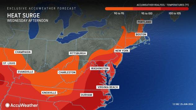


Temperatures and humidity are on the upswing into midweek across the northeastern United States, but the surge will be short-lived, AccuWeather meteorologists say, as an approaching cold front triggers severe thunderstorms that will slice into the hot and humid air into Wednesday night.
With the cold front still well to the West, thunderstorms were erupting as far north as Ontario and Quebec and as far to the south as the lower Mississippi Valley as of the afternoon hours.
 |
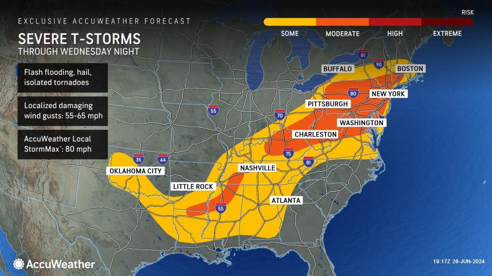
The risk of some thunderstorms packing strong wind gusts, hail and disruptive downpours will extend from upstate New York and central New England to Kentucky, Tennessee and Mississippi in areas east of the Mississippi River.
AccuWeather meteorologists have outlined a moderate risk of severe weather into Wednesday night from Connecticut to Kentucky, as well as parts of Tennesse, Mississippi, Arkansas and Louisiana. A moderate risk means numerous storms are in store in the zone, which can produce damaging wind gusts, hail and flash flooding.
 |
The New York City, Philadelphia, Baltimore and Washington, D.C., metro areas are within the moderate risk zone along the Interstate 95 corridor. While there can be a stray gusty thunderstorm beforehand, most of the severe thunderstorm risk will occur well after evening rush hour along much of I-95 in the mid-Atlantic and New England.
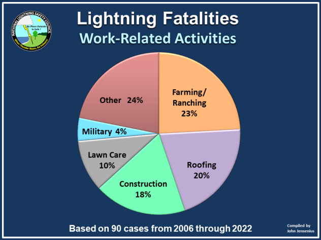
A thunderstorm does not have to be severe to bring danger. Lightning is by far the most dangerous aspect of any thunderstorm and can strike without notice. Experts warn that people should move indoors at the first rumble of thunder.
 |
Lightning fatalities during work-related activities. (National Lightning Safety Council) |
A picnic pavilion, overhang, tent, or golf cart are not considered safe havens against a lightning strike. Standing beneath a tree can be especially dangerous, as lightning often strikes the tallest object in a location, and the discharge may travel to ground level.
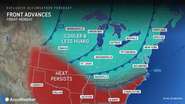
In the wake of the front Thursday, or where rain and thunderstorms occur early in the day Wednesday, temperatures and humidity levels will once again be trimmed. High temperatures will trend downward by 8-15 degrees from midweek peaks Thursday.
 |
On Thursday, highs will range from the upper 60s to the mid-70s in the central and northern Appalachians to the mid-80s to near 90 along the lower part of the mid-Atlantic.
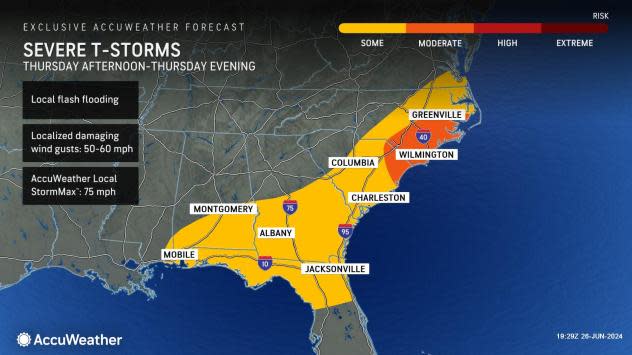
Thunderstorms will erupt ahead of the cool front in the Southeast states on Thursday. Thunderstorms will be severe during the afternoon and evening in part of the zone from southeastern Virginia to the panhandles of Florida, Alabama and Mississippi.
 |
Following a refreshingly cool Thursday night, high temperatures Friday will be several degrees lower than Thursday.
Looking ahead, the Northeast is likely to experience another bump in temperatures and humidity levels over the weekend, with another round of showers and thunderstorms.
 |
The strongest storms on Saturday will extend from the Ohio Valley to the eastern Great Lakes. However, showers and embedded thunderstorms may waste no time farther to the east in New England and in part of the mid-Atlantic. The heaviest storms will tend to fire along the Atlantic Seaboard on Sunday to Sunday night.
Yet another, perhaps more substantial dip in temperatures and humidity will occur early next week for the start of July.
 |
Monday, July 1 may begin with a refreshing breeze, cool air and low humidity in the Northeast, which may seem a bit more typical of September.
Want next-level safety, ad-free? Unlock advanced, hyperlocal severe weather alerts when you subscribe to Premium+ on the AccuWeather app. AccuWeather Alerts™ are prompted by our expert meteorologists who monitor and analyze dangerous weather risks 24/7 to keep you and your family safer.
