
From farmland to suburbia: Aerial photos 10 years apart show incredible transformation
Incredible aerial photos have revealed the dramatic transformation of land, infrastructure and homes across western Sydney over the past 10 years.
Last week, Australia’s population hit 25 million despite experts previously predicting it was not expected to reach the milestone for a few more decades.
Nearmap executive Shane Preston said with the Australian government planning to invest $2.9 billion over the next 10 years to accommodate the booming population, more and more change can be expected.
The aerial shots, snapped of Sydney’s western suburbs including Box Hill, Parramatta and Penrith, already show the dramatic reduction in land to make room for houses, stadiums and train stations.
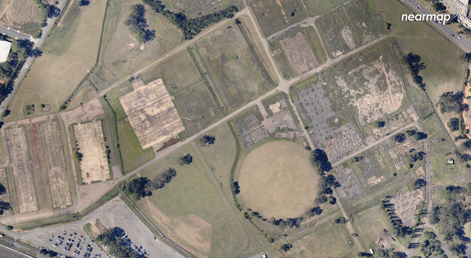
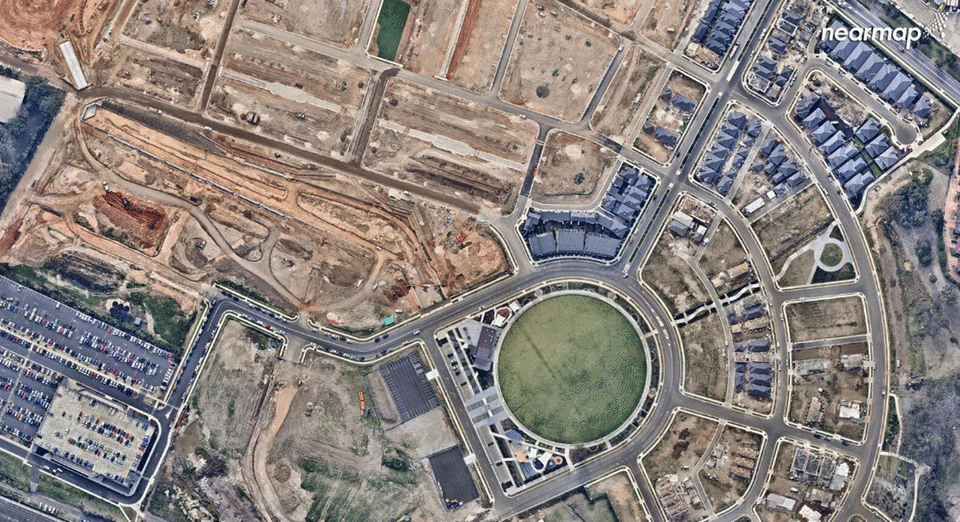
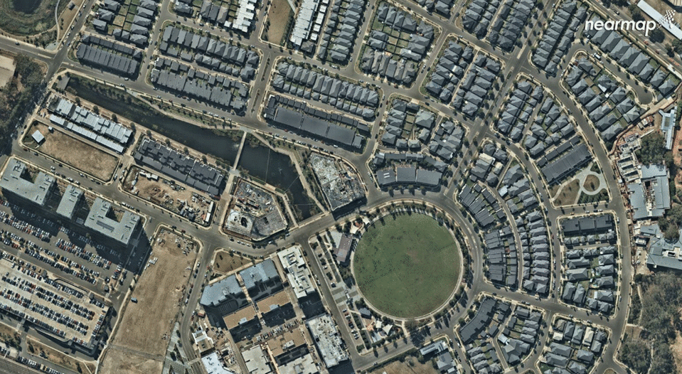
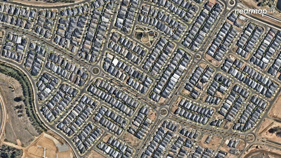
A photo of Penrith taken in December 2009 show a barren landscape virtually unrecognisable from today’s scene apart from a sports oval.
The 2014 picture reveals the addition of a few residential properties, a huge car park and some construction.
The most recent image, from April 2018 shows the completed construction and rows of almost identical houses.
The aerial shots of Kellyville and Box Hill over the decade show how creeks were dried up and green fields stripped to make way for construction.
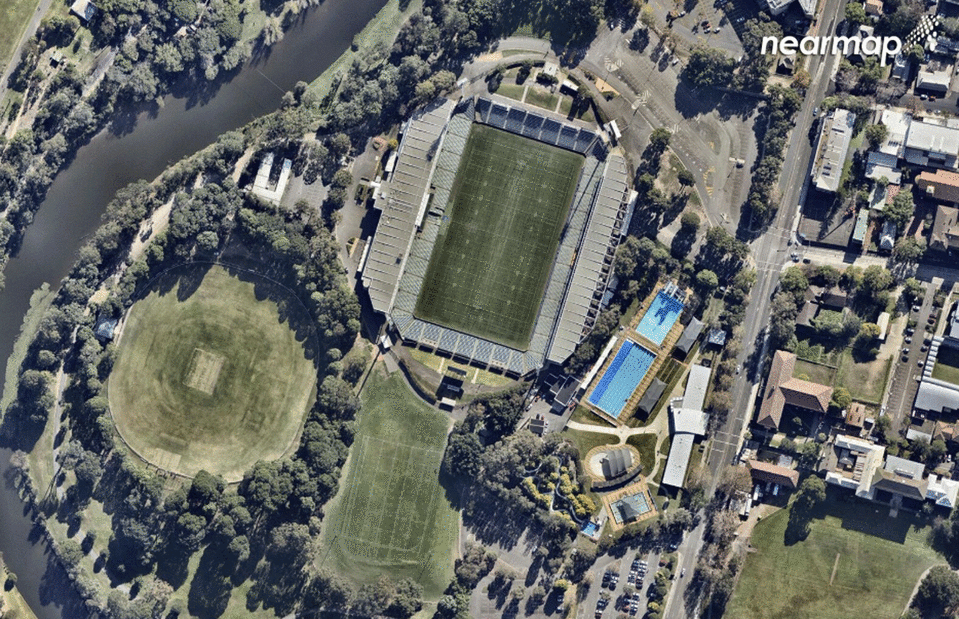
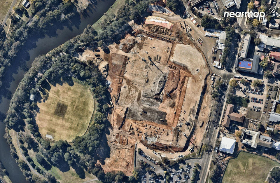
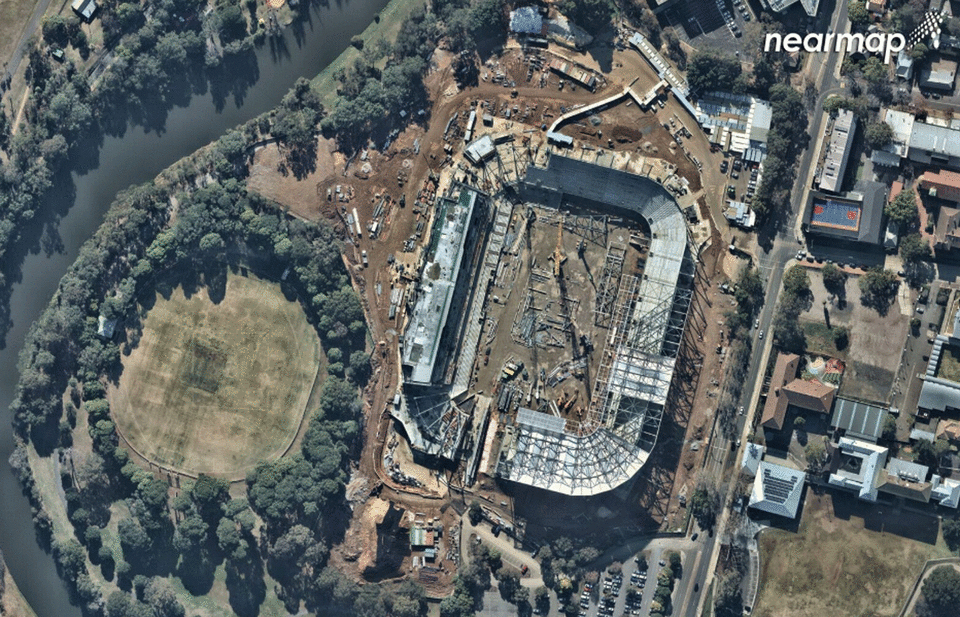
Western Sydney Stadium nearing completion
The erection of the Western Sydney stadium, which is replacing the demolished Parramatta Stadium, was also captured in the photos. The mammoth stadium is planned to be open in mid 2019 with a 30,000 seat capacity.
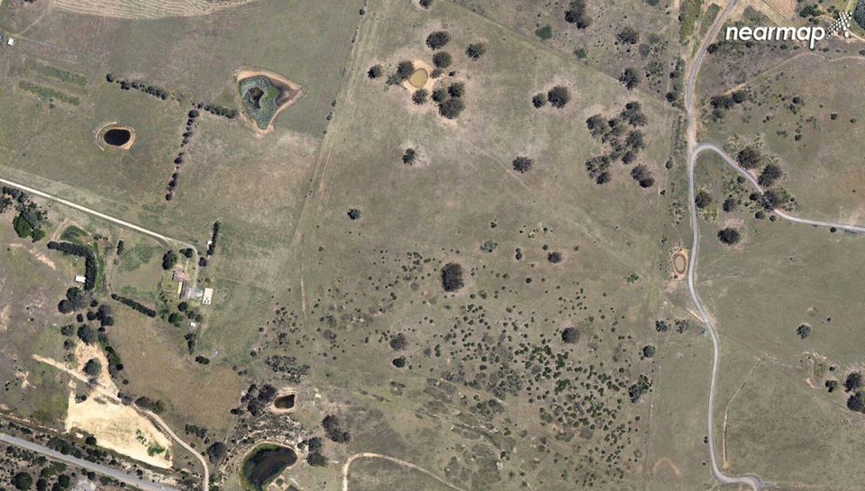
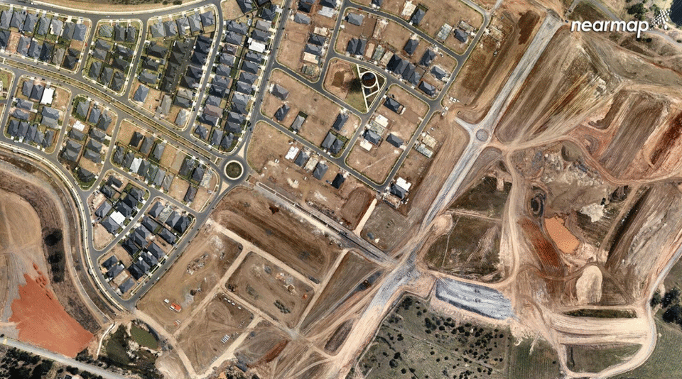
The rapid transformation of Spring Farm, Macarthur
One of the most dramatic, visual changes is represented in the images of Spring Farm in the Macarthur region of Sydney over the past decade.
Until recently, the area was mainly farmland with a winery and underwent suburban redevelopment.
Mr Preston said the aerial photos are increasingly important as the region prepares for growth with the population spike.
“Local government can remotely evaluate the suitability of a proposed area for development, monitor its progress to ensure it remains compliant, and communicate updates to the community once complete, all without leaving the office,” he said.
“The ability to replace physical site visits with virtual ones, not only saves time and resources, speeds up the development lifecycle, but also eases congestion woes and reduces the carbon footprint by taking hundreds, if not thousands of cars off the road every year.
Australia’s population to hit 26 million by 2021
“Building the right infrastructure for urban growth is a challenging task but access to sophisticated technology will ensure our urban areas remain places people want to live, while supporting a booming population.”
The ABS population clock estimates that the nation’s population is increasing by one person every one minute and 23 seconds.
If that pace continues, Australia’s population is expected to hit 26 million in another three years from now.

