
Extraordinary satellite images show massive dust cloud over NSW
Satellite images have shown the extent of a large dust storm that accumulated underneath cloud across NSW, blanketing most of the state with thick haze.
The skies of Sydney and surrounds were filled with the dust cloud as temperatures climbed to over 40 degrees on Thursday.

The images were posted on Twitter by Weatherzone developer Andrew Miskelly who described them as: “Cumulonimbus clouds over SE NSW and the ACT cast lengthy shadows across the dusty air beneath”.
The dust travelled from Central NSW where it lingered over Sydney hiding underneath heavy cloud.
Mr Miskelly also posted images of Topsoil captured by the sentinel-2 satellite taking flight near Nyngan.
Topsoil takes flight near Nyngan, NSW earlier today. Imagery from Sentinel-2. https://t.co/dXNOyMIIsi pic.twitter.com/f8JCUTGbmu
— Andrew Miskelly (@andrewmiskelly) January 23, 2020
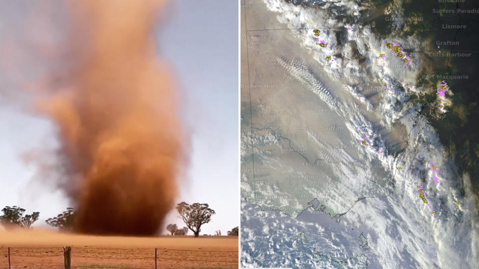
An image of a dust twister was also captured in Parkes before it swept across the rest of NSW and lingered under cloud.
The dust is expected to move further inland throughout Friday as BOM predicts damaging winds of up to 90 km/h around areas in Newcastle and the Central Coast.
Do you have a story tip? Email: newsroomau@yahoonews.com.
You can also follow us on Facebook, Instagram and Twitter and download the Yahoo News app from the App Store or Google Play.


