
Heat, fires, floods: wild weekend weather
Areas of outback Queensland are facing isolation as floodwaters cut them off, while Melbourne is sizzling through its hottest day of the year so far.
Ex-Tropic Cyclone Kirrily is continuing to drench northern Queensland, despite crossing the coast more than a week ago. Meanwhile, authorities are watching another tropical low which is gaining strength in the Coral Sea.
Conversely, Victoria has been put on bushfire alert as the mercury soars across the state.
Other areas of the country are also experiencing peak summer weather, with temperatures above forecast for above 30 degrees for all capital cities except Hobart which will chill at a max of 21C and Perth which is expecting 27C.
Victoria
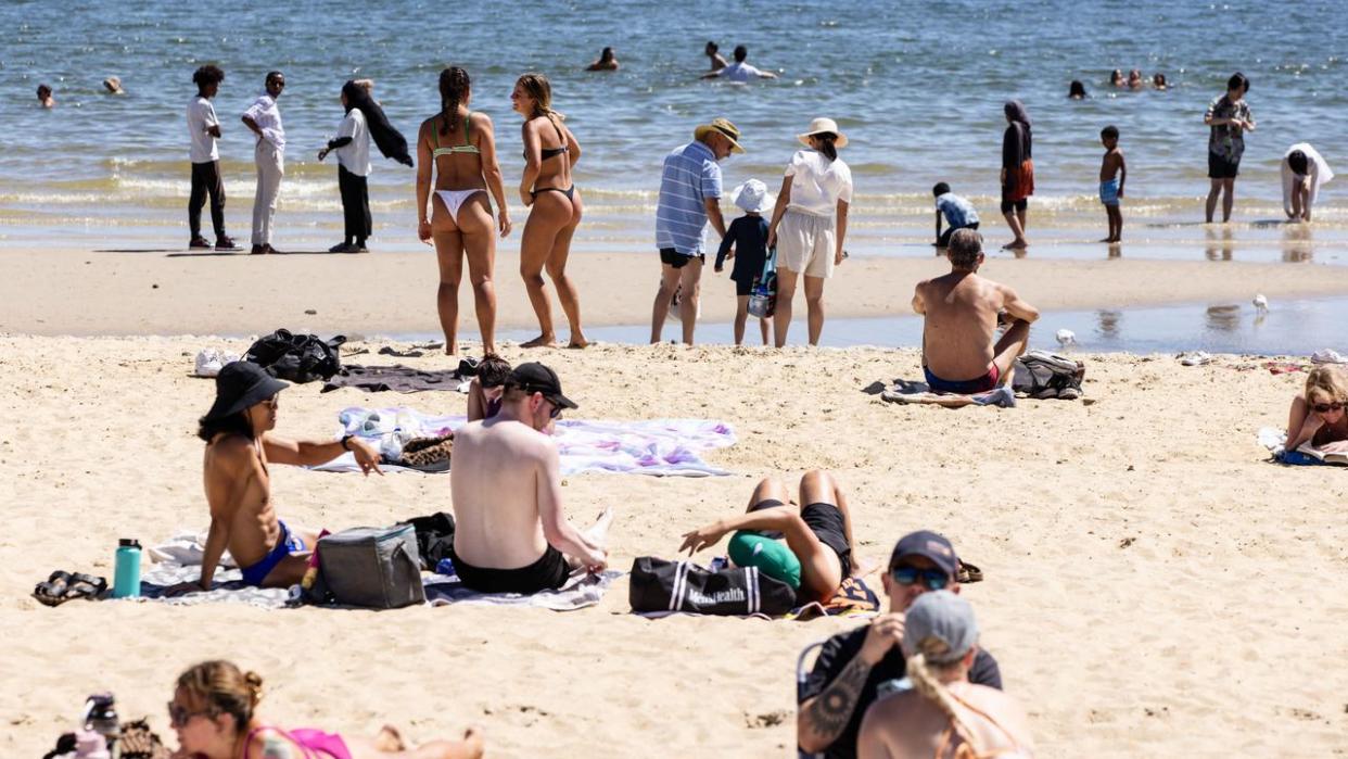
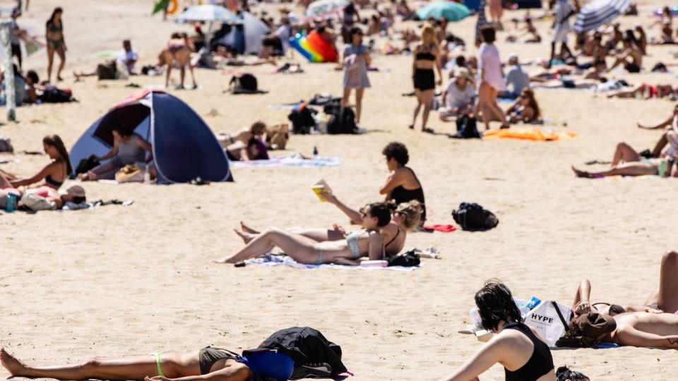
After a mild start to the summer, Sunday’s 38 degree heat will be the first day of the year classified by the Bureau of Meteorology as “hot” for the Victorian capital.
Hot, blustery winds will characterise the scorcher, with winds of 40km/h in some parts of Victoria.
The extreme conditions have prompted a total fire ban in parts of the state and a weather warning for extreme fire danger, with the Mallee and Wimmera districts at particular risk.
Due to the extreme risk, the CFA has recommended all locals enact their bushfire survival plans and said everyone should monitor the fire and weather situation via radio or television.

CFA chief officer Jason Heffernan said community members needed to be alert.
“We’re expecting northwest to north-easterly winds around 25 to 40 km/h and a south-westerly wind change in the afternoon,” he said.
“The wind change will make it challenging for firefighters on a fireground.”
Bureau forecaster Morgan Pumpa said despite metropolitan Victorians sweating through Sunday, it was regional areas that would be enduring the worst of the heat.
“Mildura will be among the hottest temperatures and expected to reach 43 degrees,” Ms Pumpa told the Herald Sun.
“Temperatures are often higher in February.
“Keep in mind the sea breeze may be uncomfortably hot if you go to the beach and ensure to keep watch for fire danger alerts in your area, excluding east Gippsland.”
She said the toasty temperatures would drop on Monday as the cool change blew through, with much of next week sitting in the mid-20 degree range.

Queensland
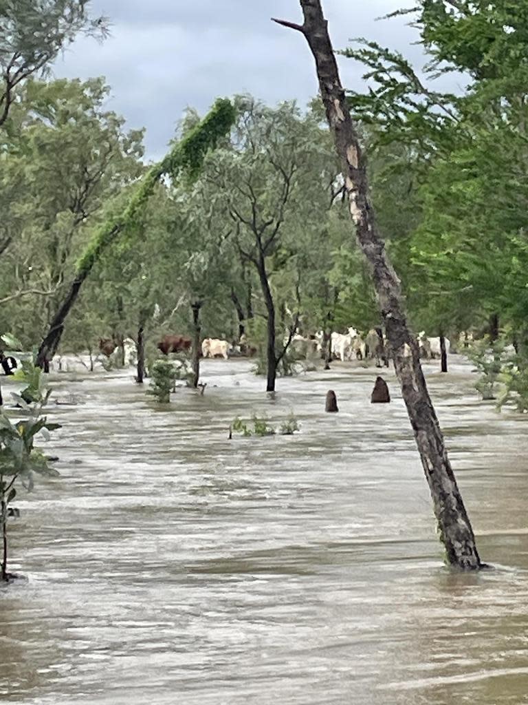
It comes as a biblical trifecta of weather events continue to lash Queensland, with floods, heatwaves and another cyclone on the cards.
Since ex-Tropical Cyclone Kirrily tore through the state’s Gulf region - dumping more than 600mm of rain in three days - much of the state has been left in disrepair and the effects of the cyclone are still rippling.
Weather warnings now stand in the northwest for severe flooding, in the southeast for heatwave conditions, and the whole state on alert for the season’s third cyclone.
Bureau of Meteorology senior meteorologist Felim Hanniffy said the system was now tracking towards southwest Queensland.
“We’ll see an easing in the heavy rainfall risk as it moves away but we will probably still have some significant protracted flooding across western Queensland,” Mr Hanniffy said to the Courier Mail.
“You’re probably looking at several weeks of flood events as flood peaks move down among the river systems.”
He said the impending heatwave in the southeast would be “low intensity”, but the high humidity would make the oppressive heat even heavier.

“Temperatures are about two to three degrees above average,” he said.
“It may get one to two degrees warmer as we go through the early parts of this coming week … we are looking at a continuation of those low intensity heatwave conditions.”
Brisbane will also sweat through a humid and sticky few days, with the city forecast to not drop below 30 degrees for the rest of the week
The rest of Queensland is returning to cyclone preparation mode, with a tropical low brewing in the Coral Sea that could develop into a cyclone next week.
Mr Hanniffy said the chances of it developing into a cyclone increases to ten per cent on Wednesday, and increases again to a “moderate” chance by Thursday and Friday.
“The system during next week is expected to take on a more western track towards the Queensland coast, but there is still large uncertainty on whether we’ll see a land falling system,” he said.
“But some of the scenarios do suggest the coastal crossing is possible later this week or over the weekend.
“By the middle of this week, we will have a better idea of where that system is going to go”.

