
Cyclone threat worsens off Aus coast

The worst is yet to come for a severe cyclone swirling off Queensland’s coast, with warnings it could reach a category five storm as officials are unable to confirm whether it will hit Australia’s shores.
Cyclone Jasper is currently a category three storm raging 1390km northeast of Cairns, and the Bureau of Meteorology (BOM) is predicting it is likely to move southwest over the next few days while gaining strength.
Jasper will become a high end category four or even a category five cyclone on Thursday night as it moves over the Coral Sea.

“Jasper is forecast to gradually move in a general south-westerly track towards the Queensland coast early next week,” the bureau warns.
“At this stage the highest risk of a cyclone impact is the region north of Mackay but the timing and severity of the coastal impact remains highly uncertain at this stage.”
The path of cyclones is notoriously difficult to predict over a long period, but Jasper will be guided toward Queensland’s coast by a strong upper-level ridge according to WeatherZone’s Ben Domensino.
“This ridge is likely to steer Jasper in a westerly direction towards the end of this week, allowing it to approach Australia,” he said.
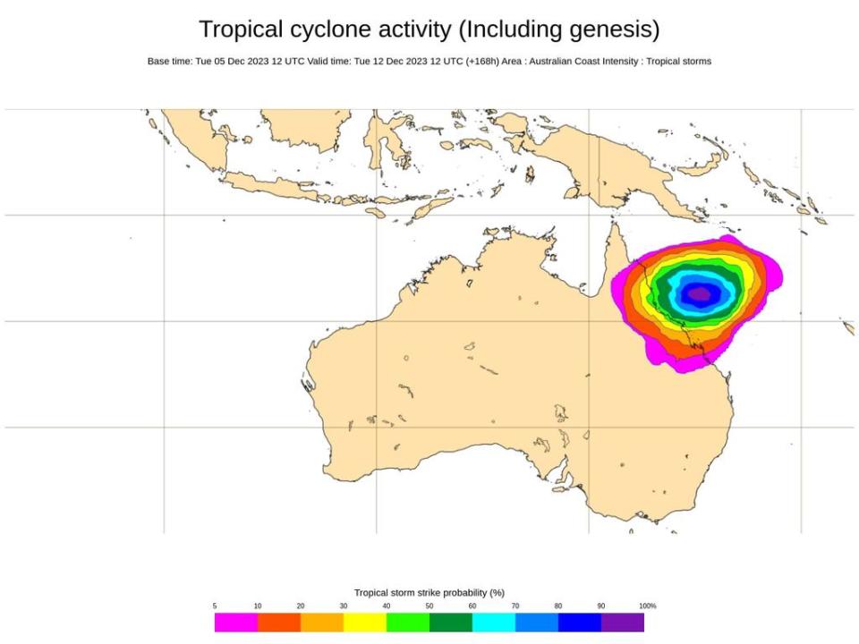
While it’s likely the cyclone will make landfall, it’s not yet known how much it will impact Australian residents.
While North Queenslanders are bracing for a cyclone, millions of Australians further south have been warned they could be at risk of heat-related illness as blisteringly high temperatures are set to roll in over the next three days.
Residents in parts of NSW, Queensland, Western Australia and South Australia have been urged to be on high alert from Wednesday for the signs of heatstroke and heat exhaustion, with cautions also in place for the Northern Territory and the ACT.
The mercury is expected to soar to a high of 42C on Saturday in parts of Western Sydney after reaching the high thirties on Friday, spelling a painful start to summer for some.
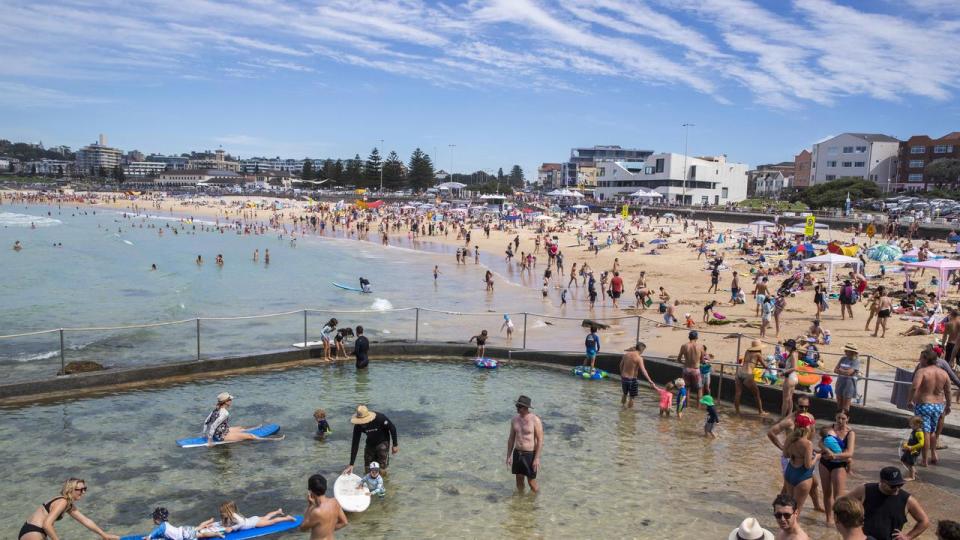
There are particular concerns for Sydneysiders this weekend, with a litany of outdoor events due to bring hundreds outside.
Thousands will be planning trips to one of the many concerts on this Saturday including The Foo Fighters and 50 Cent at Sydney Olympic Park, Dermont Kennedy at the Opera House and Alex G at the Metro Theatre in the CBD.
Festivalgoers planning on attending the Let the Good Times Roll festival on The Central Coast on Sunday have also been warned to be on the look out for signs of heat stress.
Those who are over the age of 65, babies and young children, those with certain medical conditions, people who work outside, pregnant women and those who live alone are all at increased risk of suffering illness when the heatwave strikes according to NSW Health’s Dr Jeremy McAnulty.
“Hot weather puts a lot of strain on the body, including dehydration, and can make underlying health conditions worse,” Dr McAnulty said.
He recommended people avoid spending time outdoors during the hottest time of the day, limit exercise to the morning and to drink water regularly.
Symptoms of heat-related illness can include dizziness, tiredness, thirst, fainting, cramps, heavy sweating, shallow breathing and vomiting.
Those who experience these symptoms need to move out of the sun and seek shade or airconditioning, drink water and even a cool shower or bath.
The towns of Armidale, Broken Hill, Bourke, Cobar, Dubbo, Goulburn, Moree, Orange, Tamworth and Yass, are also expected to be impacted, with temperatures expected to reach the low to mid forties, and the mid thirties over higher terrain.
The Rural Fire Service (RFS) is warning of a heightened fire danger during the heatwave period, urging those visiting bushfire-prone areas to know the day’s Fire Danger Rating, and to make a Bushfire Action Plan.
NSW Health said those most vulnerable during a heatwave include people over 65, babies and young children, people with certain medical conditions, people who work outside, pregnant women, people who live alone or are socially isolated, and people who are homeless.
NSW Police are also urging people to take it easy on the roads, with many people deciding to head to the beach, where parents have been asked to keep an eye on kids near the water.
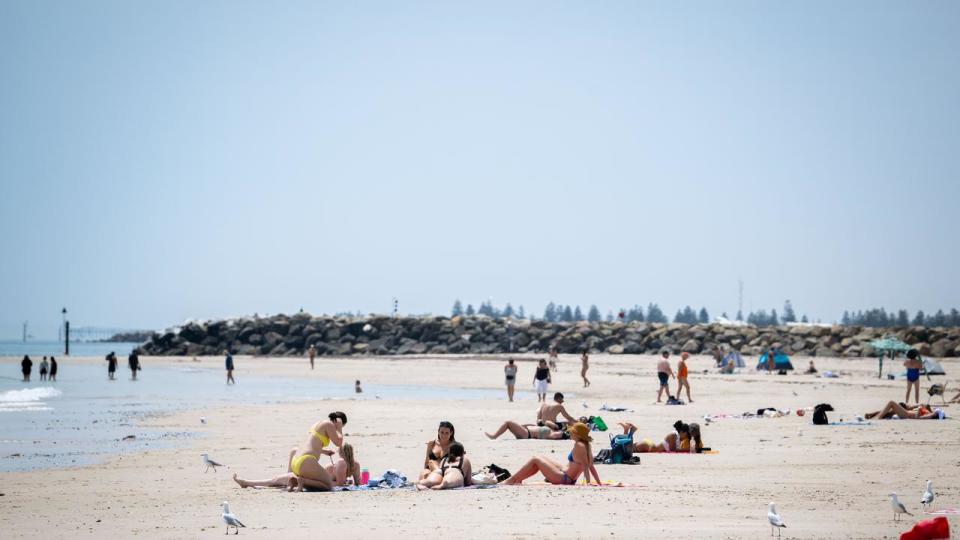
Those closer to the coast will be a little more fortunate, temperatures expected to peak at 31C on Friday around the Sydney CBD, and 35C on Saturday.
In Western Australia, an extreme heatwave warning has been issued for the Kimberley district, including the areas of Derby, Fitzroy Crossing, Kiwirrkurra, Leinster, Lombadina, Telfer, Wiluna and Warburton. The warning is currently in place until Friday.
A severe heatwave has also been issued for the Pilbara, Gascoyne, Goldfields, North Interior and South Interior Districts.
In the in-land Aboriginal reserve of Warburton, the mercury had already soared to 32.4C by 6.30am on Wednesday, with forecasted highs of 44C on Wednesday, 41C on Thursday, and 42C on Friday.
Large parts of Aus are being affected by #heatwave conditions today. Our Heatwave Warnings include the likely timing & intensity of the forecast heatwave so you can prepare for the heat & seek advice.
Know your weather. Know your risk.
More: https://t.co/0u075eQs9Gpic.twitter.com/KOXGHeiHt3— Bureau of Meteorology, Australia (@BOM_au) December 5, 2023
Queensland’s northern peninsula is also under a severe heatwave warning, with areas in the Gulf Country, Channel Country, Maranoa and Warrego and Darling Downs and Granite Belt Districts also affected. In-land areas could reach the low to mid forties, before dropping to the mid to low twenties overnight.
However, residents in coastal areas will be shielded away from the extreme temperatures, with Brisbane reporting a high of 32C on Wednesday.
A similar forecast has also been issued for South Australia, with in-land towns bearing the brunt on the heat, including the Flinders, North West Pastoral and North East Pastoral districts.
In Marla - a town in the state’s north west - the mercury will hit 45C on Wednesday, and increase to 47C on Thursday.
Temperatures are forecast to remain at a high of 45C on Friday, before it significantly drops to 29C from Saturday onwards, with showers expected to ease the heat.
From this weekend and into early next week, South Australia could also be hit with a raft of dangerous weather, including heavy rain, severe thunderstorms and damaging winds.
As it stands, a severe heatwave warning has been issued for the southern state’s Flinders, North West Pastoral and North East Pastoral Districts areas, and is in place until Friday.

