
Millions to be drenched by ‘unusual’ weather
An unusual weather pattern is set to drench large parts of Australia this week, as two weather systems clash over central, southern and eastern regions.
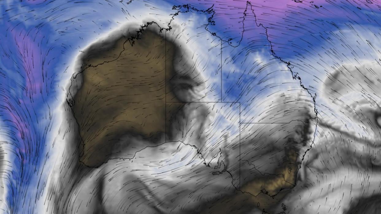
Coral Sea moisture is expected to collide with a cut-off low directly above Australia and trigger widespread cloud and rain over multiple states from Thursday and into early next week.
A band of cloud and rain is likely to develop from Queensland to South Australia from Thursday and continue well into the weekend, with rainfall set to become more widespread and heavier over parts of central, southern and eastern Australia into the first half of next week.
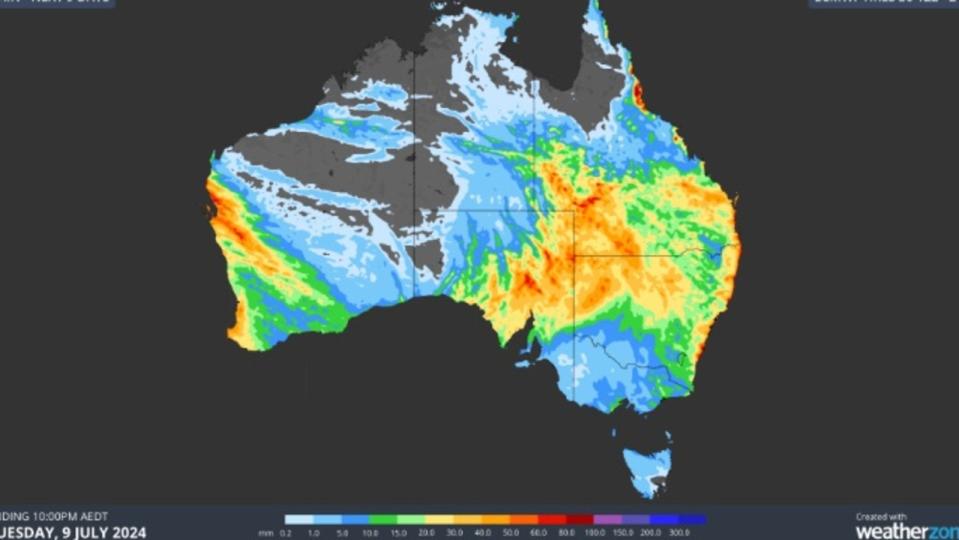
Parts of Queensland, South Australia and NSW, including Lake Eyre and the Murray-Darling Basin, could receive 30 to 60mm across several days.
Sydney is expected to receive its heaviest falls on Tuesday with highs of 15mm, while 7mm to 9mm is expected for the remainder of the week.
Rainfall is likely to ease closer to the weekend for Brisbane after a wet start to the week, with up to 20mm to fall on Tuesday.
Melbourne, Adelaide and Hobart will likely remain dry before light showers hit the cities early next week.
While the downpour will help fill inland water storages, a Weatherzone meteorologist is warning it could impact outback road and rail transport networks.
“Flood watches and severe weather warnings will be issued later this week and early next week if necessary,” meteorologist Ben Domensino said.
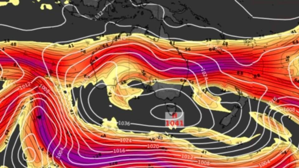
It comes as millions of Aussies are bracing themselves for another Arctic week as a cold mass positions itself over much of the country.
Colder and drier air is expected to spread across Australia this week, with both maximum and minimum temperatures forecast to fall “well below average”.
Melbourne will experience a cold and dry week, with partly cloudy days and maximum temperatures of up to 14C.
Launceston is forecast to plunge to below zero degrees for the next seven to eight mornings in a row.

