
The danger that comes with much-needed rain storms
Thunderstorms bringing rain for fire-torn areas desperate for a drizzle on Australia’s east coast could actually be presenting more of a danger than reprieve.
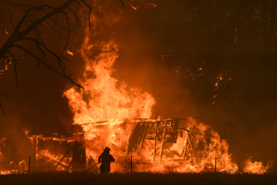
Powerful lightning strikes brought by these storms have the potential to spark new fires in already vulnerable areas, like in the NSW Blue Mountains where a fire was started overnight after a tree was hit.
The threat is expected to continue, with more storms on their way in NSW and Victoria in the coming week, Weatherzone meteorologist Felix Levesque told Yahoo News Australia.
“Because it’s been a very dry season and the moisture content is very low on everything, any strike increases the potential for fire activity,” Mr Levesque said.
The donation mistake that could have 'disastrous' consequences
'Probably didn't mean it': Karl's savage shot at MP over 'weather girl' apology
“Combining increased lightening potential over the last week and weeks ahead does increase the potential for fires, but hopefully it also brings some showers.”
He said lightning strikes were an unavoidable “price to pay” for the chance of getting some rain.
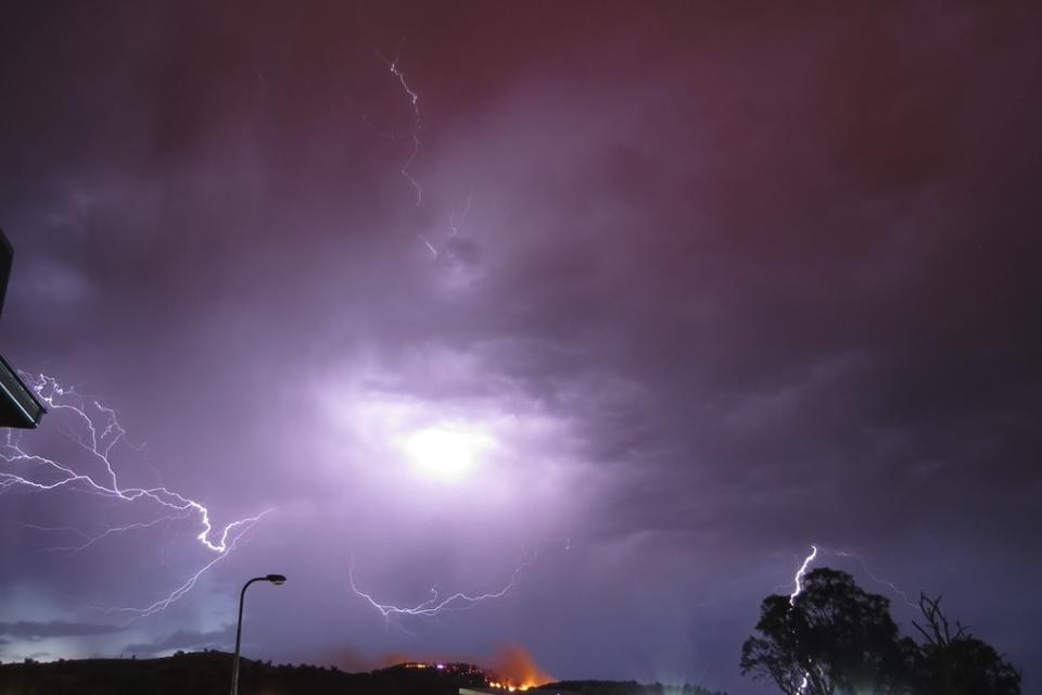
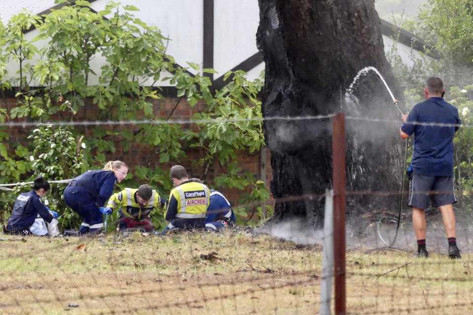
Two people were struck by lightning near Sydney within 10 minutes of each other on Monday.
Mr Levesque added a particularly dangerous weather system was a dry thunderstorm, which was most likely to occur in inland areas where there was less moisture.
A dry thunderstorm produces thunder and lightning but very little water, as most of it evaporates before reaching the ground.
These could potentially hit inland NSW and Victoria in the coming weeks, which could seriously interfere with the work of firefighters battling the total 144 blazes still burning in both states.
There is currently a severe thunderstorm warning in place for the Hunter, Central Tablelands, Northern Tablelands and parts of the Mid North Coast, North West Slopes and Plains Forecast Districts.
The Bureau of Meteorology said this could bring heavy rainfall, damaging winds and large hailstones.
A fire weather warning has also been issued for the Southern Slopes area due to hot and dry conditions.
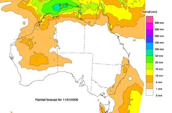
North coastal NSW and inland areas are likely to experience up to 10mm of rain Thursday, as well as further south including Moruya Heads.
⚡⚡ Severe #Thunderstorm Warning issued for Heavy Rainfall Damaging Winds & Large Hailstones in Hunter, Central Tablelands, Northern Tablelands & parts of Mid North Coast, North West Slopes and Plains. Keep up to date with warnings at https://t.co/bKgH3U9x5k #NSWSES pic.twitter.com/AjIwXWtltc
— Bureau of Meteorology, New South Wales (@BOM_NSW) January 8, 2020
On Friday, a large section of Victoria is likely to have between five and 10mm of rain, as well as the lower half of South Australia.
By Saturday, five to 10mm of rain is expected down the eastern coastline from Brisbane in Queensland all the way down to Bairnsdale in Victoria.
More rain is forecast for Sunday, particularly in areas surrounding the NSW and Queensland border, where up to 25mm could fall.
Do you have a story tip? Email: newsroomau@yahoonews.com.
You can also follow us on Facebook, Instagram and Twitter and download the Yahoo News app from the App Store or Google Play.


