
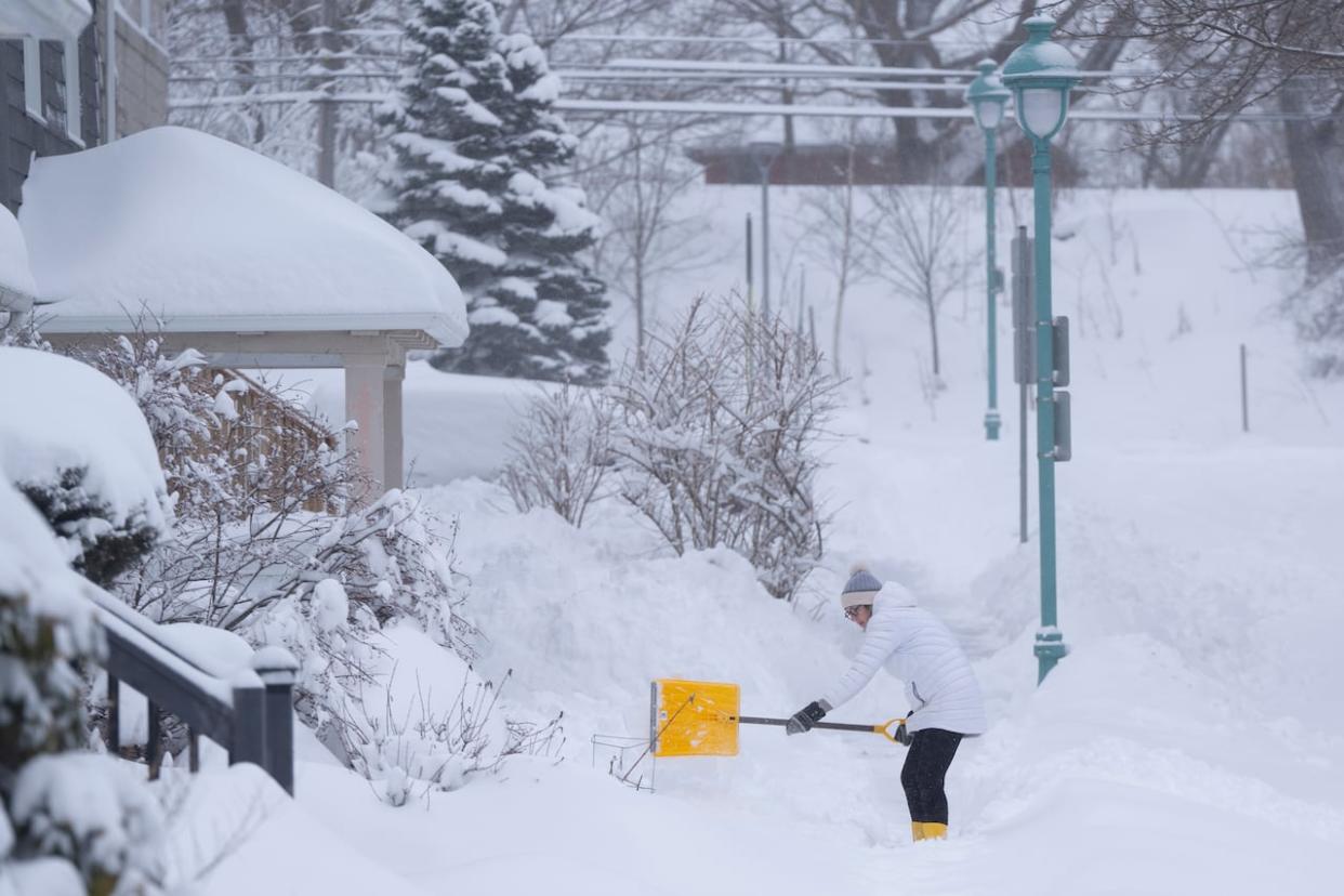
Strong nor'easter set to arrive in Nova Scotia Tuesday bringing blowing snow
An incoming nor'easter which is developing south of the border on Monday is set to arrive in Nova Scotia beginning Tuesday afternoon and continue into Wednesday.
Some uncertainty remains when it comes to the exact track and ultimately the total snowfall, however confidence is increasing that the strengthening storm will bring widespread snow and blowing snow to Nova Scotia.
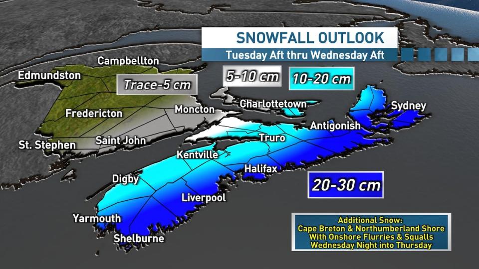
The heaviest snow is most likely to fall along the Atlantic coastline, then into the Northumberland Shore region and across Cape Breton where amounts ranging of 20 to 30 centimetres are most likely. Further north, amounts will drop off quickly, but could generally range from about 10 to 20 centimetres.
(Ryan Snoddon/CBC News)
As the storm continues to develop on Monday and into Tuesday, there will be better information about its path. Be sure to check back for updates as the storm gets closer.
The storm will be rapidly strengthening as it tracks through our region, which means that the winds will also be a factor with this storm. With northeast winds set to gust between 60 and 70 km/h and up to 80 km/h along parts of the coast, blowing and drifting snow will be an issue.
Could hit Halifax commute
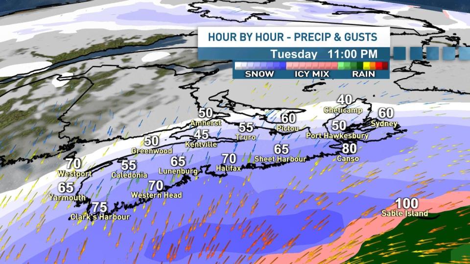
While there is still some disagreement on the ultimate track, the timeline is more certain. Snow will track in from west to east through Tuesday afternoon arriving in Halifax and central areas around the afternoon commute bringing blowing snow as winds ramp up.

(Ryan Snoddon/CBC News)
The snow will continue to track eastward into Cape Breton on Tuesday evening. For most of the province, the heaviest snow and strongest winds are set for Tuesday and early overnight hours.
(Ryan Snoddon/CBC News)
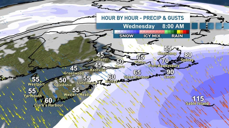
The snow will depart through the overnight hours and into Wednesday morning, however brisk northerly winds will linger throughout the day, especially for the Northumberland Shore and Cape Breton.
(Ryan Snoddon/ CBC News)
The cold and breezy northerly winds will bring onshore flurries and the risk of snow squalls throughout Wednesday afternoon, overnight and into Thursday with additional snowfall likely, especially in Inverness County.
MORE TOP STORIES

