
State to be battered by 100mm of rain
NSW residents should have their umbrellas ready, with up to 100mm of rain predicted to hit parts of the state within seven days.
Wet conditions are forecast to carry on for the rest of the week and over the weekend in Sydney, Newcastle, Wollongong and the Central Coast.
On Wednesday, there is a very high chance of rain along the coastal fringe, with a high chance elsewhere in Sydney.
The chance of showers remains high on Thursday and Friday, with a very high chance rainfall will continue in Sydney for a wet weekend, according to the Bureau of Meteorology.
Senior meteorologist Dean Narramore, in an updated forecast from Wednesday afternoon, said five-day rain totals for NSW’s Mid North, Hunter and Sydney regions would likely be in the 50mm-100mm range, with isolated falls even higher than that.
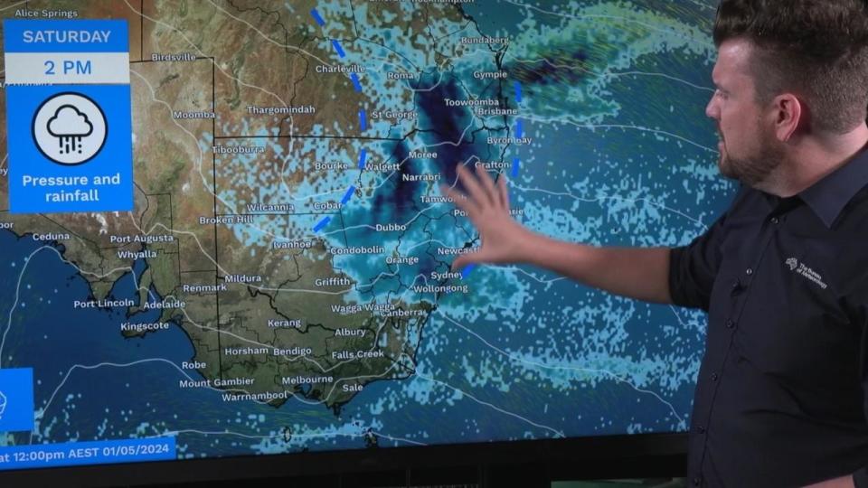
He said the rain event would begin to “ramp up” on Friday.
“We start to see things really ramp up on Friday, as we see more moisture get fed into this upper low,” he said.
“That’s going to bring a band of rain and thunderstorms through much of inland NSW and southern inland Queensland.
“Some of those falls could be in that 15-25mm, maybe isolated falls even higher than that.”
The weekend would likely bring “widespread” rain, showers and thunderstorms to much of northern and central NSW and southeast parts of Queensland, he added.
A moderate flood warning is in place for the Warrego River in NSW.
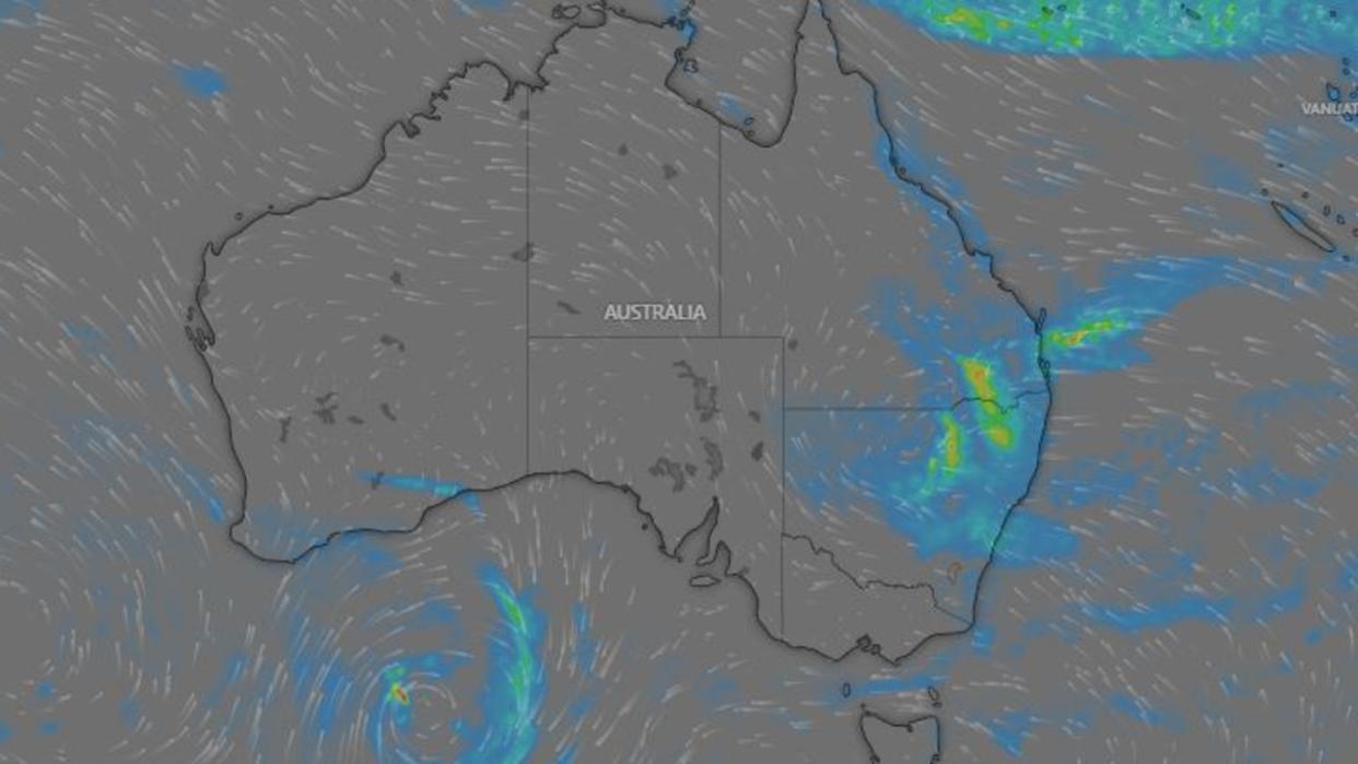
“A large high-pressure system south of Tasmania is directing a moist onshore flow onto the east coast, driving several days of showers to the Queensland and NSW coast, tending to rain for parts of eastern NSW later in the week,” a Bureau spokesperson said.
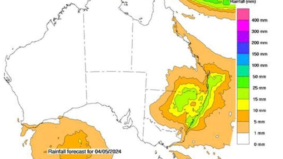
“This system, combined with a coastal trough, is forecast to bring daily rainfall totals of 5-20mm during the rest of the working week to eastern NSW, although higher totals are possible along the coastal fringe.
“An upper-level trough is expected to move into western NSW and bring showers, rain and thunderstorms to inland NSW on Thursday and Friday. This will move eastwards and deepen to bring even heavier rainfall along the northern and central coasts of NSW over the weekend. Five to seven day rainfall totals are generally expected to reach 50-100mm, with isolated heavier falls.”
Wet weather may also hit Brisbane, with a chance of showers over the next few days, including a high chance of rainfall on Friday and Saturday, while drier conditions are expected in Melbourne, with partly cloudy conditions predicted for the rest of the week and the weekend.
In Perth, rain is expected in the lead up to the weekend, with the chance of thunderstorms on Wednesday and Thursday.
“In Western Australia, a weak low-pressure systems just south of the state will also bring light showers to parts of the southwest and the south coast for the next few days,” a Bureau spokesperson said.
“Daily totals generally aren’t expected to exceed 15-20mm.”
Forecast for capital cities for the rest of the week:
Perth
Wednesday — showers increasing, max 26
Thursday — showers, max 25
Friday — possible shower, max 23
Melbourne
Wednesday — partly cloudy, max 18
Thursday — partly cloudy, max 17
Friday — partly cloudy, max 18
Sydney
Wednesday — showers, max 21
Thursday — showers, max 22
Friday — showers, max 21
Brisbane
Wednesday — partly cloudy, max 25
Thursday — shower or two, max 24
Friday — shower or two, max 23
Adelaide
Wednesday — mostly sunny, max 19
Thursday — mostly sunny, max 22
Friday — mostly sunny, max 22
Canberra
Wednesday — partly cloudy, max 18
Thursday — partly cloudy, max 17
Friday — partly cloudy, max 18
Hobart
Wednesday — partly cloudy, max 17
Thursday — cloudy, max 15
Friday — partly cloudy, max 16
Darwin
Wednesday — mostly sunny, max 35
Thursday — mostly sunny, max 35
Friday — mostly sunny, max 35

