
Cyclone to ‘intensify’ as it nears Aus
A tropical cyclone is expected to make landfall in Queensland within days, with locals warned it would bring more heavy rainfall to the region.
The state has experienced significant flooding over the past month with towns still recovering from the damage to homes and businesses in the aftermath of Tropical Cyclone Jasper.
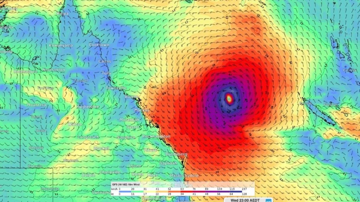
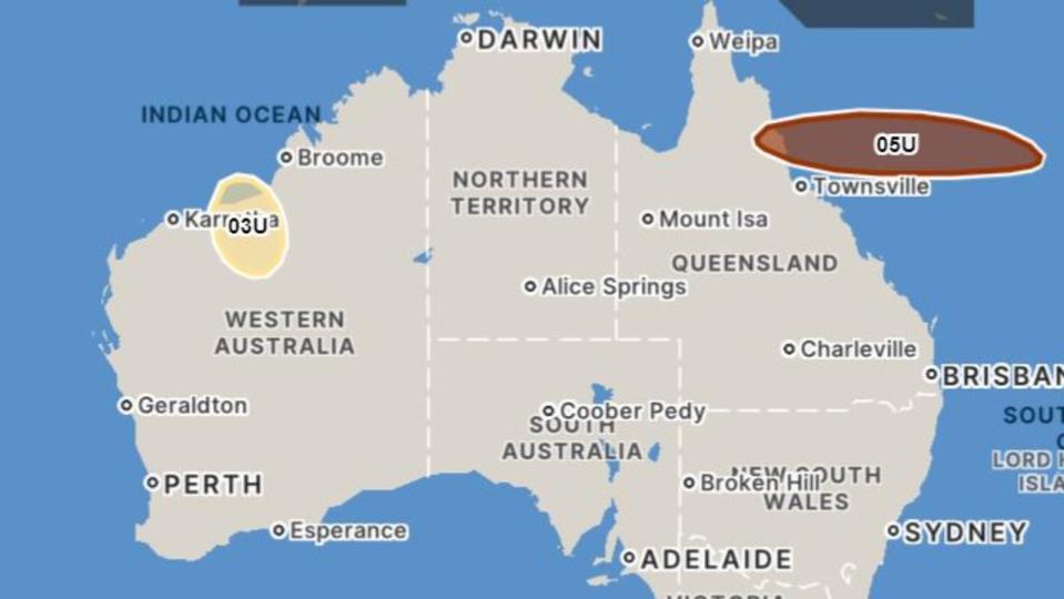
Tropical Cyclone Kirrily is more likely than not to develop by Monday off the state’s coast in the Coral Sea, before moving west towards Cairns where it is expected to make landfall about Wednesday.
Soon to be named Kirrily, the system is likely to become the third tropical cyclone of the season on Monday evening or the early hours of Tuesday.
The cyclone will “quickly intensify” after Monday, possibly becoming a category two storm on Tuesday and a category three on Wednesday.
However, meteorologists are not yet able to predict where it will make landfall according to a spokesperson from the Bureau of Meteorology.
“There’s still a range of scenarios in this situation, but our consensus track does cross it to the south of Townsville...we could see it cross between Cairns and Mackay,” he said.
“As we move into the Wednesday and Thursday timeframe we’re likely to see shower and thunderstorm activity increasing across the Central Coast but again, this is just one model scenario here. There’s a range of scenarios where it could be further north or further south.”
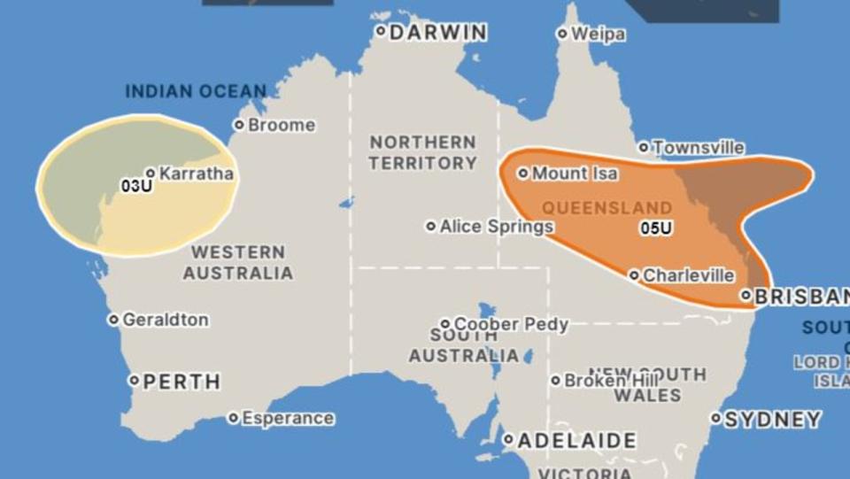

The tropical low will then stretch across the state from Mount Isa to Townsville on Thursday, before expanding south.
“Some [models] also have the cyclone moving further south and inland, possibly even to parts of Southeast Queensland. So this could bring widespread heavy rainfall flooding and damaging winds,” a BOM spokesperson said.
Communities on the east coast of Queensland are advised to stay up to date with forecasts and warnings.


Heatwave stretches from Queensland
Maximum temperatures are expected to climb to the mid to high thirties on Sunday in southeast Queensland as a severe heatwave warning is issued for the region.
This will increase to the high thirties to low forties inland by the start of next week.
Locations likely to be impacted include Bowen, Birdsville, Brisbane Metropolitan Area, Beaudesert, Boonah, Gladstone, Ipswich, Woorabinda and Yeppoon.
The severe heat will stretch into northern NSW, with the north west slopes and plains staying hot into mid-next week.
Maximum temperatures in the high thirties to low forties are forecast for towns in the north including Moree.

