
'Nothing as big as this': Fears as Cyclone Owen gains strength as it heads for land
Residents have been warned to brace themselves for a strengthening Cyclone Owen turned for the Queensland coast with forecasters now saying it’s likely to make landfall on Saturday.
Owen is still a category three cyclone, with wind gusts of almost 200km/h, but is likely to become a category four system before it reaches the Queensland coast.
The storm is sitting off the Northern Territory coast but has performed a U-turn and is now tracking slowly east, back towards Queensland.
Severe Tropical Cyclone Owen continues to move east over the southern Gulf of Carpentaria and is strengthening. #CycloneOwen https://t.co/AWJKLhynnl pic.twitter.com/JMWH4dOZQA
— Bureau of Meteorology, Northern Territory (@BOM_NT) December 13, 2018
It could produce wind gusts of 280km/h when it approaches the coastline. Forecasters had expected that to happen on Friday, but now say a Saturday crossing between Gilbert River Mouth to Pormpuraaw is likely.
“It will approach the coast later on today and into this evening, but it ‘s now looking like early tomorrow morning,” Bureau of Meteorology forecaster Jonte Hall told ABC radio on Friday.
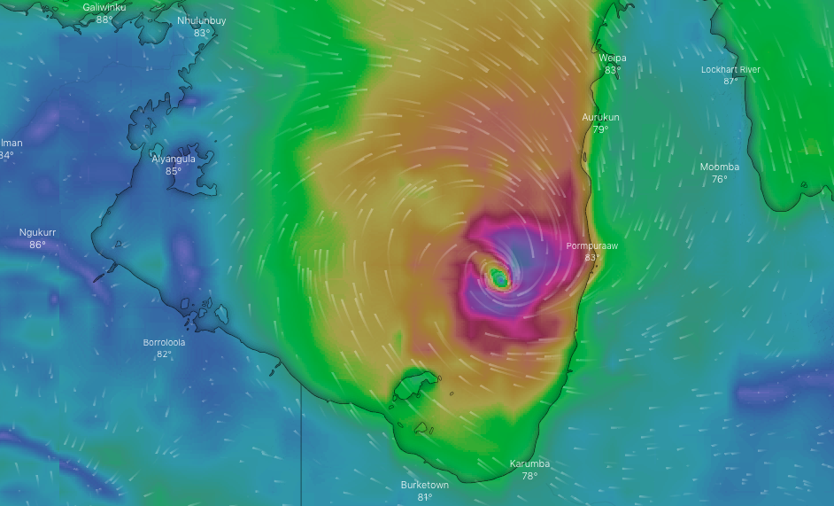
A cyclone warning is in place from Port McArthur in the Northern Territory, to Aurukun in Queensland, including Mornington Island, Karumba, Kowanyama and Pormpuraaw.
“Everyone is worried because we’ve never been in this situation before. Obviously we had it earlier this year but nothing as big as this,” Kowanyama mayor Michael Yam told 7News.
The storm is expected to become a rain depression after making landfall, with authorities warning of heavy rain with the potential to cause flooding along much of Queensland’s east coast.
Premier Annastacia Palaszczuk says authorities are worried about the possibility of landslides if heavy rain hits central Queensland, where landscapes have been destroyed by recent bushfires.
But she says authorities are well prepared, both in the cyclone danger zone and elsewhere as the state braces for very wet weather.
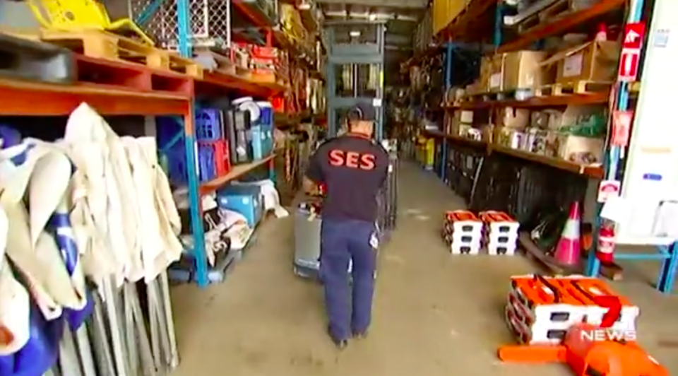
Extra rescue and emergency crews have been sent into the cyclone warning area.
Residents have been warned to take their own precautions, stocking up on necessities such as medications and securing their properties.
Floods continue in Victoria
Victorians are being urged to brace for more flooding after a month’s worth of rain fell in parts of the state overnight and the wild weather is set to continue.
A flash flood warning is in place for Wangaratta, Byawatha and surrounding areas including the Hume Freeway on Friday and authorities are bracing for continued high water levels on Friday.
Twenty homes flooded in the Birchip area in central Victoria overnight and 10 people were evacuated. A community meeting will be held later today, the SES said.
“It’s like an ocean here where we are at the moment, our whole street is under water,” one resident told 3AW on Friday.
VicSES volunteers have responded to more than 20 requests for assistance requiring rescue from flood water, including a number of vehicles impacted by flood water on the Hume Highway. Flash flooding can occur quickly – never walk, ride or drive through floodwater. #vicstorms pic.twitter.com/kMQAhmiwtt
— VICSES News (@vicsesnews) December 13, 2018
A severe weather warning for heavy rain and flash flooding is most likely to occur about the northeast ranges, the Otways, in south Gippsland and over far east Gippsland, the Bureau of Meteorology said on Friday.
Rain areas and isolated thunderstorms are expected across the warning area, with periods of heavy rain that may cause flash flooding.
Affected areas may include Bright, Yarram, Mallacoota, Falls Creek, Mt Hotham and Mt Buller.
More than a month’s worth of rain has already fallen across parts of Victoria.
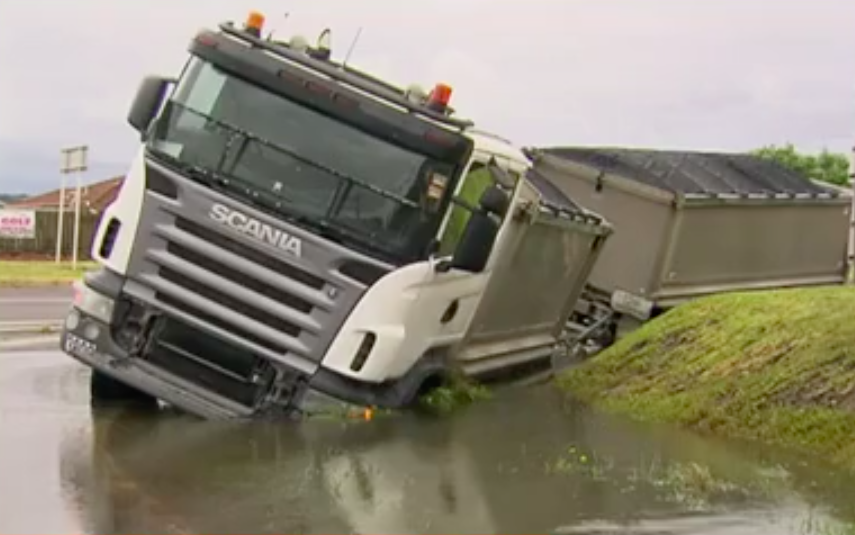
People are reminded not to drive through floodwater, after 120 people needed rescuing from the Hume Freeway south of Wangaratta, including 17 by helicopter.
Up to 500 vehicles were impacted by floodwaters on the Hume Freeway.
Significant traffic diversions are in place, with large parts of the Hume Freeway are closed and drivers urged to plan ahead for longer trips.
Sydney battered by thunderstorm
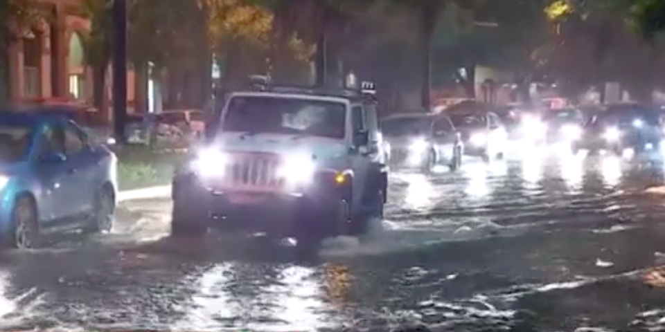
Severe thunderstorms which wreaked havoc in Sydney, and have left more than 30,000 homes and businesses without power with parts of NSW still copping a drenching.
Wind gusts of up to 107km/h were recorded at Coonamble in the central-western plains while winds reached 105km/h in Narrabri in the state’s north west slopes, the bureau said.
Storms which lashed parts of Newcastle, Sydney and Wollongong on Thursday evening and had eased by about 9.15pm prompting the cancellation of a severe thunderstorm warning, the bureau said.
During the storms more than 40mm of rain fell in 30 minutes in Auburn in Sydney’s west.
Endeavour Energy emergency crews are restoring power to more than 30,000 homes and businesses in the Blue Mountains, western Sydney and the Illawarra after lightning and damaging winds lashed the areas.
Some people in Warragamba, Silverdale and Wallacia in Sydney’s west were without power overnight due to the widespread damage of the storm, Endeavour Energy said in a statement on Thursday night.
Work to restore power is expected to go into the night.

