
Cold snap brings frost warning and record low temperatures
Wet and wintry conditions are expected to continue throughout the week across Australia’s east coast as two cold fronts bring heavy rain and chilly temperatures.
Monday saw record low temperatures in parts of Victoria, with Hamilton in the state’s south west recording its coldest day in 22 years, dropping to nearly -3C.
Melbourne stayed under 10 degrees for the whole weekend and Monday morning, with Olympic Park recording a chilly 4.2C and the airport a near-freezing 1.7, Hannah Wilson from Weatherzone told Yahoo News Australia.
Cranbourne residents experienced the coldest morning in the city, waking to a temperature of just 3.1 degrees.
Temperatures are expected to increase slightly in Melbourne and hover around 17 and 18 as the week progresses until a cold front moves through late on Friday.
Frost is expected for Tuesday as a cold front moves across the Great Australian Bite and towards Victoria.
“There will be no rain until Friday or Saturday when a cold front moves through. Saturday is looking like it will be the wettest day for the week,” Ms Wilson said.
Sydney soaking to continue
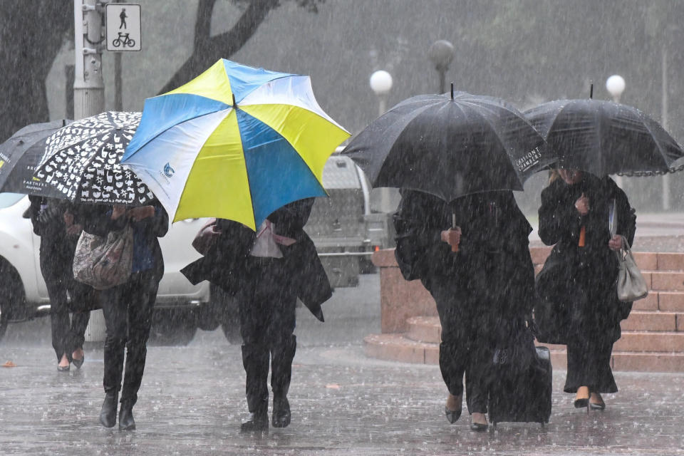
Sydneysiders will be relieved to know Monday morning was the coldest expected for the week, but they can expect plenty of showers to last throughout the week.
The city was drenched by more than 33mm before most people started work, and at least 20mm more was on the cards for the rest of the day.
Wet weather will ease in Sydney by Friday however and make way for a sunny weekend.
“Tomorrow there will be heavy showers similar to today, and the same for Wednesday and Thursday, before easing on Friday,” Ms Wilson said.
#Sydney has seen some short and sharp burst of rain overnight as showers drifted over from the coast. Showers are forecast to continue this morning, though are expected to ease through the day. pic.twitter.com/2UhqBw3lS2
— Bureau of Meteorology, New South Wales (@BOM_NSW) June 23, 2019
Chilly weather sweeps through Australia
Those in southern parts of the country won’t be so lucky though, with the cold front expected to hit Adelaide the worst.
South Australia recorded its coldest June day in three decades on Sunday with an icy 9.6 degrees.
While Monday was its coldest day expected for the week, a cold front passing through on Friday is set to see temperatures drop to 14 degrees ahead of storms on Saturday.
On the west coast, wet conditions will remain clear in Perth for the remainder of Monday and Tuesday, before showers and storms for the rest of the week.
A cold front has produced widespread rain. Falls in excess of 70mm were recorded in parts of #Perth. Bungendore (just east of Armadale) has recorded 76.8mm. Perth Metro has recorded 176.8mm for the month of June so far. The June average is 124.5mm. https://t.co/8rzmM6wgQG pic.twitter.com/S1DImDa2P3
— Bureau of Meteorology, Western Australia (@BOM_WA) June 22, 2019
Saturday will get particularly cold, with a low of just five degrees expected for the capital city.
Canberra will have clear skies until some showers on the weekend, but have a freezing low of -1 on Tuesday and a week-long maximum of just 16 on Saturday.
Showers are expected each day until Friday in Queensland’s capital city, before conditions clear for the weekend and into early next week.
Darwin in the Northern Territory will remain in the high 20s and early 30s throughout the week and completely avoid the wet weather.
Do you have a story tip? Email: newsroomau@yahoonews.com.
You can also follow us on Facebook, download the Yahoo News app from iTunes or Google Play and stay up to date with the latest news with Yahoo’s daily newsletter. Sign up here.

