
‘More rain’ to fall on saturated Qld
Queenslanders are in the path of danger once again as thunderstorms bring a renewed risk of flash flooding to large parts of the state.
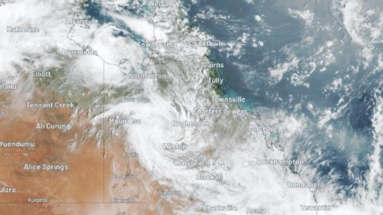
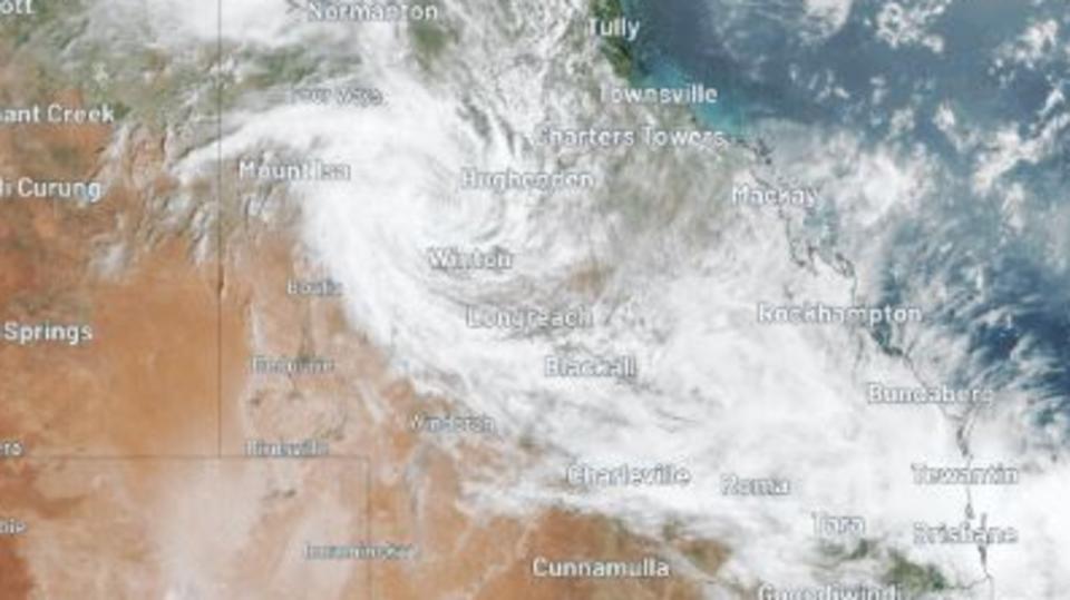
Ex-Tropical Cyclones Kirrily and Jasper have inundated the Far North with metres of water in recent weeks.
Kirrily is still doing so despite being downgraded to a storm system after crossing the coast on the eve of Australia Day.
As the remnants of Kirrily continue to drench Queensland’s northwest, the system is also funnelling moisture down into the southeast of the state, which is bringing intense rain and storms with it.
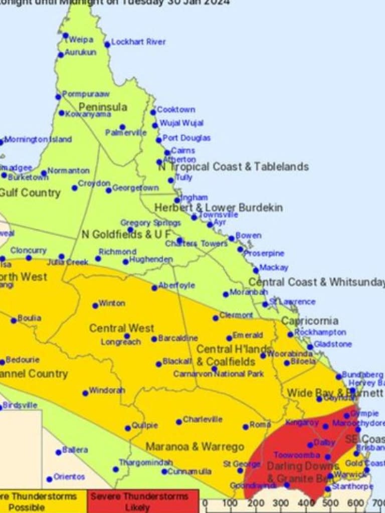
The Bureau of Meteorology currently has 16 warnings in place, largely cautioning residents that severe thunderstorm and flooding will continue.
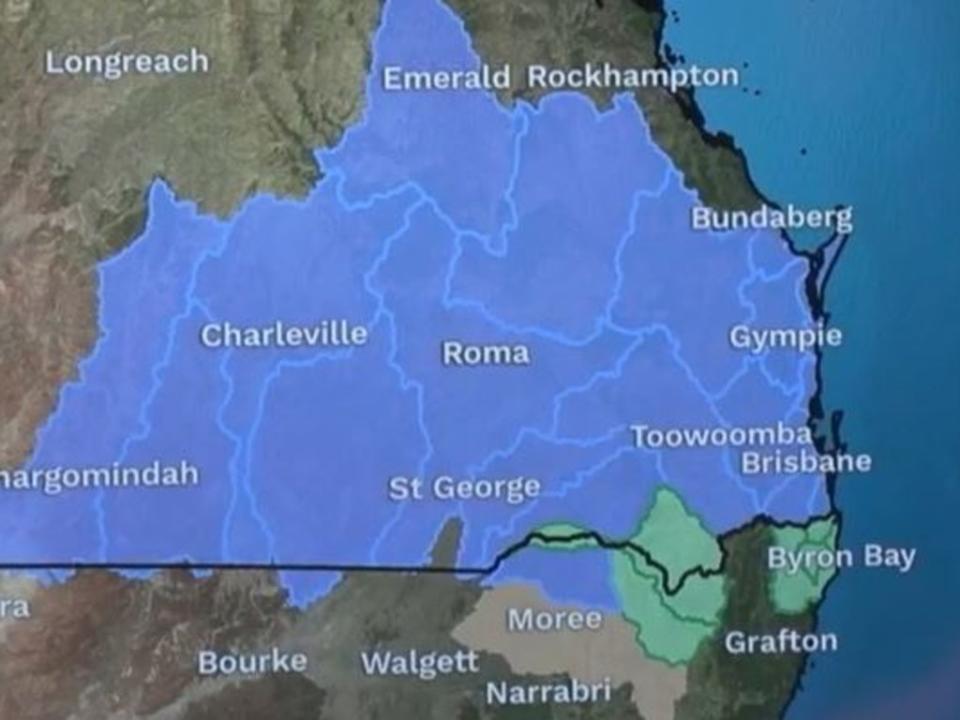
Flood warnings are in place for much of southern and central Queensland including for the Georgina, Western, Dimantina, Warrill, Bremer Rivers, with minor warnings in place for eight other river systems.
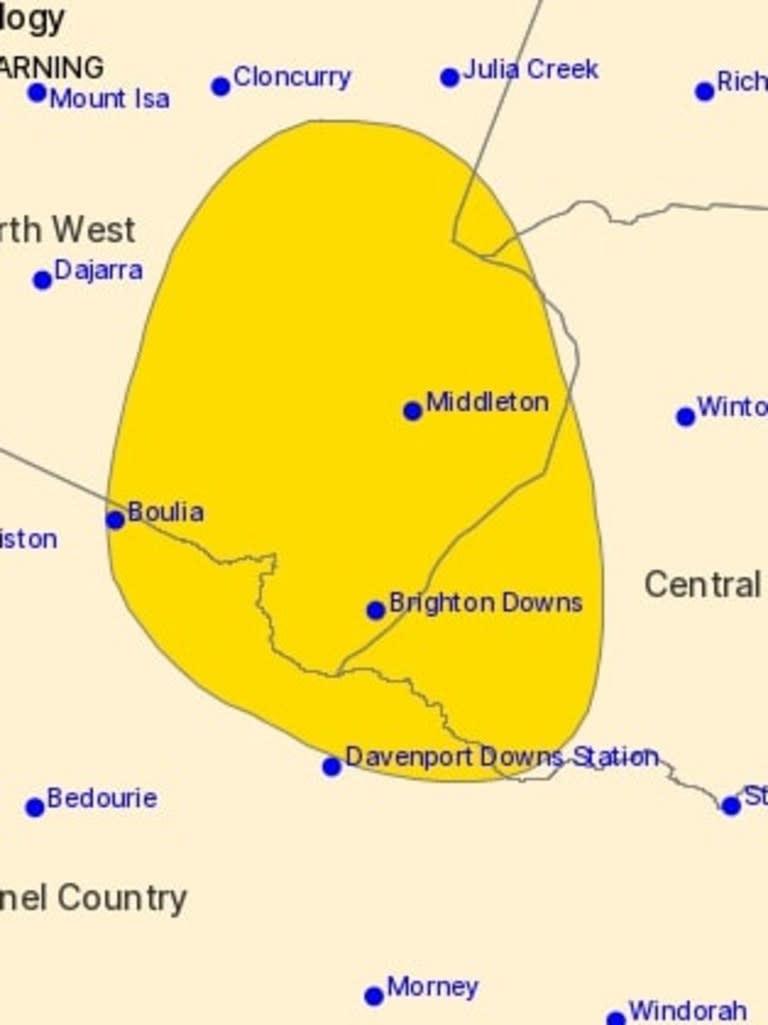
In the west, a severe weather warning is in place for areas including Boulia, Selwyn, McKinlay, Brighton Downs and Middleton, with the ex-cyclone system “expected to meander across the interior” bringing heavy rainfall until Wednesday.
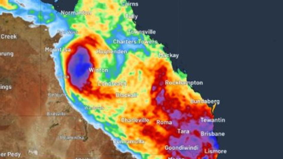
Affected areas can expect to see up to 140mm of rain in just 24 hours, with isolated falls of up to 250mm.
The extra water, falling on areas that have already seen over 200mm fall in the 24 hours to Monday morning, has triggered authorities to warn residents of potentially life threatening flash flooding in the area.
The south and southeast can expect to be plagued by that low pressure trough and a “very humid, unstable air mass” that is triggering thunderstorms until Wednesday.
The Bureau has issued two warnings for separate parts of the state.
Those in the state’s interior have been warned of severe weather caused by a low pressure trough combined with a “very humid, unstable air mass” that’s triggered thunderstorms with heavy rainfall and damaging winds.
“Very dangerous thunderstorms are likely to produce heavy, locally intense rainfall that may lead to dangerous and life-threatening flash flooding and damaging winds over the next several hours in parts of the Maranoa and Warrego and Darling Downs and Granite Belt districts,” the Bureau warned.
The area of St George is at particular risk, with 67mm of rain falling in just one hour before 3.45pm on Monday afternoon.
Further east, a surface trough is expected to “sharpen” on Tuesday, bringing heavy rainfall that could cause flash flooding for areas including Toowoomba, Brisbane, Maroochydore, Gympie, Kingaroy and Caboolture.
“Locally intense rainfall which may lead to dangerous and life-threatening flash flooding is also possible over the warning area with six-hourly rainfall totals between 150mm to 200mm,” the warning read.
In its warnings about the rain threat to the Brisbane, the Bureau noted that the precipitable water value, which measures how much water is in the air, is sitting at just 0.1mm below the record of 70.9mm set in March 2017.
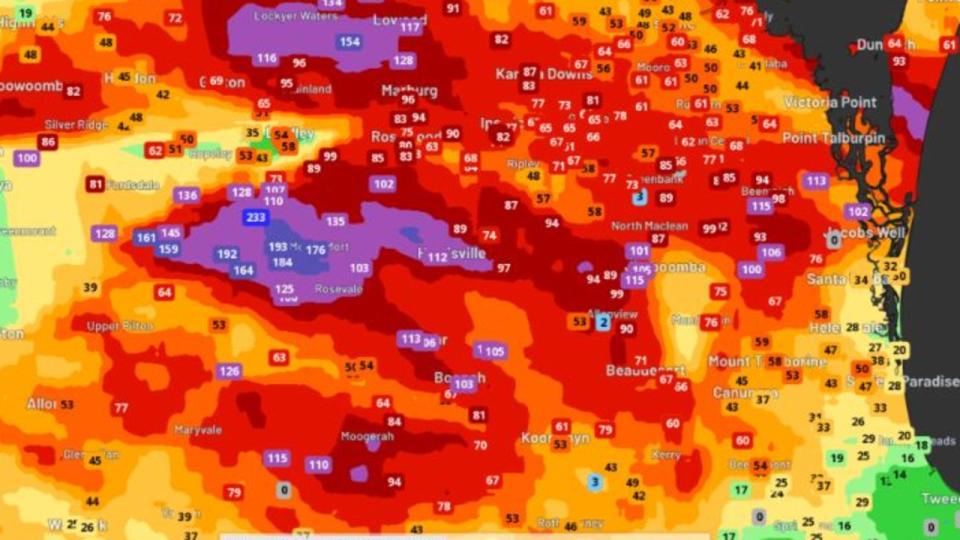
“This means if we do get showers or thunderstorms, lots of moisture is available and can produce heavy or even locally intense rainfall,” the warning read.
“This is a risk the next two days, so flash flooding and riverine flooding remains possible.”
While the rain will stick around for the next three days, Tuesday is looking to be a soaker, according to WeatherZone meteorologist Joel Pippard.
“Tuesday is looking like a potentially very wet day in the southeast, as a coastal trough looks to form, followed by a low-pressure system over the water,” he said.
“Some models are suggesting widespread rainfall of 100-200mm, isolated 300+mm falling in just one day.”
The Bureau is predicting that up to 90mm of rain will fall in Brisbane on Friday, with temperatures to reach a high of 27C.

