
Grim weather warning as rain gathers
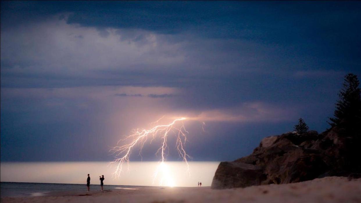
Intense thunderstorms that could dump up to 100mm of rain in a matter of hours are making their way across much of southeast Australia, as more wild weather threatens clean-up efforts.
The Bureau of Meteorology on Saturday afternoon issued a weather alert for residents across NSW and Victoria, from Seymour and Shepparton to as far north as Narrendera and Wagga Wagga,
Storms were expected to move through the largely-alpine region on Sunday afternoon and into Monday morning with locally intense rainfall raising fears of “life-threatening” flash flooding.
It comes as a low pressure trough is expected across NSW and Queensland later in the weekend to early next week, bringing heavy rainfall to the states already battling flood and storm damage.
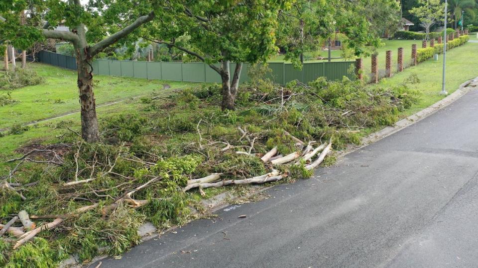
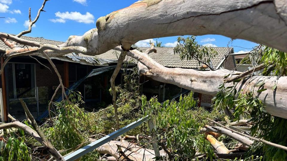
This could be especially painful for people in parts of southeast Queensland who are in the middle of a clean up following last week’s devastating storms.
The Queensland government has recently pledged $1m to help the affected communities, but with more potential wild weather the clean-up will be even more difficult.
Premier Steven Miles said the plan was to get the area back to normal as soon as possible.
“We are in recovery mode now ... it’s really important that we get that work done as quickly as possible,” he said.
At one stage following the storms 130,000 people were left without power.
Parts of South Australia have already been on the receiving end of the low pressure trough with the town of Ceduna, in the state’s south central, exceeding its monthly average rainfall in just 36 minutes on Friday.
A large thunderstorm lashed the town, dropping 13.6mm of rain between 2pm and 2.36pm.
The average January rainfall for the town is 13.1mm.
Rain and thunderstorms are expected for most of the state on Saturday and Sunday, meaning the rainfall count in Ceduna for the month is only likely to climb higher.
As this low pressure trough moves east over the next few days, it will produce widespread rain and storms over Victoria and Tasmania, and there will also be daily storms in the northern tropics due to a broad area of low pressure there.
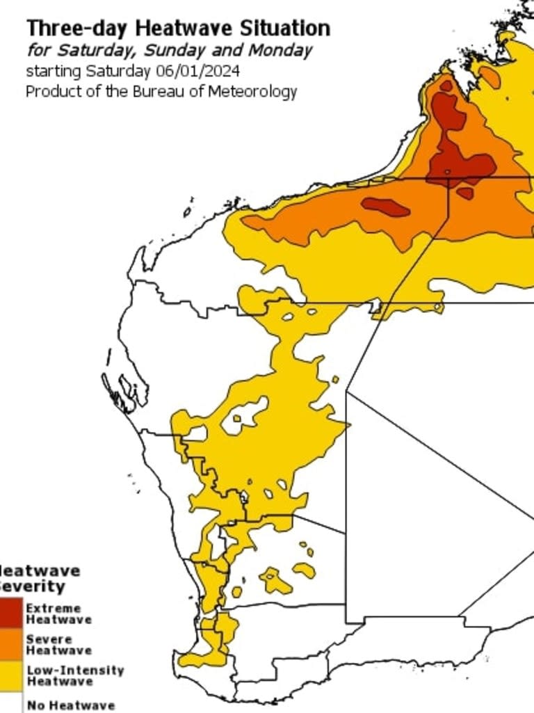
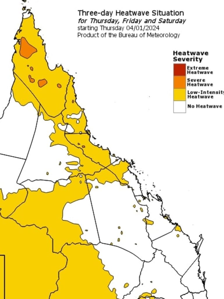
On the other end of the scale, several states have large areas under a heatwave warning with the mercury climbing in the country’s centre and north.
Parts of Western Australia, Northern Territory, South Australia and Queensland have heat warnings with WA’s western north interior and Pilbara region under an extreme warning.
Severe heatwaves can be dangerous and even deadly for many people, especially older people, babies, children, pregnant and breastfeeding women, people with medical conditions and those who are unwell.
Those who find themselves in an area under an extreme heat warning are urged to stay at home, inside and stay cool.
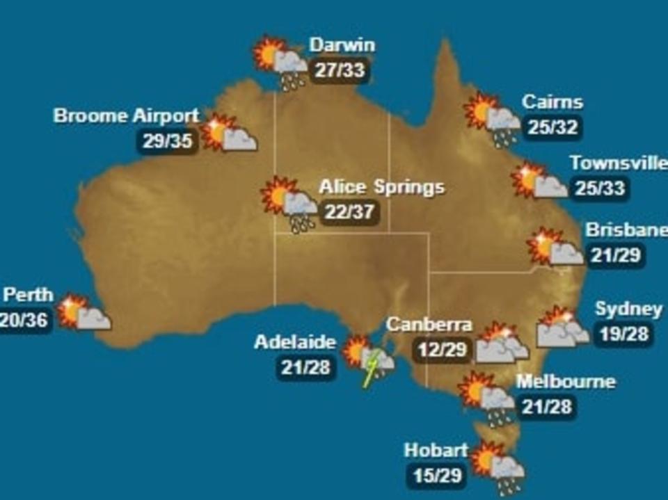
WEATHER THIS WEEKEND IN CAPITAL CITIES:
Sydney — Cloudy with maximum temperatures of about 28℃;
Melbourne — Cloudy Saturday and a maximum of 31℃, with rain and storms developing Sunday;
Brisbane — Partly cloudy across the weekend with scattered showers and maximum temperatures of 28℃;
Perth — Sunny with a maximum of 36℃ on Sunday;
Adelaide — Heavy rain and thunderstorms expected but the mercury will still likely hit 30℃;
Hobart — Mostly sunny on Saturday, before it turns late Sunday thanks to that trough moving east along from South Australia with decent rainfall expected and tops of 29℃;
Canberra — Some rain to develop late Sunday, temperatures in the mid to high 20s; and
Darwin — Warm with maximum temperatures of 33℃ across the weekend, with rain and possible storm activity.

