
Icy blast warning for millions of Aussies

Severe weather warnings are in place for parts of south eastern Australia, with damaging wind gusts are set to continue on Tuesday and Wednesday.
The second week of winter is forecast to bring a seasonal cold front through southeast Australia, which will push northwards to Sydney by Wednesday, with winds of well over 100km/h hitting Tasmania and Victoria on Tuesday.
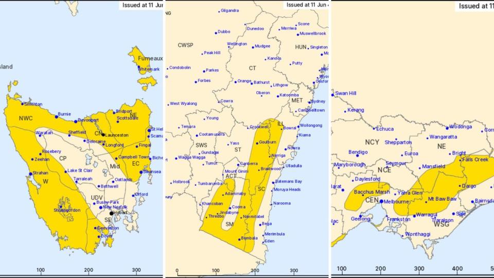
The Bureau of Meteorology has issued severe weather warnings for damaging winds in northern and western parts of Tasmania and surrounding islands, as well as for Victoria’s northern and northeastern mountains, Gippsland and the Mornington Peninsula, and the mountain ranges in NSW.
“Through all of these places, winds could exceed 90 or 100 km/h” said Angus Hines, senior meteorologist at the Bureau of Meteorology.
“But around some of those mountains, 120- 130 [km/h is] not out of the question for those strongest gusts
“That is strong enough to bring down trees and branches, potentially cause power outages, damage properties and make for dangerous driving conditions, particularly in tall vehicles like caravans as well as on motorbikes.”
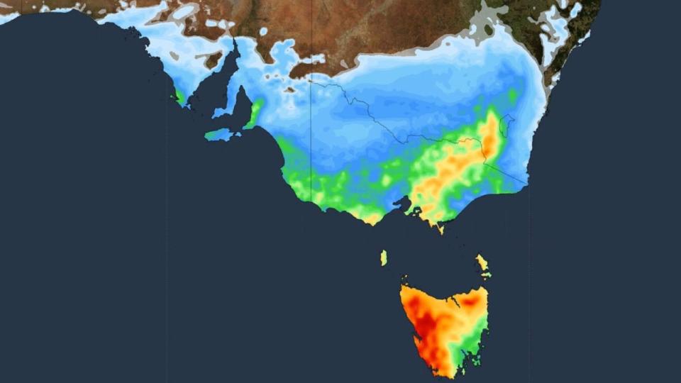
Rain is also set to hit Australia’s south east, with hail forecast on Tuesday night and Wednesday in Tasmania and the south coast of Victoria.
Areas of southeast South Australia also need to be wary of gale warnings and sheep graziers have been put on alert by the Bureau of Meteorology as well, with warnings issued saying there is a risk of losses of lambs and sheep exposed to the cold, showers and strong north-westerly winds.
Winter chills combined with strong winds pushed the apparent temperature below freezing in central and eastern Tasmania on Monday night.
Melburnians woke on Tuesday to strong winds and rain, with Melbourne Airport posting -0.5C on the ‘feels like’ readout with 72km/h gusts.
Victoria and New South Wales are expected to feel the brunt of the cold front most acutely on Tuesday and Wednesday, Weatherzone reported.

The cold front brings decent snowfalls for the Alpine resorts after a less-than favourable climatic opening to ski season, with the Bureau of Meteorology predicting 5 to 20 cm.
This week’s powerful cold front follows a week of heavy rainfall in south west Western Australia and south east NSW.
Weekly rainfall totals exceeded 100mm and there were isolated totals of more than 200mm in NSW’s Illawarra district, while parts of the Central West and Gascoyne districts in Western Australia recorded weekly totals of more than 100mm.

