
‘Stay safe’: Dire forecast of 350mm deluge
Large parts of Australia’s east coast continue to be lashed with rainfall as dangerous floodwaters surge, trapping residents and causing widespread flood warnings.
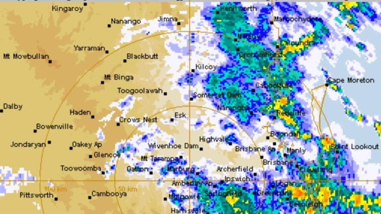
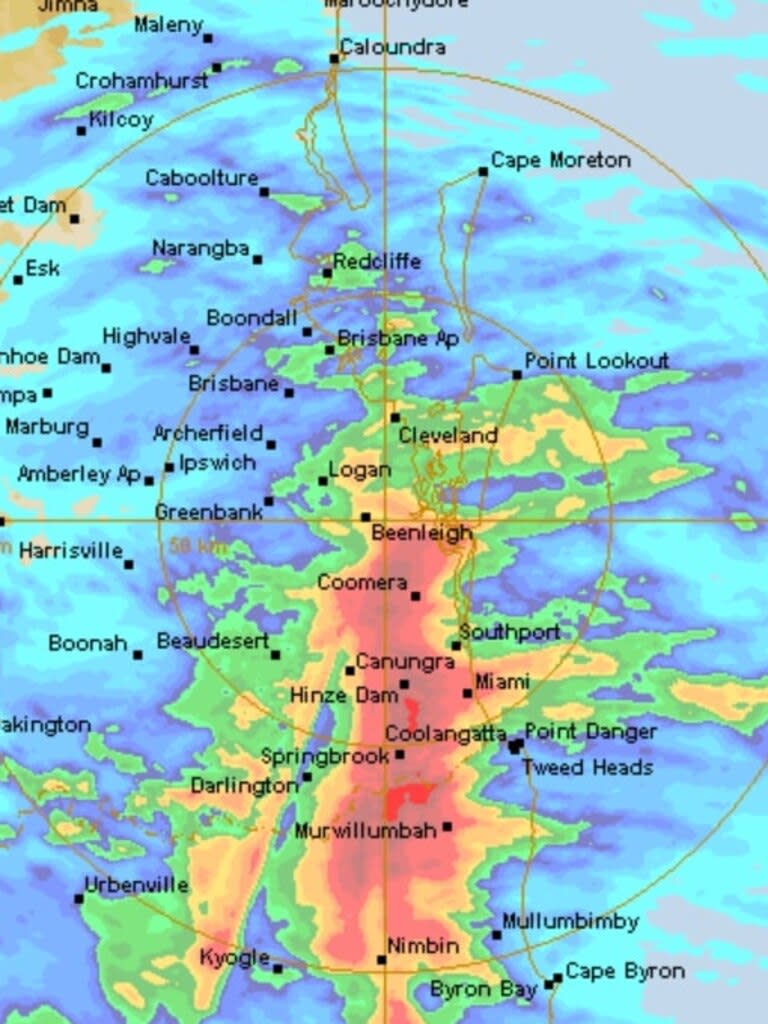
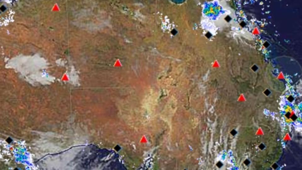
The Bureau of Meteorology has forecast up to 350mm of rainfall for South East Queensland and northern NSW, with residents and emergency services scrambling to prepare for further damage in the wake of severe storms since Christmas.
Severe weather warnings remain in place for the Gold Coast, Brisbane and Sunshine Coast areas, with communities told to stay on high alert for potential flash flooding.
Bureau meteorologist Miriam Bradbury said most of the east coast, except Tasmania, is at risk of heavy rainfall as it moves south towards Victoria.
“The risk of heavy fall may persist in some parts into the morning so we should be aware of that risk as we head into the evening and overnight period,” Ms Bradbury said.
“The moisture is moving south with the risk of severe storms for parts of NSW and Victoria.
“The risk of flash flooding is there, particularly with those severe thunderstorm areas... about the NSW and Queensland border, inland and southern NSW and much of Victoria.”
A warning has also been issued for eastern and northern suburbs of Melbourne, with heavy winds, hail and rain forecast for Tuesday night.
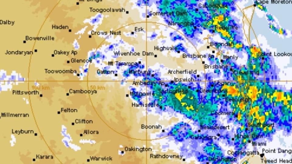
Moderate flood warnings remain in place for the Logan and Albert rivers in Queensland, while in NSW there are minor flood warnings for the Tweed and Richmond rivers.
Severe thunderstorm warnings are also in place further north in Queensland’s Wide Bay and Burnett region.
“During this event we have a flood watch in force for the Lower Brisbane River and also, of course, the Upper Brisbane River,” a bureau spokesman said.
“There is at least potential for isolated minor to moderate flooding along the Brisbane River during the course of this event.
“We have a lot of creek systems that are now becoming wet and there is a risk of localised flash flooding that will remain a risk during the course of this event.
“We’re generally looking at increased risks of flash flooding in Brisbane.”
Seqwater is also monitoring dams in the region.
Queensland Disaster Recovery Minister Nikki Boyd said there had been 700 calls for SES support in the previous 24 hours and 4800 requests since the Christmas Day storms ravaged the region.

There’s about 3000 volunteers in the state’s SES workforce, and they’re being supported in the southeast by 88 personnel deployed from the Victorian SES and 42 from NSW SES daily.
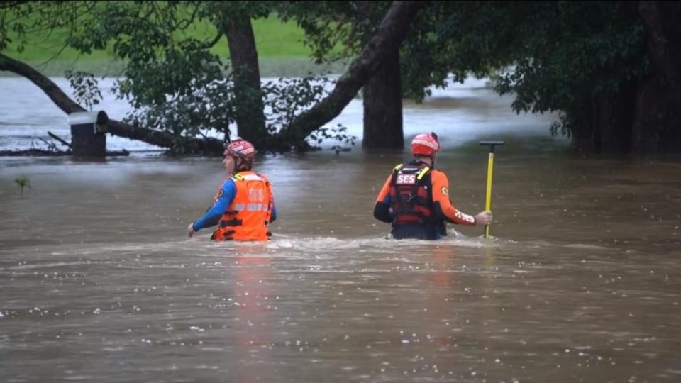
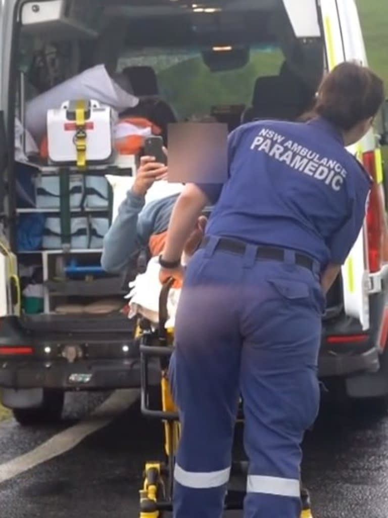
Ms Boyd said there’d been 20 swift water rescues since 5am on Monday.
“Those folks from Fire and Emergency Services are very highly specialised and they’ve been out assisting people who’ve been stranded in vehicles, assisting people in their homes and also assisting people at campsites,” Ms Boyd said.
“Over 50 people have been rescued, and 44 of those came from Natural Bridge campsite.”
Ms Boyd urged Queenslanders to reconsider their travel plans over the next 24 hours as weather conditions intensify.
“If you’re at a campsite, if you’re on the road and you don’t necessarily need to be there, please think about what precautions you can take to keep yourself and our emergency service staff safe over the next 24 hours,” she said.
There’s been 21 homes destroyed, 990 reports of moderate damage and 280 homes with severe damage.
Federal Emergency Management Minister Murray Watt said Australian Defence Force personnel would be joining the clean-up from Thursday.
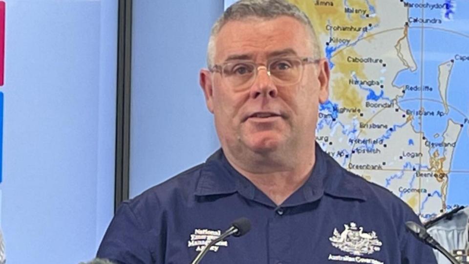
“We know that right across those three councils, there remains quite a lot of the energy network which needs replacement, power lines that are down, and one of the issues is accessing that infrastructure along with water, sewerage treatment plants and telecommunications infrastructure,” Mr Watt said.
“So the ADF personnel will, in particular, be focusing on the clearance of debris to make it easier to access that infrastructure and get it repaired and reconnected.
“Those personnel starting with an initial deployment of 30 people will be on the ground from Thursday, January 4, so we’re literally in the process right now of getting them mobilised.
“Initially we expect them to be available for a week, but there’s an opportunity to extend that period if necessary, but having seen ADF personnel in action in the past, I know they’ll be able to get through a lot in that period of time.
“This is something that’s obviously been a matter of discussion between ourselves and the Queensland government day after day, working out exactly what was required.”
The ADF staff will join 70 Disaster Relief Australia personnel who have already been deployed to assist with clean-up efforts.
“The compounding effect of this heavy rainfall and flooding on the damage that we’d already seen with the storms meant that frankly, Queensland did need a bit of a hand with extra resources and they were brave enough to ask and we were happy to deliver with that support,” Mr Watt added.
Gold Coast mayor Tom Tate said now was the right time for ADF personnel to offer on the ground support, explaining any earlier would have been a waste of resources.
“The focus was about getting through the storm event and mother nature was unpredictable,” Mr Tate said.
“I didn’t want to have ADF here (any earlier), they’re welcome but (they’d be sitting) here and they can’t get out and rectify and help with equipment clearing debris.
“Now we need muscles and machinery to help clean up the place and I think it’s the right timing.
“That’s why we made the request yesterday (to the state government).”
Premier Steven Miles said his government urgently requested the ADF be sent after receiving the request from the Gold Coast City Council on Monday night.
Mr Tate said having the ADF help in the clean up was a “good start”.
“Once they’re on the ground we will make a recovery plan and we will know it’ll be resourced appropriately,” he said.
“They’ve got experience with bigger equipment, we’ve got some mammoth trees that have come down.
“We’ll be asking them what type of machinery do they have in their arsenal to get rid of these trees.
“I’ll be guided by them about what they’ve got to help us with.”
A joint federal-state assistance package for small businesses and farmers affected by the natural disaster was also announced on Tuesday.
Affected small businesses, primary producers and not-for-profits in City of Gold Coast, Scenic Rim Regional Council and Logan City Council can apply to assist with the repair and recovery of essential equipment and for loss of income.
The support includes concessional loans of up to $250,000 to repair or replace damaged buildings, plant, stock and equipment.
Working capital loans of up to $100,000 to assist with paying rents and wages will also be made available to help enable continued operations for affected businesses.
“We know that many small businesses are doing it tough following these major storms,” Queensland’s Small Business Minister Lance McCallum said.
“There are over 104,000 small businesses across these impacted regions.
“Now, not all businesses will be impacted but that really does give an idea of the potential scale of the impact of these storms.”
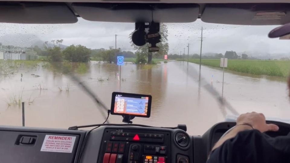
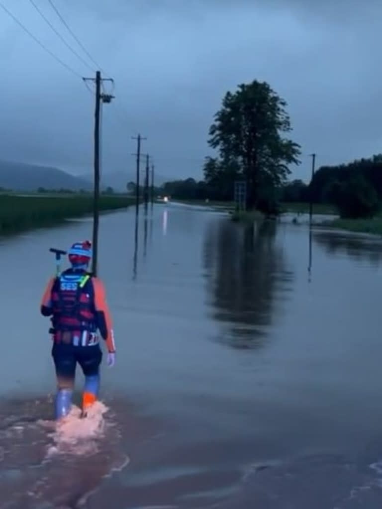
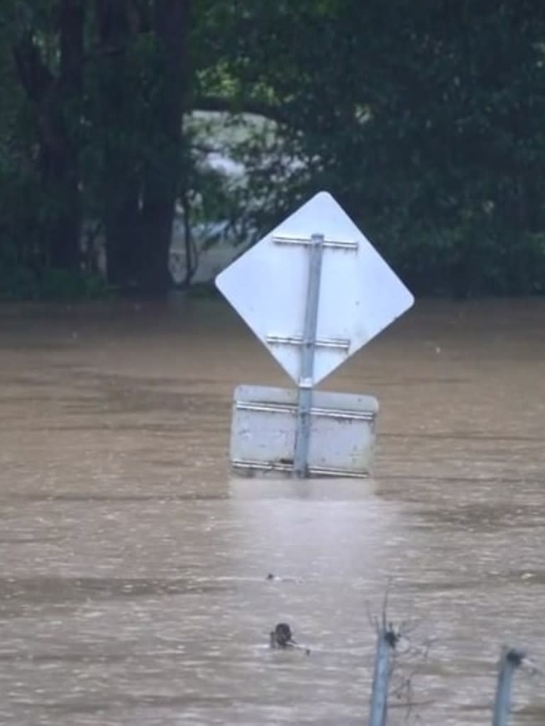
The NSW SES has responded to more than 115 call-outs in the past 24 hours, completing 27 rescues as waist-high floodwater ravaged the Northern Rivers region.
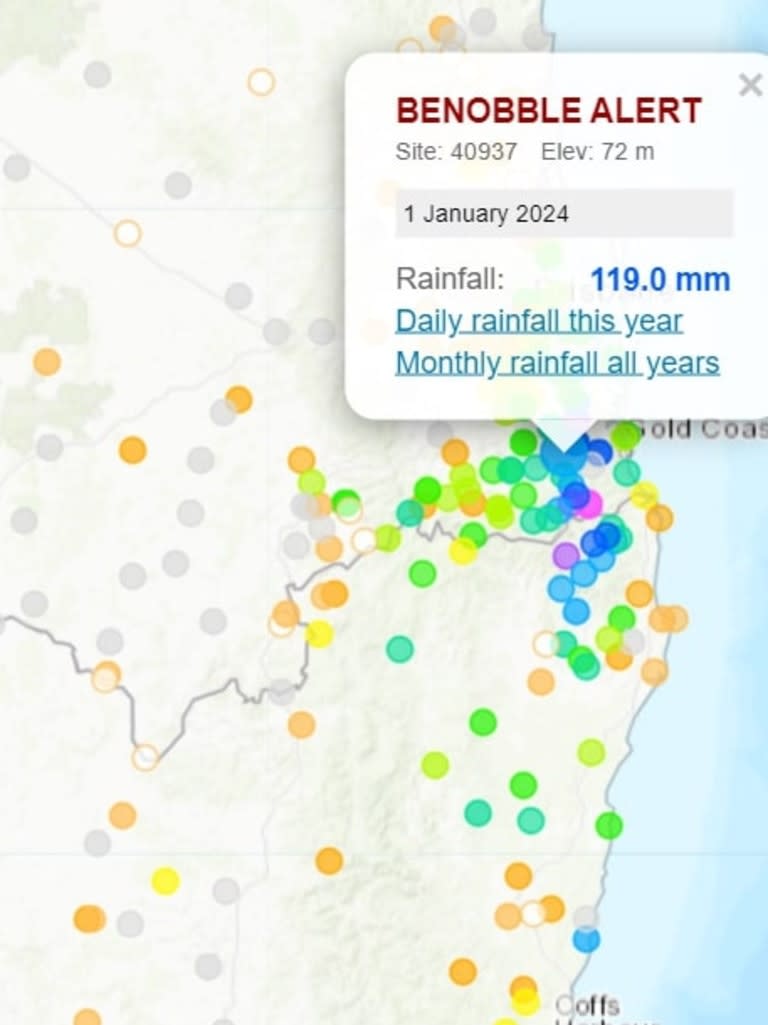
The heavy rainfall included more than 300mm falling in the Bald Mountain area, with many other parts of the region receiving more than 200mm since Monday.
NSW SES Assistant Commissioner Dean Storey said even with rain expected to ease on Tuesday, the danger was still very real for local residents.
“Catchments in and around the Northern Rivers continue to see the impacts of significant rainfall over the past 24 to 48 hours, and we’re expecting flood warnings to continue across the region,” he said.
“People in the Northern Rivers should heed the direction of emergency services on the ground, never drive through floodwaters and avoid unnecessary travel today.”
One rescue involved a man who was bitten by a snake escaping the rising water, highlighting another danger of flash flooding.

South East Queensland was also on the receiving end of large amounts of rain, with several catchments in the Gold Coast area registering more than 150mm in the past 24 hours.
The rain has led to flood warnings for parts of Capricornia and the southeast coast, moderate flood warning for the Logan and Albert rivers, minor flood warning for the Dawson, Connors and Isaac River catchments, flood warnings for the Nerang and Coomera rivers and a final flood warning for the Paroo River.
Residents in the areas are asked to remain vigilant and avoid entering or attempting to drive through floodwaters.
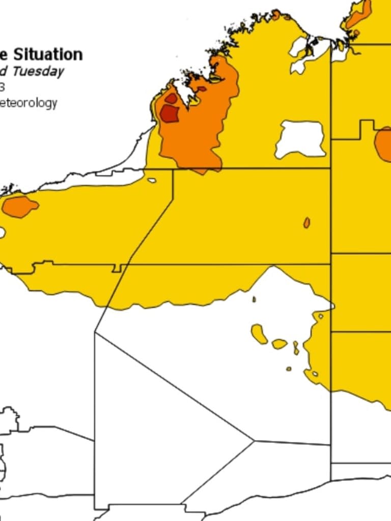
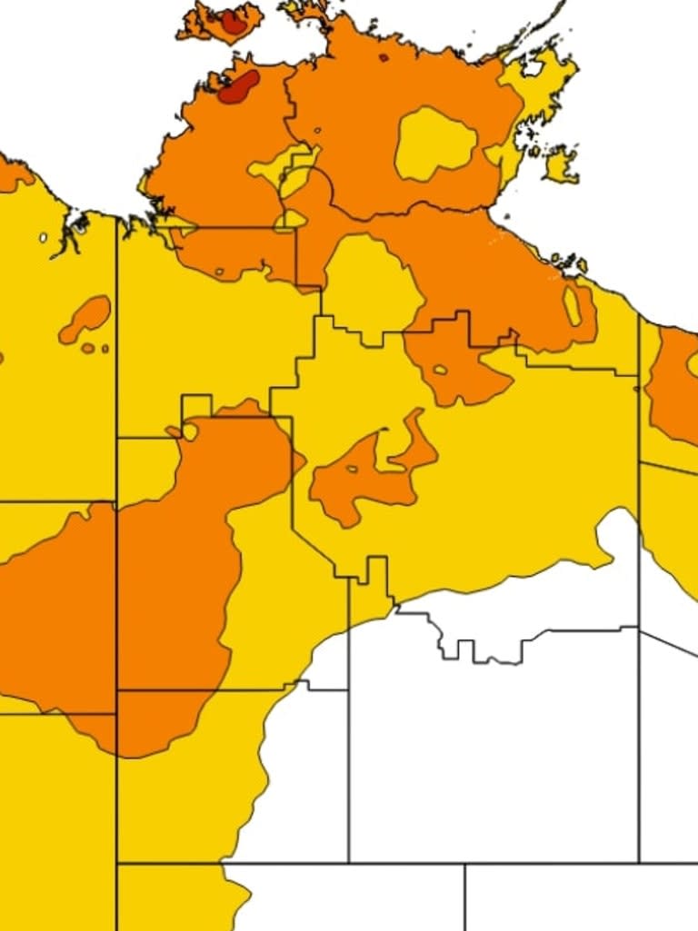
A large trough is triggering the storms and showers across NSW and southern Queensland while also responsible for drawing heat across the northern interior and the west, leading to heatwave warnings for large parts of Queensland, Northern Territory and Western Australia.
The northern parts of all three states have warnings in place for possible dangerous high temperatures, with residents asked to be vigilant.
Onshore winds are bringing light showers to coastal SA, western Victoria and southern WA, leading to mild conditions.
Melbourne and most of Victoria can expect cloudy conditions on Tuesday with the chance of thunderstorms and a high chance of scattered showers.
Adelaide and Perth are both expected to be sunny with a top of 30C. Sydney faces the slight chance of a shower and a top of 29C, as does Hobart with a top of 22C.
Darwin can expect rain and a possible thunderstorm, with the mercury expected to reach the mid 30s.
Though not as heavily hit in recent days as the Gold Coast, Brisbane is expected to be wet, with possible flash flooding from thunderstorms and heavy falls.

