City set to smash rain record

Sydney’s record-setting rainfall is forecast to drag on for another week at least, with Australians across central and eastern parts of the country also in for a wet weekend.
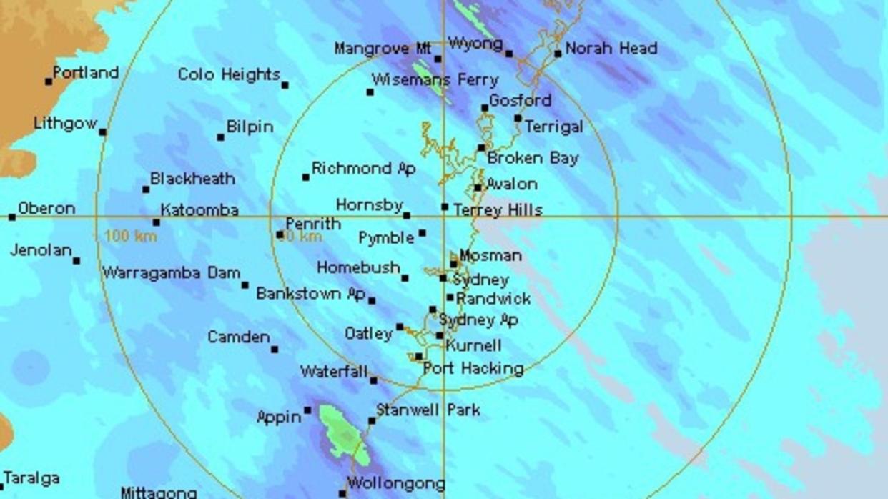
The Harbour City recorded more rain in the first six days of May than the monthly average of 117mm — and there is 34 to 127mm on the radar for the next week.
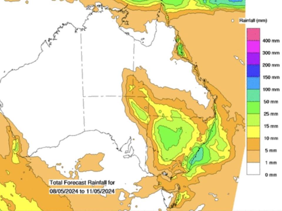
Showers and cloudy conditions along the east coast from the south coast of NSW up into Queensland could bring further daily rainfalls of 15 to 30mm each day for the rest of the week, moving into the weekend.
“But it’s the weekend when things will really start to ramp up,” Sarah Scully, meteorologist at the Bureau of Meteorology, said.
Along the southern half of the NSW coast, there is the potential for 100 to 150mms of rain between Wednesday and Sunday, with some areas predicted to potentially receive more than 200mm.
Canberra will likely cop the deluge as well.

“Persistent coastal showers are forecast to continue along much of the east coast and adjacent eastern ranges this week, as a series of high pressure systems crossing Tasmania maintains an onshore flow into NSW,” the Bureau of Meteorology says.
On Wednesday morning, Cronulla got a dousing, with 9mm recorded.
Sydney could also break a rainfall record; twice, in 1943 and 2022, 16 consecutive days of more than 1mm rainfall was recorded at the Observatory Hill weather station.
This consecutive days of rain streak began on May 1 and does not look set to end anytime soon.

On Thursday, central parts of the country can expect widespread rain and some thunderstorms, with the potential for heavy rainfall in the north east pastoral district of South Australia.
“On Friday, the focus of the heavier rainfall will shift into the interior of NSW, however widespread rain will also move into southern parts of Queensland as well,” Ms Scully said.
Ms Scully urged residents near the Warrego River in NSW to stay up to date with the latest forecasts and warnings, given there was already moderate flooding there.
“Any further rainfall over those swollen catchments will respond really quickly,” she said.
On Friday afternoon, coastal showers in NSW will start to increase, with the rain ramping up on Saturday.
“Catchments along the coast there are already really wet from recent rain, so this increases the chance of flooding” Ms Scully said.
“But at this stage, it’s too difficult to say the exact location or the severity of the flooding.
“Residents across eastern parts of NSW should stay up to date with the latest forecasts and warnings and also flood watches may be issued as we move closer towards the weekend.
“It does look like it’s going to be a really wet weekend, particularly for eastern parts of NSW and possibly even south eastern parts of Queensland as well.”
Brisbane can expect up to 10mm of rain this weekend, though only a droplet or two is forecast for the remainder of the week.
Melbourne can expect just a millimetre or two for the next seven days, while Hobart will get showers on Wednesday night.


