
East coast cops a drenching but inland towns remain dry

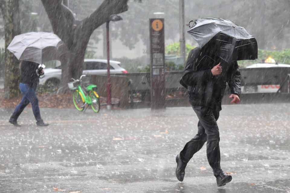
The east coast of NSW has been lashed with wild weather, with some areas in Sydney copping almost 100mm of rain in 24 hours.
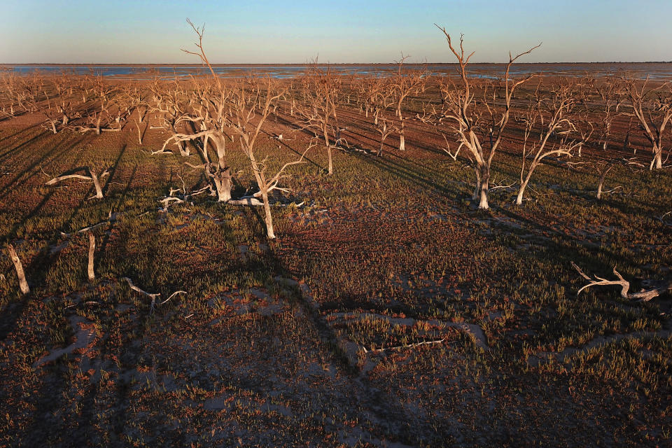
But the drought-stricken inland areas that face the alarming prospect of running out of water in months have not received nearly enough drops to make an impact.
Bureau of Meteorology duty forecaster Gabrielle Woodhouse told Yahoo News Australia heavy rain was mostly just reaching NSW coastal areas.
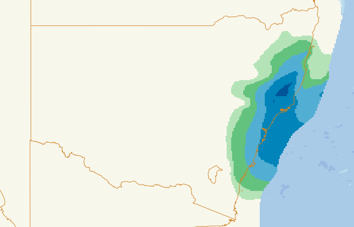
Some northern suburbs of Sydney, like Hornsby, received 90mm of rain as of 9am on Wednesday, St Ives was hammered with a whopping 93mm while Sydney’s CBD recorded about 65mm.
Towns desperate for rain miss out
Some towns in Central West NSW that face running out of water in just three months only received a sprinkle of the much-needed rain.
Forbes in the Central West only received 2.8mm of rain this week. Dubbo fared a little better with a total of 9mm.
Further north, Tamworth had barely a drizzle of 0.4mm while Armidale received just 0.6mm.
Merriwa, in the Upper Hunter, received 17mm in the past 24 hours, the biggest dumping since March.
“The northwest slopes and plains have had a millimetre or two at best,” Ms Woodhouse said.
“Those areas that are particularly drought-affected, the rain hasn’t got there and won’t help there.”
Ms Woodhouse said despite the heavy rain across NSW coastal areas this week, it would not be enough to really impact the drought being suffered across the state.
“For some places the water deficiencies are quite big and will take a very long time to make some sort of impact,” she said.
“It would take at least several months of above average rainfall.”
Warm weather expected before second cold front
Ms Woodhouse said rain hitting the NSW coast would ease tonight but light showers would linger on Thursday and Friday.
There will be warmer weather ahead of the weekend before another cold front sweeps through from Western Australia on the weekend.
Sydney’s temperatures will reach 23 degrees on Friday and 25 on Saturday, with most of the state experiencing tops of about 5 and 10 above average for this time of year.
But the warm weather will again be short-lived, with NSW to cop the cold front to finish off the weekend.
“The cold front is currently southwest of WA and will move through parts of WA tonight and tomorrow before moving through South Australia on Friday,” Ms Woodhouse said.
“It will be a slow moving change that will hit parts of NSW by Saturday night.”
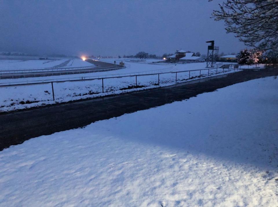
A cold front hammered parts of NSW on Tuesday with thick snow and heavy rain.
With Sydney’s CBD posting temperatures of 27 on Monday, it dropped to just 9 on Tuesday morning.
Do you have a story tip? Email: newsroomau@yahoonews.com.
You can also follow us on Facebook and Twitter, download the Yahoo News app from the App Store or Google Play and stay up to date with the latest news with Yahoo’s daily newsletter. Sign up here.

