
Fears of what a ‘super El Nino’ will bring

Australia will likely sweat through a “super El Nino” this year, with meteorologists finding the warm climate pattern is “very likely” to hit after three consecutive La Nina events.
Early Warning Network meteorologist Ken Kato said this wouldn’t be your “garden variety” El Nino either.
“A super El Nino isn’t really an official word, but at this stage it looks like the El Nino will probably be a really strong one,” Mr Kato told Today.
“What sets this one apart from the other ones (is) if it evolves into an El Nino that’s as strong as currently predicted.
“It will probably develop in winter through spring and perhaps last until early summer this year.”

Mr Kato said El Ninos can cause drier than normal conditions that tend to encompass large regions of eastern and parts of northern Australia, often leading to warmer than average daytimes.
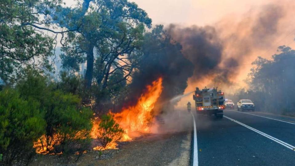
“It also increases fire weather,” he said.
“These are the type of weather conditions that increase the risk of bushfires spreading rapidly.
“It also increases frost risk, increases the risk of coral bleaching in the Great Barrier Reef and also often causes fewer tropical cyclones on average.”
El Nino, which means “little boy” in Spanish, is the warm phase of the El Nino-Southern Oscillation, occurring when sea surface temperatures in the central and eastern tropical Pacific Ocean become warmer than average.
While El Nino is associated with many months of warming in the central and eastern tropical Pacific, La Nina is associated with a sustained period of cooling.
El Nino and La Nina have one of the strongest influences on year-to-year climate variability in Australia.
According to the latest ENSO Outlook from @NWSCPC, the El Niño Watch persists with El Niño likely to develop within the next couple of months and then persisting (> 90% chance) into the winter.
More on that + our scorching oceans at the ENSO Blog.https://t.co/0RRmVKHQJrpic.twitter.com/CeHYn0ZRsE— NOAA Climate.gov (@NOAAClimate) May 11, 2023
The US Climate Prediction Centre found last week that there was an 80 per cent chance of a moderate El Nino occurring in the coming months, with more than a 90 per cent chance that it will last into summer.
Currently, there is a 55 per cent chance of a strong El Nino, up 15 per cent from last month.
There is still a 5 to 10 per cent chance the event won’t develop; however, the predictability of its potential strength will become clearer in the next few weeks.

