
One state facing days of rain

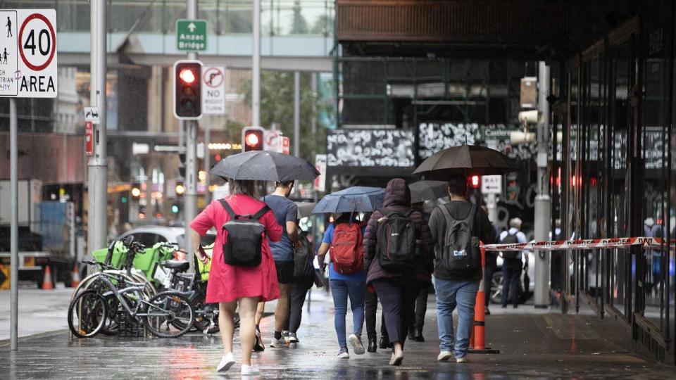
New South Wales is facing days of rain after parts of the state recorded its heaviest downfall in decades, as ex-tropical cyclone Kirrily crosses the border and continues to move south.
Torrential rain soaked regional towns in the state’s northwest on Monday, with Tibooburra recording 79mm of rainfall within just 24 hours, marking the town’s heaviest rainfall in three years.
Also in the state’s northwest, Fort Grey recorded 100mm of rainfall, amounting to nearly double its summer average.
The weather system is moving south over the state’s west before it is eventually expected to travel out to sea over the state’s south coast on Tuesday.


The ex-cyclone triggered flood watches and warnings on Monday, with moderate and minor flood warnings remaining in place on Tuesday morning for parts of the state’s west.
Moderate warnings for catchments including the Lachlan River to Cottons Weir and the Belubula River remain in place as the Bureau of Meteorology predicts localised river level rises.
The tropical deluge is also expected to cause the Warragamba Dam to spill within the coming days, with the southern section of the catchment to receive enough rainfall to bring dam levels to 100 per cent within days.

The dam levels are likely to mirror those during spills in mid-2020 to 2022 during the triple La Nina.
Kirrily will move the heaviest rain to NSW’s southeast overnight and it will also affect the ACT, including Canberra and densely populated areas of southern Sydney.
The bureau has issued a severe weather warning for people in the Southern Tablelands, South West Slopes, parts of the Central West Slopes and Plains, Riverina, Lower Western, Upper Western and ACT forecast districts as heavy and “locally intense rainfall” is expected to hit.
#Severe Weather Warning
for HEAVY, LOCALLY INTENSE RAINFALL
For people in Southern Tablelands, South West Slopes and parts of Central Tablelands, Central West Slopes and Plains, Riverina, Lower Western, Upper Western and ACT Forecast Districts.https://t.co/xnUW6y1xcUpic.twitter.com/ZWDfJZ8Ngr— Bureau of Meteorology, New South Wales (@BOM_NSW) February 5, 2024
The warning comes as Oberon, in NSW’s Central Tablelands, recorded 32mm of rainfall within 30 minutes on Tuesday morning.
More than 80mm was also recorded at White Cliffs in just six hours in the early hours of Tuesday morning.
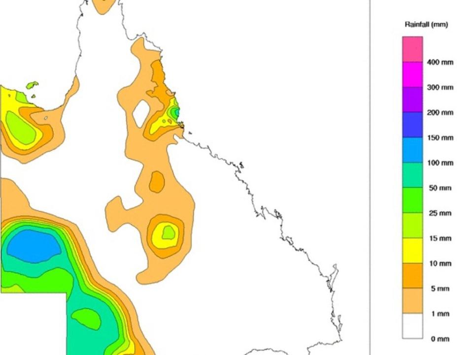
While Kirrily has migrated south, Queensland’s south coast continued to receive significant rainfall overnight.
Cowley Beach recorded 101mm of rainfall within 24 hours, while Bingil Bay was drenched by 110mm overnight.
Nearby, Menavale Alert received 76mm of rainfall and Fisher Creek recorded 71mm of rainfall within 24 hours.
While the ex-tropical cyclone has weakened in the state, a “protracted flood event” will continue in parts of western Queensland.
The Balonne River to Surat surpassed flood levels on Monday as it reached more than 9m and the river is expected to peak at nearly 10m on Tuesday.
⛈️Storm forecast Tues 6 Feb: Severe thunderstorms with locally heavy rainfall/flash flooding are possible in parts of northern and Far North #QLD on Tuesday. Damaging winds also possible with development in the far west near the #NT border. Warnings:https://t.co/iNHEVlHendpic.twitter.com/dQTKJ2kzl3
— Bureau of Meteorology, Queensland (@BOM_Qld) February 5, 2024
The Gregory River at Gregory Downs reached more than 13m on Monday but is expected to ease on Tuesday.
The bureau has predicted damaging winds to develop in Queensland’s far west near the Northern Territory border on Tuesday as well as severe thunderstorms with potential for locally heavy rainfall and flash flooding in the state’s north and far north.
Kirrily’s effects have also reached South Australia, as a sandstorm hit Moomba in the state’s far north east over the weekend.

