
‘Destructive’: Wild images as cyclone hits

Cyclone Megan has already paved a destructive path through an island off the Northern Territory coast with destructive winds tearing trees from the ground and flooding rains.
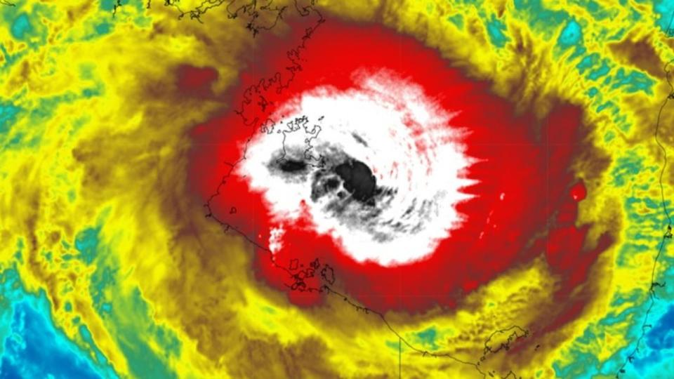
The cyclone intensified to a category 3 system on Sunday afternoon and is the fifth tropical cyclone to impact the country this season.
The bureau issued an alert at 3.30am (ACST) on Monday, warning residents to “take shelter” as the “very destructive core” of the cyclone will “start to impact the coast” between Bing Bong and the Queensland border within a few hours.
Warnings have now shifted from the Groote Eylandts to Port Roper in the Northern Territory up to Mornington Island in Queensland according to the Beareau of Meteorolgy
“A little bit of a smaller warning area, but still covering the same coastal and inland parts of the territory — Borroloola main area, Port McArthur, Robertson River and the Nathan River,” a spokesperson said.
However, the warning doesn’t apply to Mornington Island itself.
The evacuation of Borroloola residents was suspended earlier on Monday afternoon as the weather intensified.
About 700 people were meant to be evacuated using planes supplied by the Australian Defence Force, the ABC reported, however the evacuation was brought to a halt.
Earlier photographs shared by residents on Groote Eylandt show the extent of the destruction as of Monday morning after destructive winds and heavy rains from the weather system began to make impact.


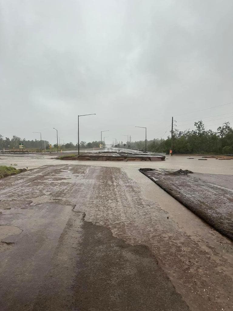

They show trees ripped from the ground and as well as yards and roads flooded following almost half of the average annual rainfall fell over the weekend.
The cyclone is moving slowly south an is due to make landfall southeast of Port Macarthur by Monday afternoon.
Wind gusts of up to 200km/h are possible at the system’s centre, while powerful winds of up to 125km/h are predicted to occur along the southwestern Gulf of Carpentaria coast and will extend to inland areas including Borroloola, McArthur River Mine, and Robinson River during the day.
The Northern Territory Emergency Service is urging communities in the warning zone to enact their emergency plan now, prepare their property by securing loose items, and prepare to take shelter.
Incident Controller Sonia Kennon told the NT News that while no evacuation order is in place, self-extraction is encouraged and anyone wanting relocation urged to report to their local police station.
“This is to ensure that we can follow up on you and make sure that you advise whoever you’re going to go and stay with, that they’re aware that you’re coming so that if you do not arrive then they can make a call and contact police,” Superintendent Kennon said.
“We ask that if that is your choice, that you ensure that you are driving a capable vehicle, like a 4WD, as we understand there is slight damage to the Carpentaria Hwy.”

Where possible they are encouraged to check on their neighbours and make sure they have enough water stored in case of supply issues following the cyclone’s impact.
Bureau senior meteorologist Miriam Bradbury warned there was a “whole suite of very significant hazards” for communities in The Gulf of Carpentaria areas.
“We have already had reports of damage about parts of the coast including Groote Eylandt,” she said.

Chief Minister Eva Lawler said while locals are “no strangers” to dangerous weather they should remember to take the necessary precautions.
“Strong winds and a lot of rain is likely over coming days – and flash flooding is a possibility,” she said.
“We’re no strangers to cyclones and floods but we all should remember to take precautions and stay safe.”
Heavy to locally intense rainfall is also likely on the coast and in parts of the Queensland Gulf Country.
Widespread falls of 100-200mm are expected, with isolated falls of between 300 and 500 mm expected over the mainland.
Rainfall will likely be heaviest in the Carpentaria region of the NT, with areas on the western and northern flanks of the cyclone due to experience a drenching.
Already the cyclone has dumped half a year’s worth of rainfall over Groote Eylandt in the past 48 hours.

The rain gauge at Groote Eylandt Airport recorded 431mm of rainfall in the 24 hours to 9am on Sunday, making it the region’s second wettest day in 103 years of records.
It brings the total rainfall to 680.4mm in just 48 hours, over half their average annual rainfall of 1275.2mm.
Coastal residents between Nathan River and the Northern Territory-Queensland border are specifically warned of a dangerous storm tide as the cyclone centre crosses the coast. Tides are likely to rise significantly above the normal high tide, with damaging waves and dangerous flooding, the bureau warns.
The weather system is expected to take a similar track to Tropical Cyclone Lincoln last month, heading west towards central parts of the NT, although it is not expected to travel as far before dissipating.

