
Big call as ‘life-threatening’ storms rage
The Australian Defence Force could be enlisted to help communities in Queensland’s southeast that have been hammered with heavy rainfall and life-threatening flash flooding to start the new year.
On Monday, Queensland Development and Infrastructure Minister Grace Grace revealed the state’s disaster coordinator Shane Chelepy was in talks with the federal government regarding the need for ADF assistance.
“We’re talking about the Army Reserves and the army veterans coming in as well,” Ms Grace said.
“(Mr) Chelepy is speaking with the ADF about how they might be able to come into assist as well.
“We’re trying to get as many hands on deck as we possibly can.”
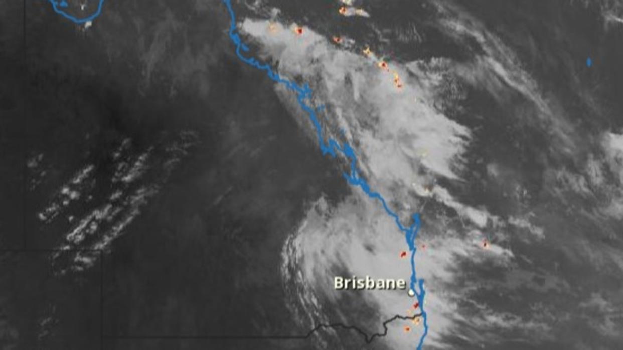
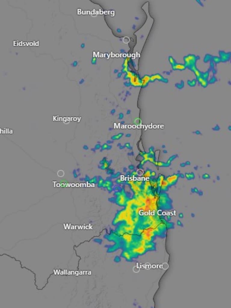
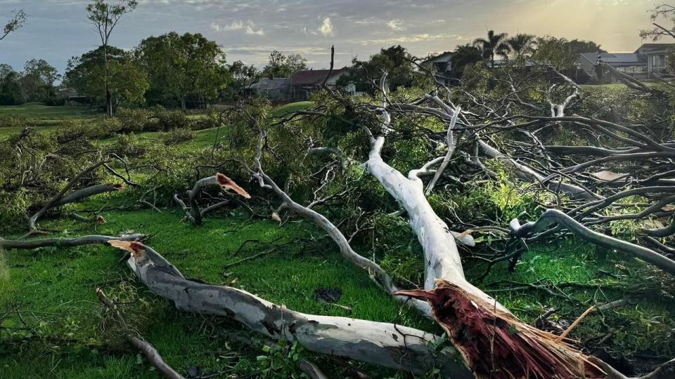
More than 500mm of rain doused the already saturated Gold Coast on Monday, with Coolangatta, Logan City, Beenleigh, Mount Tamborine and Springbrook regions also affected.
Queensland’s Emergency Management Minister Nikki Boyd said up to 250mm of further rainfall could hit the southeast of the state on Monday night.
“We’re seeing a rapid onset of rainfall and the catchments are already quite saturated,” Ms Boyd said.
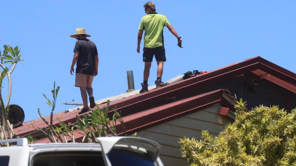
A warning for severe thunderstorms has persisted through to the new year after homes were torn apart in the Gold Coast area in late December.
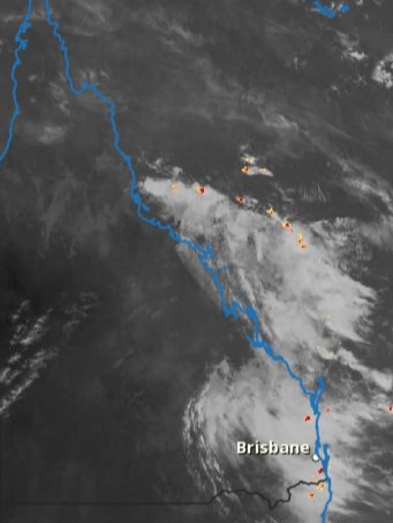
The bureau has attributed the conditions to humid, easterly winds colliding with a coastal trough overhead in South East Queensland.
Thunderstorms are likely to dominate the region for most of Monday, with a further warning for residents to be aware of possible flash flooding.
Little Nerang Dam, northwest of Springbrook, recorded a staggering 150mm of rainfall and run-off in the space of three hours before 5.30am.
A flood alert for the Nerang River, Mudgeeraba, Tallebudgera and Currumbin creeks was issued midmorning on Monday.
Up to 350mm of rain was recorded from 9am on Sunday through to Monday morning, causing river and creek levels to rise to concerning levels.
It’s been reported that holiday-makers camping near the Numinbah Valley and Natural Bridge in the Gold Coast were rescued by the Queensland Fire and Emergency Service.
A QFES spokeswoman said campers had been stranded by floodwaters at two separate sites in the Scenic Rim region, but all had been accounted for and had been moved to an evacuation area.
BOM issues warning on impending conditions
While the intensity of storms has eased slightly in the Hinterland region, the bureau has warned severe conditions could redevelop in coming days.
Bureau of Meteorology community information officer Daniel Hayes said conditions were likely to persist through to Wednesday, with the possibility of “quite intense” rainfall hampering residents at various times throughout January.
Mr Hayes said localised rainfall had exceed 250mm in some areas and there was a serious threat to residents in high flood-prone areas.
Severe thunderstorms and heavy rainfall conditions are likely to persist through to Wednesday.
“Effectively, more of the same is expected for the southeast coast area into tomorrow,” he said.
Eventually, the harsh weather patterns will “retreat inland” into central Queensland, easing over the state later this week.
Emergency services urge people to stay home
QFES Deputy Commissioner Kevin Walsh said the rain event was expected to continue for the next 24 hours and urged those living in affected areas to stay at home.
“If there is no compelling reason to be out on the road, can I suggest, over the next 12 hours at least, people stay in their homes,” he said.
“I can’t express the importance enough (for) people staying home over the next 12 hours.”
The bureau said residents and travellers should never walk through or attempt to drive through flood waters.
Commuters are urged to avoid driving because of the dangerous conditions and park vehicles away from trees during severe storm events.
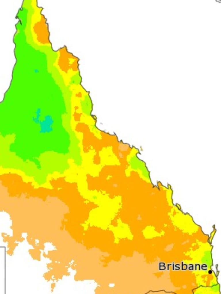
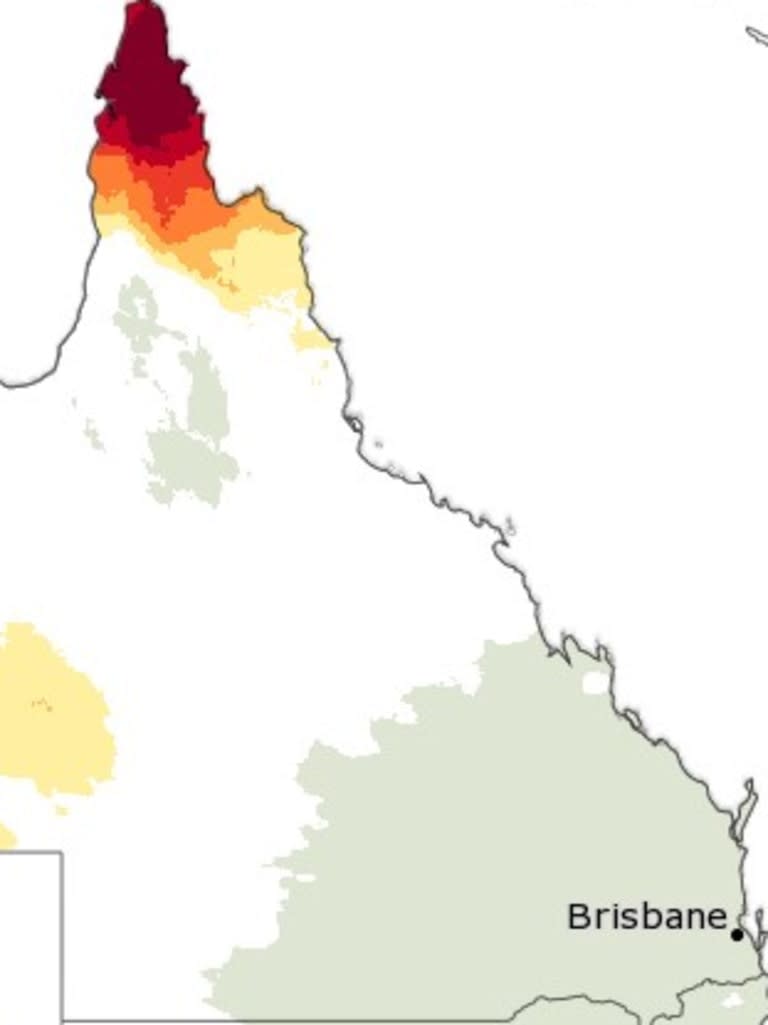
In the north of the state, Queenslanders are having to contend with hot and humid weather, with temperatures sitting in the low to mid 30s in Cairns and Townsville for the rest of the week.
A low-intensity and severe heatwave warnings have been issued for the western half of the stat, and an isolated extreme heatwave warning northwest of Cairns.
Based off most recent data, temperatures reached into the 97th percentile for areas close to Gladstone and Hervey Bay and the UV index sits at 14 throughout the state, which is above extreme levels.

