Coldest storm of winter and spring to dump snow in California
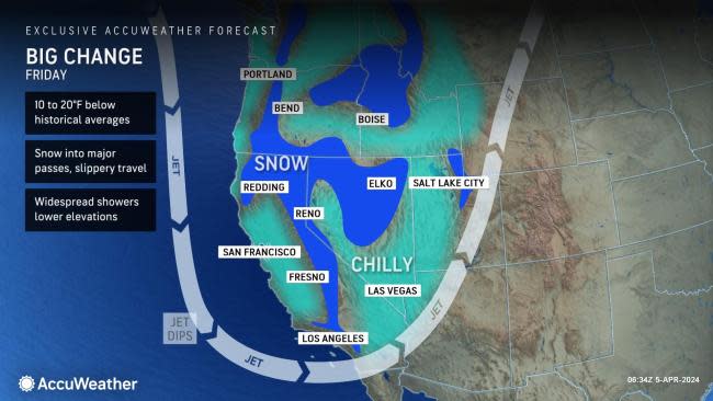
California residents and southwestern United States motorists should be prepared for slippery travel over the passes while some thunderstorms associated with a storm system could be feisty, AccuWeather Meteorologists say.
Disruptions to outdoor plans are likely, and travel may be slow in some cases due to the winterlike storm pivoting into the western U.S.
 |
"An unusually cold storm will pivot slowly through California and the southwestern United States into the start of the weekend," AccuWeather Expert Senior Meteorologist Ken Clark said.
"The storm will push freezing levels to their lowest point of the entire cold weather season," Clark explained. "That means it will snow over the passes in Southern California."
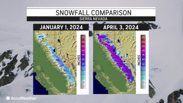
The existing snowpack will get yet another late-season boost.
 |
Snow levels will lower on Friday and will dip to around 2,500 feet in the central Sierra Nevada and to around 3,000 feet or so in the Transverse Mountains and Coast Ranges in Southern California.
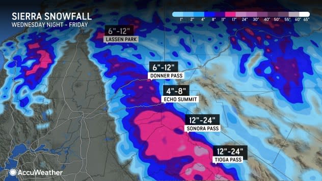
From 1 to 2 feet of snow will fall on the Sierra Nevada with 6-12 inches and slippery travel over Donner Pass, California, along Interstate 80. Heavy-duty snow removal equipment should be able to keep up with the storm and keep the pass open, barring any accidents, but travel may be slow and possibly down to one lane.
 |
"Snow will be in the air at times over the passes of Southern California," AccuWeather Senior Meteorologist Brett Anderson said.
Over Cajon and Tejon Passes in Southern California, little to no snow accumulation is likely on most of the roads, but there can be some slippery spots over the crest of the passes, especially on Friday.
The storm system will lead to an eruption of thunderstorms over the region.
"The air aloft will be quite cold and perhaps the coldest of the entire winter season," Clark said. This will provide a recipe for clouds to bubble up and develop into gusty showers and thunderstorms, mainly during the midday and afternoon hours through Friday.
It is possible that some of the strongest thunderstorms produce small hail and damaging wind gusts at a highly localized level.
 |
Other than the thunderstorm activity, rainfall in most cases is likely to be unremarkable with the storm, Clark said. Some highly localized downpours can lead to brief street and highway flooding, but nothing like what some storms over the winter produced.
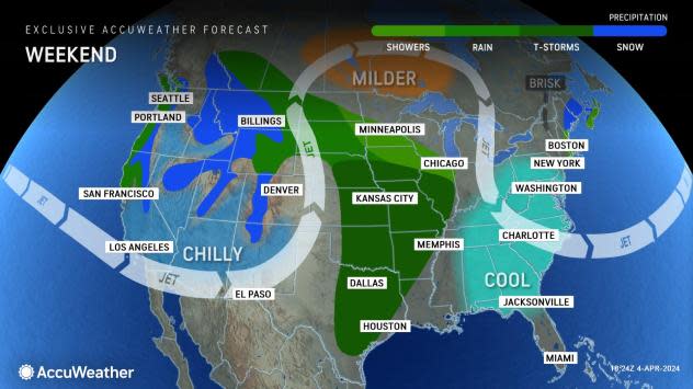
As the core of the cold air pivots farther inland as the weekend progresses, conditions will stabilize in much of California. Clouds, showers and mountain snow will taper off, and temperatures will trend upward.
For example, in Sacramento, California, following high temperatures in the mid-50s F with AccuWeather RealFeel® Temperatures in the 30s and 40s at times, readings will rebound into the 60s over the weekend and the 70s early next week. The historical average high in early April is close to 70.
Farther south, in Los Angeles, high temperatures will only be in the 50s on Friday with clouds and showers, but near 70-degree temperatures and sunshine will return on Monday. A high in the low 70s is typical for early April.
 |
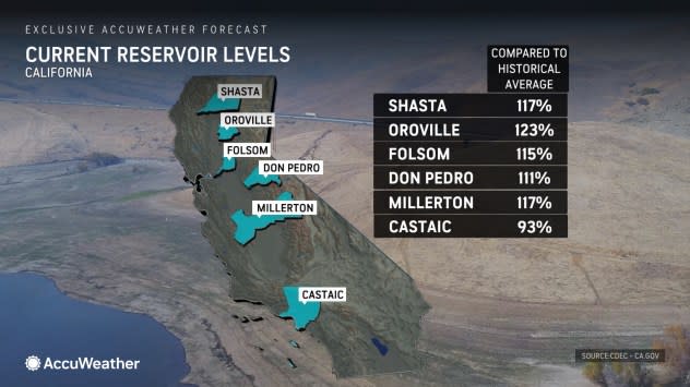
The additional rain and mountain snow from the storm into Saturday will further boost the Sierra snowpack and later further boost reservoir levels as that snow melts moving forward this spring and summer.
"Earlier this winter, AccuWeather announced that because of the stormy conditions from last winter and this most recent winter, no water shortage issues due to the weather are likely through next year and into the spring of 2026," Clark said.
Want next-level safety, ad-free? Unlock advanced, hyperlocal severe weather alerts when you subscribe to Premium+ on the AccuWeather app. AccuWeather Alerts™ are prompted by our expert meteorologists who monitor and analyze dangerous weather risks 24/7 to keep you and your family safer.

