
Australian weather: Melbourne records wettest August day in 20 years
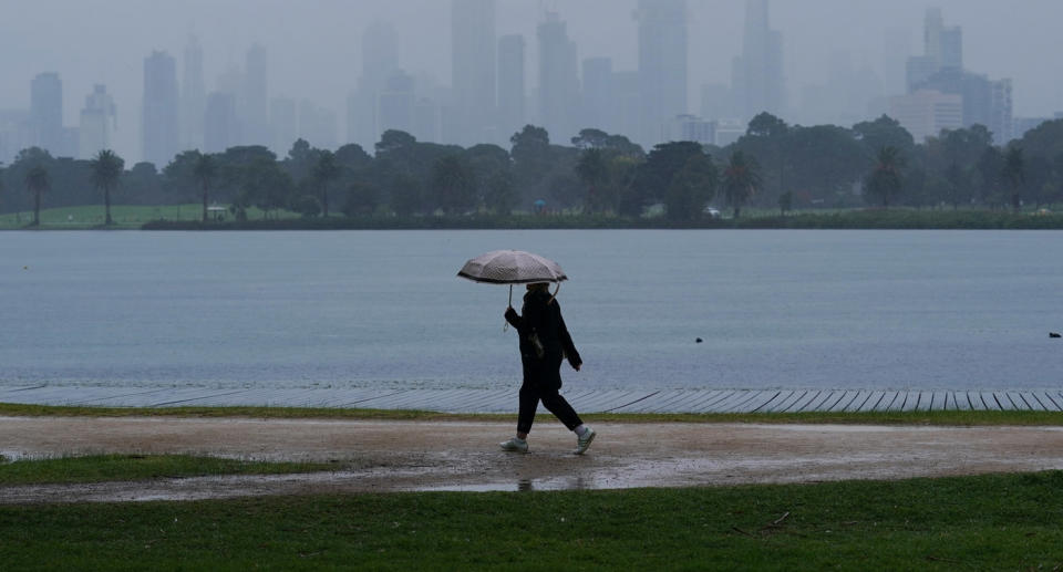
Victoria’s weekend deluge has seen weather records broken in parts of the state as an Antarctic cold front moved across Australia’s east, with Melbourne recording its wettest August day in more than two decades.
The state’s capital received a hefty dumping in the 24 hours from 9am Saturday, receiving a whopping 25.6mm of rain – the most for an August day since 1999.
Viewbank, northeast of the city, was also drenched during that period with 29.2mm of rain, which was the highest ever recorded for the area.
The same was the case for Glenburn, in the Shire of Murrindindi, which received 29.6mm of rain, while Mount Mercer in the state’s west had 27.2mm and Bullarto had 33mm.
The most rainfall for the whole of Victoria was dumped in Mount Donna Buang, in the southern reaches of the Victorian Alps of the Great Dividing Range, which had 63.6mm.
Lake Eildon, also in Victoria’s Alpine Region, recorded its lowest ever August maximum of just 6 degrees.
'Sums up 2020': Chilling photo emerges amid state's devastating battle on two fronts
'Scared for my life': Water spout-turned tornado smashes beachfront homes
More chilly weather records were broken in NSW and the ACT over the weekend, including in Orange in the NSW Central Tablelands, which recorded its coldest day of the year on Saturday, reaching just 3.7 degrees.
“A few locations over parts of the Central Ranges and the Southern Ranges recorded their coldest day so far this year,” Rebecca Boettger, from the Bureau of Meteorology, told Yahoo News Australia.
Bit of a soggy weekend in #Melbourne ☔ 25.6mm in the city rain gauge in the 24hrs to 9am made it the wettest August day since 1999! #FernyCreek & #Monbulk topped the leaderboard with 32mm. A further 2-10mm today, up to 15mm in the Dandenongs.https://t.co/9OlceTORgW #MelbWeather pic.twitter.com/HfdGXkdPpo
— Bureau of Meteorology, Victoria (@BOM_Vic) August 23, 2020
A beautiful image captured by @nampix at Clarence in the Blue Mountains this morning as snow settles across the Gospers Fireground.
It’s going to be a cold and windy day so rug up and ensure that you keep anything flammable at least a metre from the heater. #nswrfs #winter #snow pic.twitter.com/2SOtgusQLx— NSW RFS (@NSWRFS) August 21, 2020
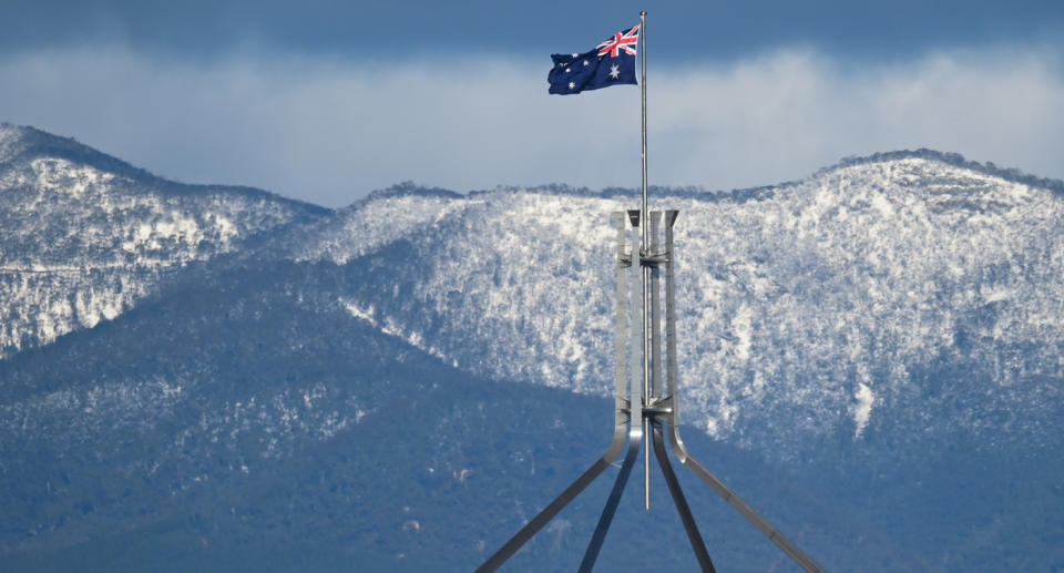
Bathurst reached 6.6 degrees on Saturday, its coldest day time temperature this year, while Canberra reached 7.5 degrees, which was also its coldest day-time temperature for the year.
“It was also possibly the coldest day since 2016 for Canberra,” Ms Boettger said, explaining current numbers were preliminary and yet to be checked by a climatologist.
Parts of NSW and the ACT are currently covered in snow despite Spring being around the corner.
The Snowy Mountains, Orange, Oberon, Blue Mountains and surrounding areas are coated in snow, as well as some part of Canberra.
The Bureau of Meteorology said on Saturday it was due to very cold and windy conditions associated with a series of cold fronts and troughs moving over the country's southeast.
Actually snowing now at Stanley - just gorgeous @abcnews pic.twitter.com/mPjYlXDpUT
— Edwina Farley (@EdwinaFarley) August 21, 2020
More than a metre of snow was expected to have fallen by the end of the weekend, BOM manager for NSW and the ACT Agata Imielska said.
Ms Imielska said residents in affected areas should be mindful of road closures and worsened driving conditions.
She said such snowfall was common for the Snowy Mountains region, but certainly unusual for Canberra, Orange and surrounding areas.
“It is very cold and for Canberra likely to be possibly the coldest winter in five years,” she said.
Ms Imielska cautioned snow lovers keen to ski outside resort areas to check the conditions and ski to their ability, citing a risk of blizzards and avalanches.
With AAP
Do you have a story tip? Email: newsroomau@yahoonews.com.
You can also follow us on Facebook, Instagram and Twitter and download the Yahoo News app from the App Store or Google Play.


