
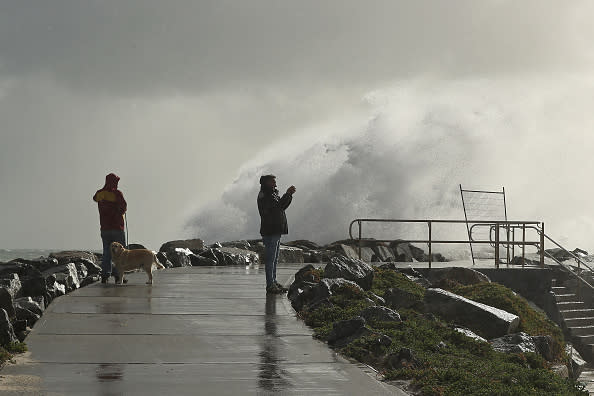
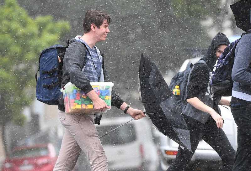
Set for a drenching: State-by-state guide to the weather expected this winter

We’re in for a wetter than average winter across Australia with southern parts of the country also set for colder than usual temperatures.
However, there is good news – with more rain, some parts of Australia will enjoy warmer winter nights, according to Bureau of Meteorology's Dr Andrew Watkins.
"When we look at the expected temperatures, they really fall in line with the expected rainfall conditions,” Dr Watkins said.
"Areas with a higher chance of above average rainfall are also looking at increased chances of cooler than average days because they are more likely to have cloud cover and more evaporative cooling in the coming months.
"Conversely, it means our nights are more likely to be warmer than average, because that cloud cover will prevent heat from escaping during the evenings."
So, what areas are in for rain this winter?
NSW and the ACT
Dr Watkins said NSW and the ACT are “generally looking wetter than average”.
Inland can expect cooler temperatures than coastal areas whereas seaward of the Great Dividing Range can expect closer to the average.

There are exceptions in coastal areas, which can expect “warmer than average” daytime temperatures.
The bureau puts that down to warm conditions over the eastern part of the Indian Ocean between Australia and Indonesia.
“That’s likely to put a lot more moisture and heat into the atmosphere,” Dr Watkins said.
“So, we are expecting more clouds to form and move over the country.”
He added if those clouds clash with cold fronts over the Tasman Sea: “we should see more rainfall over NSW”.
Most of June’s rain should occur over the second-half of the month.
Between June 8-21, some areas from Sydney to the Central Coast can expect between 25-50mm, the west is forecast to get 15-25mm and expected rainfall drops gradually as you go further inland. The BOM says there is about a 50 per cent chance of reaching these totals.

The ACT can expect similar totals to Sydney over these weeks too while areas west of the capital near Tumut, Cabramurra and Adaminaby south through to Kosciuszko National Park could see up to 100mm.
BOM forecasts the deluge over the fortnight is a 65-70 per cent chance.
Sydney’s had a wet Friday, with between 3-5mm in most central parts from 12-1pm.
Expect a warm start to winter though, with temperatures maxing out between 17-21 up until next Friday.
The ACT will be cooler with tops of 12-16. Expect a chilly Wednesday with a blistering low of -2.
However, BOM predicts we’re in for a warmer winter than usual with most of the NSW coastline between 70-80 per cent chance of having a higher than median winter temperatures.
Could the rain in NSW break the drought?
Weather Zone meteorologist Joel Pippard told Yahoo News Australia the high temperatures off the Indian Ocean are “a good sign”.
Mr Pippard noted this is the first time the Indian Ocean Diapole had a “strong negative” since 2016.
He said in 2016, the Murray-Darling Basin received recorded rainfall before it became crippled by drought.
When asked if it’s possible upcoming rainfall could alleviate drought in the area, he said “absolutely”.
“If we get rainfall similar to 2016 it is a good sign we could alleviate drought,” he said.
“But again, this is only a forecast.”
Western Australia to get heavy showers
There’s currently a severe weather warning in place for Lower West, South West, South Coastal and parts of Great Southern districts parts of Western Australia.
The bureau said a cold front is bringing damaging winds, possibly up to 100km/h.
“Rainfall totals of 40 to 50mm are possible in the Perth hills and parts of the Southwest District,” BOM said.
“Heavy showers and thunderstorms could reduce visibility and make driving conditions hazardous.”
As for the coming weeks, Dr Watkins said the southwest should have higher than average rainfall over winter.
“In terms of temperatures, much of the state is looking at average to below average temperatures particularly in those areas where we expect to see higher rainfall,” he said.
Dr Watkins expects cloud cover to keep WA warm at night.
Areas including Perth through to Busselton, Bunbury and Margaret River could see between 50-100mm between June 8-21. Margaret River and surrounds have a 50/50 chance of this while Perth is higher at between 60-65 per cent.
Further up the west coast and some areas including Coral Bay and Exmouth could see as little as 1-10mm.
Temperatures for this weekend and the week ahead for Perth should see tops between 18-22.
Victoria to be cooler than average in parts
Only the far east of Victoria, including Gippsland, will be spared a wetter than average winter with warmer daytime temperatures too, Dr Watkins said.
Victoria could also be cooler than average in the west but normal in the central areas.
From June 8-21, Melbourne could see about 25-50mm of rain. East Gippsland should see about the same but with a lower chance than Melbourne.
Further northeast, and areas through to the state border could see up to 100mm.
Towns in the northwest corridor including Mildura could see as little as 10mm.
Melbourne’s in for showers next week after a clear weekend with tops of 13 to 17.
Monday will be the wettest day of the week with between 6-10mm of rain forecast.
Queensland’s dry season begins
Southern Queensland should be wetter than average but with no temperatures out of the ordinary for winter.
Dr Watkins said the northern part of the state is in the dry season come winter.
He added the same “ocean drivers” affecting NSW were also set to affect Queensland’s south - providing rain but also heat.
The southeast could see some areas receiving as little as 15mm but as high as 50mm between June 8-21.
However, most of the state moving west will see just 10-25mm over this period. It’s the same with coastal areas from the Whitsundays through to Cairns.
Much of Queensland’s border with the Northern Territory isn’t forecast to have any rain at all.
Brisbane’s in for a mostly warm and sunny week ahead with temperatures sitting a top of 23.
Adelaide set for a drenching
“Well, winter is certainly looking wetter than average for South Australia with virtually the entire state likely to have a wetter than average winter,” Dr Watkins said.
He added this is an 80 per cent chance of occurring.
The rain will mean cooler days and warmer nights due to the cloud cover.
Adelaide’s due for up to 100mm from June 8-21. It’s the same for most of Kangaroo Island which was lashed by bushfires earlier this year.

Inland South Australia, closer to the border with the NT, should see between 1-10mm.
Residents in Adelaide should enjoy Friday’s sun while it lasts because the rest of the week is set for showers.
Expect them to ease after Monday though, with up to 10mm on both Saturday and Sunday, and eight on Monday.
Temperatures should reach tops of about 17.
No June rain for Darwin
The southern part of the NT should be wetter than average, Dr Watkins said but generally, like Queensland, much of the territory enjoys cooler, dry winters.
“The wetter areas could be a bit cooler than average,” he said.
“So down towards Alice Springs in the southern half of the state but could be warmer across the north - especially during the days.”
Despite having some wetter than average rainfall, Alice Springs and surrounds are probably only looking at about 1-5mm between June 8-21, with most of this rain occurring in the second week.
Darwin’s not forecast for any rain at all with the city set for a toasty start to winter with temperatures in the low 30s.
Alice Springs could be a bit cooler with a top of 27 on Saturday before it slightly cools through to Wednesday.
Tasmania ‘warmer than average’
“In terms of temperatures it is looking like it’ll be warmer than average,” Dr Watkins said of Tasmania’s winter.
He said Tasmania doesn’t face the same wetter than average temperatures as mainland Australia due to the cloud bands.
“Typically those northwest cloudbands don’t extend all the way down to Tasmania,” he said.
“They can sometimes, but typically they don’t.”
That doesn’t mean Tasmania won’t face any rain though. Areas near Queenstown and Strahan on the west coast could receive 100mm or more for June 8-21.
Hobart will only receive about 5-10mm though.
Launceston could receive up to 100mm.
Tasmania’s first week of winter for 2020 should see Hobart with tops of about 14 degrees and Launceston slightly warmer with tops around 15-16.
Do you have a story tip? Email: newsroomau@yahoonews.com.
You can also follow us on Facebook, Instagram and Twitter and download the Yahoo News app from the App Store or Google Play.


