
East coast braces for wild weather, huge waves as cold front looms
Residents on the east coast are being warned to rug up as a cold front brings biting cold winds for the rest of the week.
A chill in Thursday’s wind across the east will make it feel 5 to 10 degrees cooler despite temperatures expected to reach the low-20s in places like Sydney, Weatherzone senior meteorologist Jacob Cronje told Yahoo News Australia.
A very cold morning is also expected on Friday across the east coast, bringing with it widespread frost, he added.
Dangerous winds should begin to ease by then as well.
The largest swells are expected tomorrow, Mr Cronje said.
Windy weather has prompted warnings from Tasmania to the Top End on Tuesday: https://t.co/YG8xnoTwqh pic.twitter.com/e2E7XzgLnc
— Weatherzone (@weatherzone) August 19, 2019
Waves up to eight metres high are expected to crash along the coast from Tasmania on Wednesday, pushing further north and reaching the NSW Mid North Coast by Thursday and Friday.
Dangerous wind warnings are in place, but the biggest gusts are due to sweep across the eastern states on Thursday.
Boat owners, skippers and rock fishermen are warned to brace for gale force winds and dangerous surf conditions with damaging south-easterly winds expected to slam the coast of NSW, Victoria and Tasmania in coming days.
Large and powerful southerly swell is expected along the #NSW coast from Wednesday. Take care with all #marine activities and watch for possible #coastal erosion. Warnings at: https://t.co/LA4tj9aUG0 @slsnsw @MarineRescueNSW @nswpolice @NSWMaritime pic.twitter.com/lW6Kn0tRK3
— Bureau of Meteorology, New South Wales (@BOM_NSW) August 20, 2019
The Bureau of Meteorology says surf and swell conditions will develop across the NSW coast on Wednesday afternoon and into the evening.
These are expected to create hazardous conditions for rock fishing, boating and swimming along the Macquarie, Hunter, Sydney, Illawarra, Batemans and Eden coasts, the BoM says.
A marine wind warning for gale force winds is also forecast for the Eden coast and a strong wind warning is in place for Sydney closed waters, and the Macquarie, Hunter, Sydney, Illawarra and Batemans coasts.
Dangerous boating conditions
Roads and Maritime Services is reminding boaters to take extra care and be aware of the risk of hypothermia.
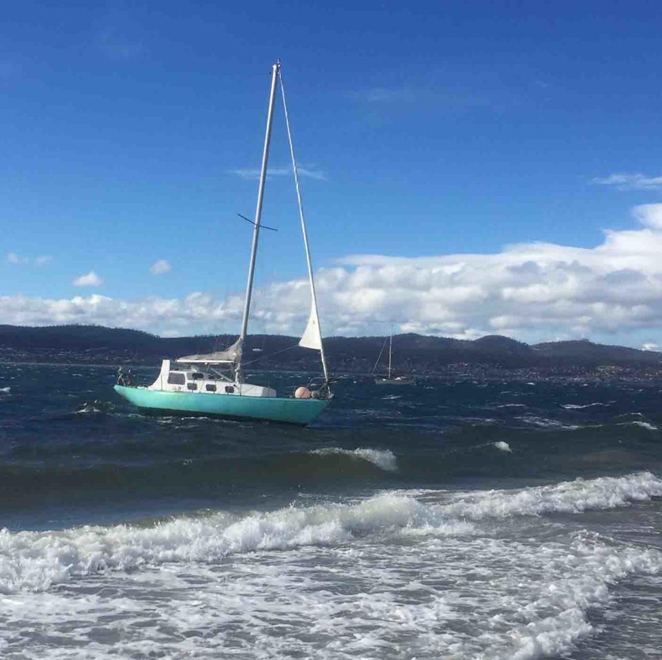
RMS also advises skippers and owners of small craft to check weather conditions before they consider crossing a coastal bar or heading offshore.
Those already on the water should carry appropriate safety equipment and wear a life jacket.
Skippers are advised to consider staying out of the water and to avoid walking near surf-exposed areas.
Rock fishermen are advised to avoid fishing near dangerous surf, to wear a life jacket and check weather forecasts before heading out.
They should seek a safe location sheltered from the surf and avoid coastal rock platforms, which are exposed to the ocean.
⚠️#Warning issued for damaging #winds across the southeast including #Illawarra, #SouthernTablelands, #SnowyMountains and #SouthCoast. Windy conditions likely to persist until Thursday. Check the latest at https://t.co/Z11hCDKat1 pic.twitter.com/7vmJYUUh9s
— Bureau of Meteorology, New South Wales (@BOM_NSW) August 20, 2019
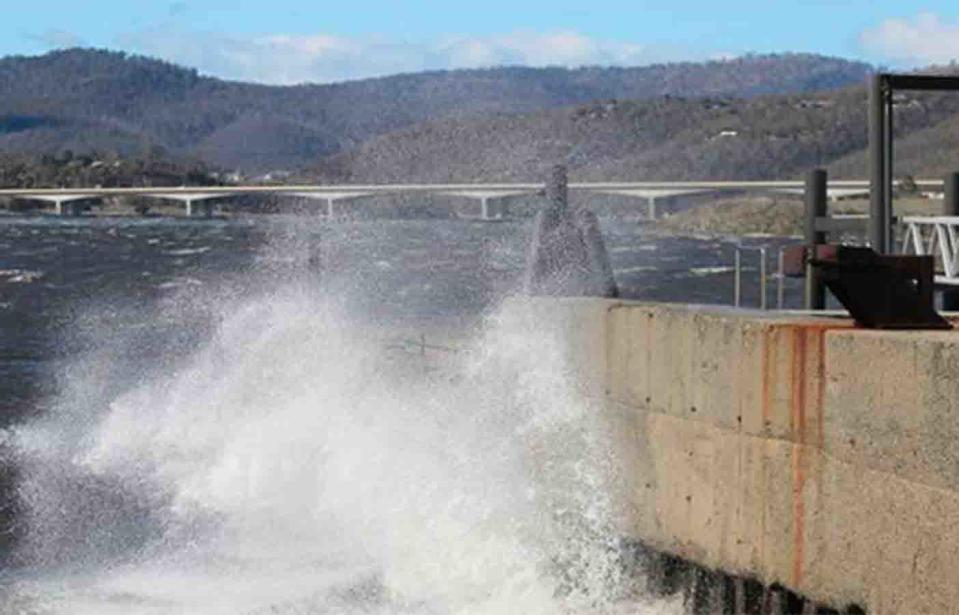
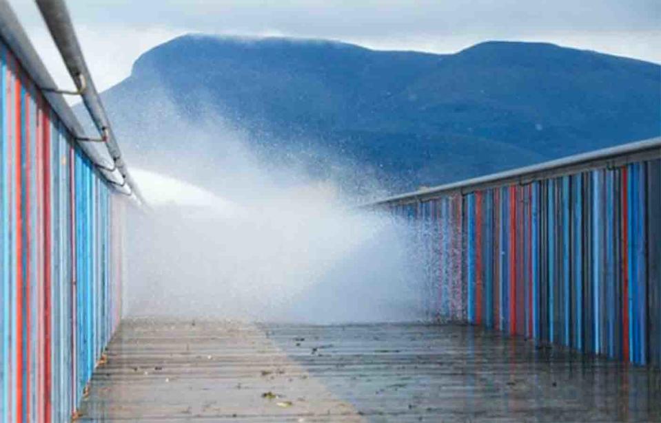
More wild wilds across Tasmania
A double cold front crossing Tasmania is generating powerful winds, rain and highland snow.
Mt Wellington was the coldest place in the country on Tuesday morning at – 2.8C.
Wild winds, predicted to exceed 100 kilometres per hour, are also set to continue across Tasmania as a cold front brings rain and snow to the state.
The warnings come after damaging winds ripped the roof off a Hobart home and sent it flying onto a neighbour's house on Tuesday night.
Tasmanians have been urged to tie their trampolines down until the wild weather subsides on Thursday.
Gusts of 139km/h were recorded at Mount Wellington on Tuesday afternoon and 120km/h in Hobart.
Emergency crews received multiple calls from residents in danger of losing their roofs while a number of trees also came down.
At Montagu Bay, a roof flew off about 5.30pm before landing in a neighbour's property. No one was hurt.
The #Severe #Weather Warning for damaging winds continues for parts of Tasmania today and early Thursday. Stay safe and check out all the latest warnings at https://t.co/NHL3HY0zFO pic.twitter.com/0KTT5WqyOS
— Bureau of Meteorology, Tasmania (@BOM_Tas) August 20, 2019
Rainfall of between 30mm and 80mm was forecast for the island's west and snow expected down to about 400m.
Weather warnings for Victoria’s coast
A severe weather warning for Wednesday has been issued for some coastal areas of Victoria and much of the eastern state, the weather bureau warned.
Damaging gusts of up to 100 km/h are expected, with gale wind warnings in place for Port Phillip, Western Port, Gippsland Lakes, West Coast, Central Coast, Central Gippsland Coast and East Gippsland Coast.
A storm force wind warning follows for Thursday at the East Gippsland Coast.
Winds are expected to ease later in the week, when cold temperatures make their way up the coast.
Northern parts of NSW and southern Queensland are expected to feel cooler temperatures by Friday, Weatherzone told Yahoo News Australia.
with AAP
Do you have a story tip? Email: newsroomau@yahoonews.com.
You can also follow us on Facebook, download the Yahoo News app from iTunes or Google Play and stay up to date with the latest news with Yahoo’s daily newsletter. Sign up here.
