
West Australia hit by 130km/h wind gusts as it is battered by Cyclone Veronica
Cyclone Veronica has continued to batter the North West Australian coastline, bringing damaging wind gusts up to 130 kilometres per hour and dangerous flooding.
The Bureau of Meteorology warned the category two system would continue travelling along the Pilbara coast between Roebourne and west of Port Hedland throughout Monday.
Veronica was labelled “slow moving” in an alert published at 9am WST, and was expected to weaken as it tracked west closer towards the Pilbara coastline.
BOM warned those in areas from Port Hedland to Mardie, including Karratha and Barrow Island, and adjacent inland areas, including Pannawonica, to heed warnings as the system approached.
“Gales with gusts up to 100 kilometres per hour are occurring between Roebourne and west of Port Hedland and are forecast to extend west to Karratha today and possibly further west to Mardie.
“They may extend to Barrow Island tonight if the system remains at cyclone intensity longer than expected,” the weather alert stated.
View this post on Instagram
A post shared by Danell Bliss (@danellbliss) on Mar 23, 2019 at 4:17pm PDT
Premier Mark McGowan urged people to stay indoors, even those who had experienced cyclones before.
“People in that part of the world are used to cyclones but this one is different,” he said on Sunday.
Veronica weakened overnight on Sunday to a category two, from a category three.
View this post on Instagram
A post shared by Ngurrangga Tours (@ngurrangga_tours) on Mar 21, 2019 at 8:43pm PDT
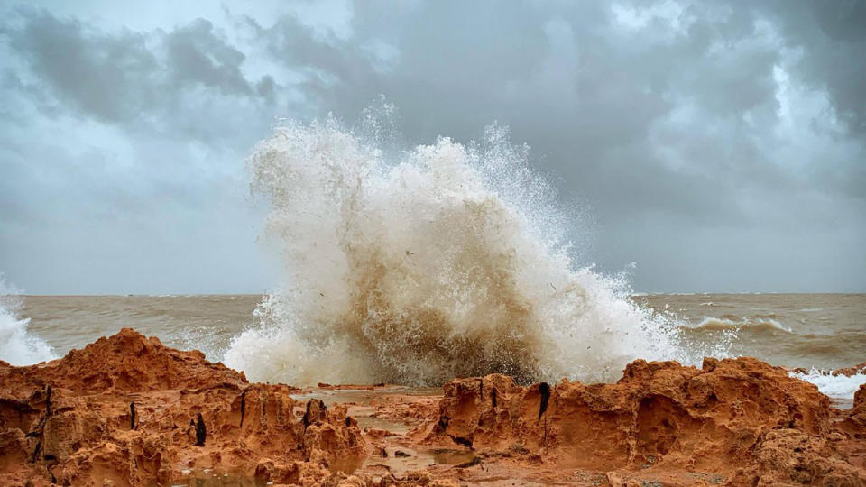
Stunning photos captured by locals showed wild swells and giant waves crashing violently into rocky parts of the North West coastline.
One man was spotted seated at a picnic shelter amid the wild weather as flooding water swelled to the height of his knees and rushed past him.

“The system is forecast to weaken below tropical cyclone intensity during Monday evening,” the bureau said.
The danger was expected to remain for most of the day with widespread and heavy rainfall causing major flooding over the Pilbara coast and adjacent inland areas.
Tropical Cyclone Veronica is expected to weaken further as it tracks westwards close to the Pilbara coast today. Conditions have eased at Port Hedland. Communities between Mardi and Whim Creek will still experience gales today. #CycloneVeronica https://t.co/B1MVXBYXhh pic.twitter.com/lveQXJx7Tz
— Bureau of Meteorology, Western Australia (@BOM_WA) March 25, 2019
“Heavy rainfall is expected to result in significant river rises, areas of flooding and hazardous road conditions,” the bureau said.
A dangerous storm tide was also predicted to hit the region in the early hours of Monday morning and damaging waves are predicted to bring inundation.
Many communities remain at red alert status.
Do you have a story tip? Email: y7newsroom@yahoo7.com.au.
You can also follow us on Facebook and Twitter and stay up to date with the latest news with Yahoo7’s daily newsletter. Sign up here.


