
The 'rain blocking' conditions preventing much-needed fire relief

While volatile weather conditions fuelling raging bushfires across Australia’s east are expected to ease slightly after Wednesday, NSW Rural Fire Service Commissioner Shane Fitzsimmons is well aware that immediate danger could be just around the corner.
“We simply aren't going to get the upper hand on all of these fires,” he said in response to the severe weather forecast thanks to another burst of hot air expected next week.
"The enormity of the task to bring these fires properly under control, to consolidate them, to get around them and mop them up is enormous."
By Tuesday, temperatures will again ramp up to the high 30s in NSW. Temperatures in Wilcannia, in the state’s west, will breach 40 degrees.

But while Mr Fitzsimmons focuses on the immediate danger with his resources stretched to their limits, he will undoubtedly be looking on in fear at the Bureau of Meteorology’s weather predictions leading into summer.
The Indian Ocean Dipole (IOD), which is the difference in temperatures between the eastern and western sides of the Indian Ocean, has weakened slightly, but it remains strongly positive and has done so since May. This is not good news.
A positive IOD means southern and central parts of Australia receives significantly less rainfall and increased temperatures for the southern areas of the country – conditions which have contributed to the ongoing bushfire crisis NSW and Queensland are currently going through.
According to BoM’s latest observations, the positive IOD is so strong, the dry and hot conditions could last well into summer.
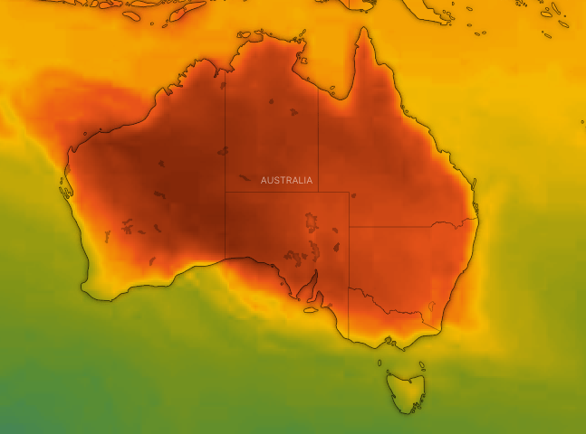
“Positive IOD events are often associated with a more severe fire season for southeast Australia,” BoM warned on Tuesday.
And while the cold front moved into Queensland on Wednesday, BoM said the fire danger in NSW remained very high because the air coming in behind was so dry.
No immediate end in sight for Queensland bushfires
And as Queensland faces extreme fire danger on Wednesday thanks to the shift in wind direction, hot temperatures in the high 30s will once again arrive as early as Friday for southern parts of the state.
By Monday, Rockhampton, north of the Yeppoon hinterland where fires continue to burn, will reach 38 degrees.
Livingstone Shire Council Mayor Bill Ludwig says the bushfire that destroyed 13 homes in the last few days behaved like no blaze anyone in the region had ever seen before.
'Proper pissed': Friend of man killed in NSW fires savages Barnaby Joyce
‘Shame on you’: Bushfire victim heckles politicians in act of desperation
Mr Ludwig says containment lines at the Cobraball fire near Yeppoon are holding, but the erratic fire is being fanned by increasing wind gusts and high temperatures.
"Nobody has seen a fire that has reacted like this - we've had bad fires before, but nothing that's moved this quickly, this dramatically," he told ABC news on Wednesday.
More than 60 fires continue to burn across Queensland, with a severe fire danger warning in place for a large swathe of the state's south.
With AAP
Do you have a story tip? Email: newsroomau@yahoonews.com.
You can also follow us on Facebook and Twitter, download the Yahoo News app from the App Store or Google Play and stay up to date with the latest news with Yahoo’s daily newsletter. Sign up here.

