
Two cold fronts set to bring heavy rain, snow and damaging winds
Australia is bracing for two consecutive cold fronts set to bring uncharacteristically heavy rain, snow, damaging winds and potentially dangerous surf.
The first of the fronts is making its way east from South Australia and will traverse Victoria on Tuesday afternoon and evening, bringing thunderstorms, isolated storms and damaging winds.
“There are currently a few weather warnings out for elevated areas of NSW and Victoria, so mainly for the Alps and really high peaks,” Weatherzone meteorologist Joel Pippard told Yahoo News Australia.
Another cold front coming in straight behind will take shape late on Wednesday as it travels up from the country’s south, and while it’s expected to be less stormy, it will likely bring more snow.
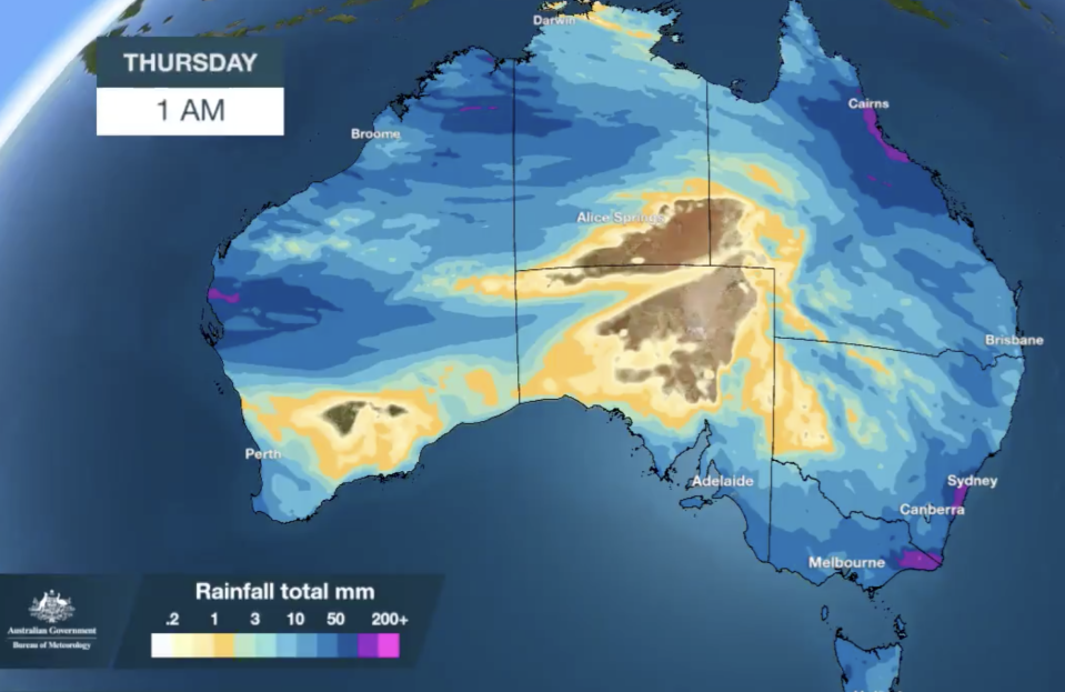
The front will track north on Thursday and bring cold air with it, meaning rainfall over the alpine regions will likely fall as snow and dump from five to 10cm in most places.
“It is interesting because of the positioning of the rainfall and the cold air mass, we may actually see heavier falls on the Central Tablelands of NSW,” Mr Pippard said.
'What's this?': Strange ring around the moon leaves stargazers perplexed
Giant sinkhole appears after heavy rain and hail smash Melbourne
“Some models are actually predicting more like 10 to 20cm of snow there which is very unusual.”
Inland regions set for substantial rainfalls
The system is expected to link up with a trough further north and bring moderate to heavy rainfall across an expansive area in northern Western Australia, the Northern Territory, western Queensland and NSW.
“Particularly areas in western Queensland that haven’t seen any decent rain at all for the last two or three months,” Mr Pippard said.
Pull out the gumboots, it's going to be a wet, wintry-like week for most of Australia ☔
A series of cold fronts will impact the SE from today, while from mid-week a thick cloud band across #NorthernAustralia will bring rain & well-below-average temps 🥶 https://t.co/UFM6xiTsKo pic.twitter.com/0Y3jOaXdHb— Bureau of Meteorology, Australia (@BOM_au) May 19, 2020
Rainfall up north originating from places that usually would be in the middle of dry season, was particularly unusual, he said.
“A lot of these places usually don’t get any rain at all in May, and we’re talking about getting 20 to 40mm of rain. So that’s very unusual.”
How cold will it get?
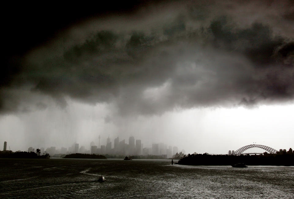
Wednesday will be the warmest this week for Sydney, where it could reach 25 degrees, before dropping to its coolest day on Friday with 18 degrees forecast.
A low pressure system forming in the Tasman Sea from Friday and strengthening during Saturday could bring heavy rain to Sydney, but could also miss the city completely, according to Mr Pippard.
“There’s a lot of uncertainty with that system, but the most likely thing will be very high surf and swell over the NSW coast this weekend,” he said.
There will at least be a hazardous surf warning and potential for a dangerous surf warning.
Melbourne set to shiver
Melbourne will likely experience a more significant dip in temperature this week, going from a top of 19 on Tuesday to 16 on Wednesday, and on Thursday just 13 degrees.
“The wind chill might be two or three degrees below that, particularly with heavy showers and it does look like Melbourne will see a fair amount of showers” Mr Pippard said.
There is likely to be two day totals of between 15 and 25mm on Wednesday and Thursday, but these kinds of downpours are not uncommon for this time of year in Melbourne.
Rain is set to continue in Brisbane until at least Friday with a weekly high of 25 degrees expected for Wednesday before a dip into the high teens for the weekend.
People in Perth have drier conditions to look forward to and a possible shower on Sunday, with temperatures hovering in the low 20s until the forecast weekly high of 26 on Saturday.
There will be more rain around in Adelaide for the week before the skies clear for the weekend, and temperatures are predicted to remain in the mid to high teens.
Hobart will be chilly with some scattered showers throughout the week and temperatures staying in the low to mid teens.
Wednesday and Thursday will be wet for Canberra where it will be near freezing on Friday with its low predicted to be just one degree, and the top to be just 13.
Darwin will have much warmer weather with daily temperatures hovering in the high 20s to the mid 30s. Rain is predicted there for Thursday and Friday.
Do you have a story tip? Email: newsroomau@yahoonews.com.
You can also follow us on Facebook, Instagram and Twitter and download the Yahoo News app from the App Store or Google Play.


