
Severe storms with 'destructive' winds over 100km/h set to lash east coast

Thunderstorms will continue to thrash Australia’s east coast this week, bringing “destructive winds, giant hailstones and flash flooding”, meteorologists have warned.
Jonathan How, Bureau of Meteorology meteorologist, on Monday afternoon said severe thunderstorms are forecast for parts of eastern Queensland and northeast NSW over the coming days, with a potential for dangerous conditions on Tuesday and Wednesday.
Queensland will bear the brunt of it on Tuesday, with storms lashing Brisbane, the Gold Coast, Rockhampton and Mackay, he said.
“Severe thunderstorms are likely and these could produce damaging to destructive wind gusts in excess of 100km/h, large to giant hail in excess of of 5 centimetres, and heavy rainfall leading to flash flooding,” Mr How said.
The same risks will extend into NSW on Wednesday, threatening Armidale, Port Macquarie and Coffs Harbour.
The bleak weather is forecast for the rest of the working week.
On Tuesday, NSW will shiver through miserable weather and cool temperatures, with a top of 20 degrees for Sydney.
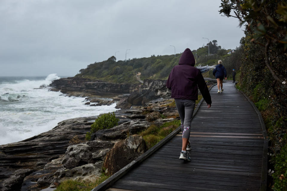
The state on Monday was lashed with heavy rain, flash flooding, gale-force winds, cold temperatures and hazardous surf conditions, but conditions eased overnight.

The SES attended 46 jobs across the state overnight with rain easing on Tuesday but heavier rain and storms are forecast to resume on Wednesday.
A three-day deluge caused a landslide at Mackerel beach in Sydney's north, destroying one house and damaging others on Monday with residents there being evacuated.
Australia's summer forecast – intense heatwaves and more cyclones
Wild weather on east coast a sign of what's to come this summer
The SES has been busiest on the Central Coast with most calls coming from Gosford, Wyong and Newcastle, while in Sydney the worst hit areas were Ku-ring-gai and Hornsby in the north and Sutherland in the south, a spokeswoman said.
Massive rainfall totals were recorded, with Gosford receiving 128mm in 24 hours and Sydney's St Ives recording 98mm.
A perfect example of how our atmosphere works in 3D:
Water vapour imagery shows an upper-level trough over central Aus moving east ; this will link with a surface-level trough to trigger #storms across #Qld and #NSW, possibly severe🌩️
Check warnings here https://t.co/touPPjieTc pic.twitter.com/o3rPr3CMJW— Bureau of Meteorology, Australia (@BOM_au) October 26, 2020
There were 14 flood rescues across the state, 11 on the Central Coast of people trapped in cars while most callers to the SES reported leaking roofs as well as fallen trees and branches blocking roads.
The BOM has issued a strong wind warning for Sydney waters, the Coffs Coast, the Hunter Coast, the Sydney and Illawarra coast
The BOM has warned surf conditions are expected to be hazardous for coastal activities such as rock fishing, boating, and swimming on the Macquarie, Hunter, Sydney and Illawarra coasts.
The NSW Police Force and Marine Area Command advise that people should stay out of the water and avoid walking near surf-exposed areas.
with AAP
Do you have a story tip? Email: newsroomau@yahoonews.com.
You can also follow us on Facebook, Instagram and Twitter and download the Yahoo News app from the App Store or Google Play.

