The Australian state bracing for its coldest day of the year
Parts of Australia will be hit with extra chilly weather this week, as one state bears down for potentially its coldest day of the year.
Temperatures in Queensland were last night between three and seven degrees lower than average, and there is near-freezing weather on the way, according to Weatherzone meteorologist Brett Dutschke.
“The next few days will be pretty chilly in southern and central parts of the the state, and be between five and six degrees below average,” Mr Dutschke told Yahoo News Australia on Tuesday.
“A few places will be chilling down to near freezing, and during the days it looks like it will be a bit colder than average over most of the state.”
While Queensland recorded its coldest temperature of the year a few weeks ago, the coming days may see the annual low challenged, Bureau of Meteorology meteorologist Peter Markworth said.
“There were a few locations that saw their lowest minimum temperature for the year today, but in general we are expecting temperatures to continue to fall in the coming days,” Mr Markworth told Yahoo News Australia.
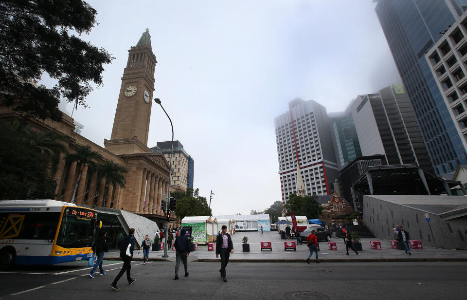
Brisbane city had its coldest morning for the year on Tuesday, recording just 9.1 degrees. In Gympie it got down to 3 degrees, while Kingaroy at -0.8 was the coldest for the state.
'Had to do something': Sad theory after man finds 20 dead turtles on beach
Set for a drenching: State-by-state guide to the weather expected this winter
'Absolutely terrible': Locals demand answers as 'devastating' items wash up on beaches
Applethorpe recorded the lowest temperature for the state this year a few weeks ago of -2 degrees, Mr Markworth said.
He said it was possible that record could be broken this week, with sub-zero and single digit temperatures expected in coming days.
In the far south, in the Goondiwindi area, temperatures are forecasted to be up to five degrees colder than average tomorrow, with a top of just 14 expected, Mr Dutschke said.
It's going to be a wet start to the week for #Tasmania #Victoria & southern #SouthAustralia & #NSW.#Snow down to 1100m through parts of Vic & NSW today, with light snow flurries possible near the NSW/ #Qld border tonight & into Tuesday. Forecasts: https://t.co/xkyhtcMBY9 pic.twitter.com/SyCd8QrlGz
— Bureau of Meteorology, Australia (@BOM_au) June 22, 2020
Residents of Charleville, Kingaroy and Roma may want to stay inside next to the heater for the next few days as the temperature plunges towards zero.
Cold winds in the south of the state related to a front that brought showers, saw a hint of sleet dumped in elevated areas on Tuesday morning, Mr Dutschke said.
“Over the next few days we can expect some frost in the early mornings, particularly in the south of the state, but there is a chance the frost will reach the central highlands area.”
Frosty mornings will be followed by largely clear skies across the state, and a few showers in the eastern Cape York area.
‘Frost and fog’ forecast for NSW
Chilly winds are affecting nearly all of NSW due to a pool of cool air lingering above the state which is also causing a few showers over inland areas, Mr Dutschke said.
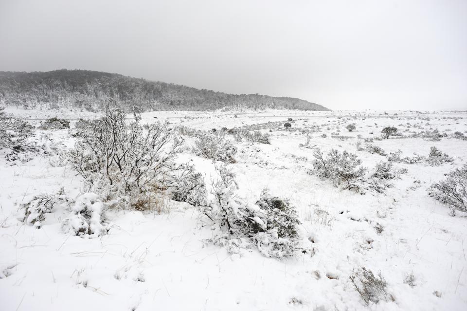
“Last night there were reports of snow along the central and northern tablelands. Not much snow, but there were a few centimetres at the main ski resorts in the alps,” he said.
Conditions are expected to dry out over most of the state in the coming days before an odd shower affecting the southern and central coasts.
“It will still be a bit breezy on the coast with wind becoming pretty gentle over inland areas. The trend of calming winds and clearing sky means that frost and fog is going to be a feature over the next few days.”
Temperatures will be as much as four degrees below average in some areas, with most places expected to be at least a bit colder than average in the coming days.
Last night in Port Macquarie it got to down to two-and-a-half degrees, which was a crisp six degrees below average, Mr Dutschke said.
Sydney is forecast to have clear skies for the coming days until some showers on Friday, with a top of 18 degrees expected for the city.
Victoria set for ‘pretty chilly’ weather
Cold winds and scattered showers were hitting Victoria on Tuesday, where a low pressure system near the southeast of the state is bringing the worst of the weather, including wind gusts between 60 and 80km/h.
In coming days conditions will dry out in inland, northern and southeast parts of the state, while southwest, central and northeast areas will still experience some light showers, Mr Dutschke said.
“It’s going to stay pretty chilly and we can expect a few areas in the next few mornings over some inland areas,” he said.
In comparison to NSW and Queensland, Victoria will have temperatures much closer to average.

Melbourne is forecast to warm up to temperatures slightly above average for this time of year, with a maximum of about 16 degrees in the next few days.
“Combined with some gentle winds, it’s going to be relatively pleasant for this time of year compared to average,” Mr Dutschke said.
Canberra in for sub-zero temperatures
In Adelaide there will be showers and a top of 16 degrees for the rest of the week, before conditions dry up in time for the weekend.
Hobart will be much the same although slightly chillier with a top of 15 forecast before sunshine and a high of 13 on the weekend.
There will be clear skies and cold weather in Canberra, where it is expected to plunge to -3 on Sunday and reach a top of just 14 on Wednesday.
In stark contrast, Darwin will avoid the rain and frosty conditions completely with temperatures hovering around 30 degrees for the whole week.
Perth will have consistent showers throughout the week with a possible storm on Friday and Sunday, the day it’s expected to reach its weekly top of 22 degrees.
Do you have a story tip? Email: newsroomau@yahoonews.com.
You can also follow us on Facebook, Instagram and Twitter and download the Yahoo News app from the App Store or Google Play.