
Photo reveals 'devastating' side-effect of downpour

NSW is in the midst of receiving its best rain in four months as the downpour across the state continues to quench the bushfires on Friday.
Sydney is expected to receive 10-25mms while up to 50mm are forecast for bushfire-affected parts of the state along with thunderstorms.
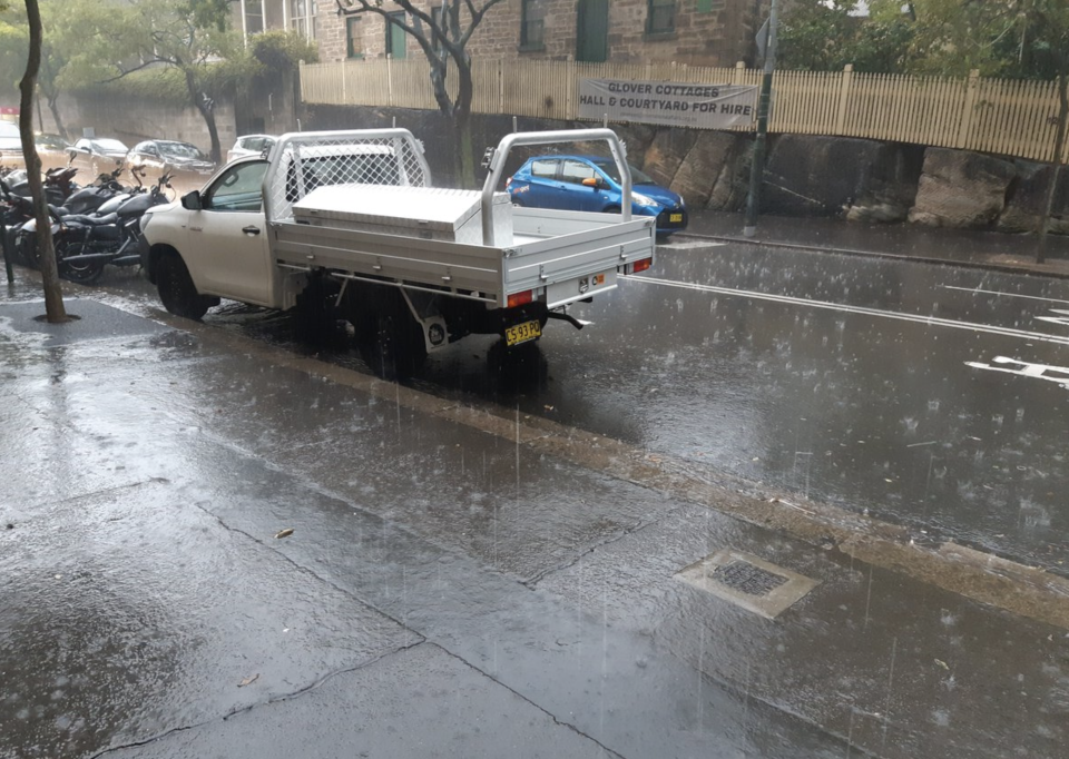
By 7am in the state capital, rain was lashing down across the city, drenching early morning commuters.
And while the rain brought great relief for exhausted firefighters and joy for drought-affected farmers, there was also a devastating side to the downpour, with hundreds of thousands of fish feared dead as a result of ash being washed into waterways from burnt areas and depleting oxygen levels.
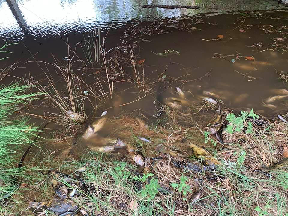
The Macleay River on NSW’s mid-north coast was badly effected with photos showing dead fish peppered along the river’s bank for 60km, residents said.
"It's devastating. It's unprecedented. It could be tens of thousands, hundreds of thousands," Bellbrook resident Arthur Bain said on Thursday.
'She was in shock': Mum captures daughter's excitement at seeing rain for the first time
Revealed: How bushfire ash is set to make it into our kitchens
There are fears further deaths will come following another large dumping of rain, with the Northern Tablelands, the Northern Slopes, the Northern Rivers, the Mid North Coast and the Hunter all expected to receive significant downpours.
Social media celebrates downpour
Social media was awash with photos and videos showing the heavy downpour.
One video showed rain pouring down steps into Town Hall station.
Many declared their relief over the rain, hoping for more to ease the drought and fire threat.
“Never been so happy to see rain!” one person declared.
Others in rural parts of NSW began sharing their joy over the heavy rain.
In two hours between before midnight on Thursday, 24mm fell in drought-affected Grafton.
In Gosford, 50km east of the giant Gospers Mountain fire, 29mm fell in just one hour by 5.30am.
Nice to see that #Sydney is getting some rain, and that it’s still incapable of dealing with it.
These are the stairs leading from George St to Town Hall station in front of the Woolworths. pic.twitter.com/UrY9Gl2GJa— Lachlan Harman 📸🏳️🌈 (@APixelShort) January 16, 2020
#Rain !!!
It’s been a long while since my backyard looked like this 😊⛈#sydneyweather pic.twitter.com/waWhCq1IoT— Angie Dalli (@angie_dalli) January 16, 2020
Most significant rainfall for four months
Falls of up to 50mm would be the state's most significant rainfall since September last year.
Rain is also expected to continue falling into the weekend and next week.
The NSW Rural Fire Service on Thursday welcomed the rain but warned it wasn't the end of the bushfire crisis.
Keep that rain dance going! 🌧 - Pic: Robertson RFS. #nswrfs #nswfires pic.twitter.com/B5f66kclkt
— NSW RFS (@NSWRFS) January 16, 2020
Late on Thursday night there were 81 bushfires burning in NSW - down from 88 just 24 hours earlier - after significant rain aided firefighters and gave them favourable conditions to strengthen containment lines.
On Thursday, there were still 1700 firefighters on the ground battling fires.
"Relief is here for a number of firefighters working across NSW," the RFS said on Twitter.
"Although this rain won't extinguish all fires, it will certainly go a long way towards containment."
The Bureau of Meteorology on Thursday night issued severe wind and thunderstorm warnings for many regions in the state.
Wind gusts of 92.6kmh at Parkes Airport, in Central West NSW, were recorded on Thursday afternoon.
Thunderstorms and heavy rain are predicted to bring flash-flooding and damaging winds to several areas including Sydney, Port Macquarie, Taree, Armidale, Orange, Canberra, Goulburn and Tamworth by Friday morning.
What a difference 24 hours and 45 millimetres makes!#rain #drought #thankyou pic.twitter.com/eIYAYzxg1x
— Rachel Gordon (@the17thphoto) January 16, 2020
If you have been following the #thunderstorm activity across #NSW today and want to know how much #rain has fallen where. Head to the rain and river conditions map at https://t.co/NvpzQDnpg9. pic.twitter.com/XmmayWdQGn
— Bureau of Meteorology, New South Wales (@BOM_NSW) January 16, 2020
Victoria’s calm before the storm
Victoria is forecast to get some reprieve on Friday from flash-flooding, blanketing smoke and lightning igniting new fires across the state.
While some "hit and miss" thunderstorms are likely in the northeast, the state is expected to have a calm Friday, with showers potentially leaving 2-5mm of rain in the eastern regions.
But the reprieve from weather conditions this week that left "the worst air in the world" in Melbourne as 77mm of rain fell in the western suburbs is not expected to last long.
Easterly winds will likely bring smoke haze from fire-ravaged areas to central Victoria on Saturday, with air quality predicted to range from "very poor" to "hazardous".
A low-pressure system could mean heavier falls across the state on Sunday and Monday, but it is not yet clear whether that rain will reach bushfire regions.
"Certainly, at this stage, there is the potential that we could see more rainfall across those fire-affected areas," Bureau of Meteorology senior meteorologist Diana Eadie told reporters.
"But it is highly dependent on exactly where that low (pressure system) is, and we will be monitoring that very carefully over the coming days."
Rain hitting the alpine and East Gippsland regions on Thursday did little to help battle the fires.
One emergency warning was placed on Thursday evening in Abbeyard.
Emergency services said the bushfire could impact the towns of Nug Nug, Buffalo River and Merrang South overnight and warned residents to leave.
Another six "Watch and Acts" alerts remained in place, as more than 1500 firefighters were kept fighting 20 active fires that have burnt more than 1.5 million hectares.
With AAP
Do you have a story tip? Email: newsroomau@yahoonews.com.
You can also follow us on Facebook, Instagram and Twitter and download the Yahoo News app from the App Store or Google Play.


