
Australia to be hit with FIVE major weather events

Victoria and Tasmania have seen historic snowfall but it seems the bizarre and somewhat chaotic weather isn’t over.
Sky News meteorologist Rob Sharpe said Australia is set to be hit by “five major weather events” in the coming days.
“There’s one for southern parts of Western Australia, a cold outbreak, then a rain event running through the east, that’ll turn into a Tasman low and then the west will be smashed by a trough that will bring heavy rain and storms to wind up the week,” he said.
“An upper cold air pool is driving Western Australia’s event while in the southeast, extremely cold upper level air is leading to snow falling right down to sea level in some areas.”
It follows the Bureau of Meteorology’s outlook released on Friday which forecast a wetter than average start to August.
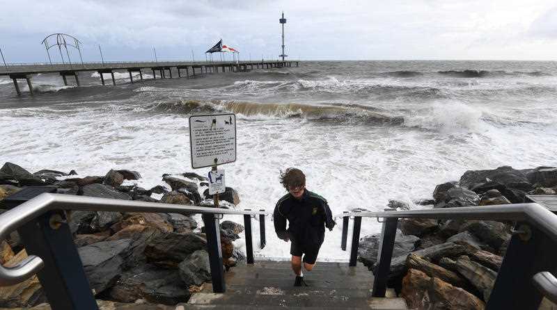
NSW braces for rain as Sydney set for drenching
The bureau predicts daytime temperatures in NSW from Wednesday through to Saturday will be below average as a deep low pressure system moves into the state.
Weatherzone meteorologist Joel Pippard told Yahoo News Australia the system will move into NSW from Thursday evening.
“Eighty per cent of the state should receive more than 10mm of rain,” he said.
“Saturday, as the inland part of the system weakens, the coastal part will develop and bring a lot more concentrated rainfall.
“Areas including Bega and Merimbula could receive 80-100mm in 24 hours.”

Sydney could also receive up to 90mm from Friday through to Sunday.
Sydney is forecast for 15 degrees on Thursday, with tops of about 17 across Friday through to the weekend with lows between 9 and 11 degrees.
Spare a thought for Ulladulla too. The town on the NSW South Coast recorded its wettest July in 66 years last week.
On Saturday it could be hit with up to 70mm of rain. Friday and Saturday have totals of up to 45mm and 50mm respectively.
#NSWWeather, Wetter and windier conditions expected about parts of NSW from Friday to Sunday as a deep low pressure system moves into the state. See the latest state forecast: https://t.co/OxwjrSmTQ7 pic.twitter.com/AixQFiuj75
— Bureau of Meteorology, New South Wales (@BOM_NSW) August 4, 2020
Temperatures are forecast for highs of about 14 and lows of 8-11.
It’s a bit of a different story for the Central Coast and Northern NSW though with rain expected to ease after Friday after receiving up to 20mm.
It will be warmer up the coast too - with highs between 19-22.
ACT prepares for rain and chilly lows
Canberra is also in for a drenching with some cold temperatures.
Friday is forecast for a low of zero with a high of just 10. Saturday and Sunday will warm up slightly, with lows of about 4 and highs of 11.
Rain is predicted to lash the nation’s capital from Friday onwards with 25-35mm forecast on Friday, 20-30mm on Saturday and 6-20mm Sunday.
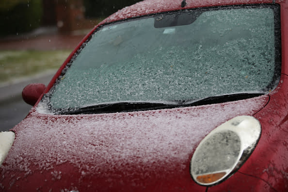
South Australia issues ‘code blue’
South Australia’s Minister for Human Services Michelle Lensink said in a statement on Tuesday the state had initiated a “code blue extreme winter weather response” for people “sleeping rough”.
The code blue will be activated from Wednesday until Friday.
“Predicted cold weather in the regions is expected to reach below five degrees for five nights or more and that’s why we, together with our homelessness partners, will be activating a Code Blue this week,” Ms Lensink said.
“People who are experiencing homelessness in these regions and need assistance to take shelter from these conditions can call the Homelessness Gateway on 1800 003 308. This number operates 24/7, every day of the year.”
Areas affected by the code include Murray Bridge, Mt Gambier, The Riverland, Kadina, Clare and Port Pirie.
Adelaide is forecast for lows of about 4-6 across the rest of the week through to the weekend with tops between 11-13 before it warms slightly on Sunday.
Clare, north of Adelaide, is in for lows of 1 and highs of just 7-9. It will slightly warm on Sunday though with a high of about 12.
Mr Pippard said some parts of Adelaide Hills and Mount Lofty Ranges, Flinders Ranges and Mount Barker will see a slight chance of snow, which is “definitely unusual”.
He said there could be up to 5cm of snow.
Some snowy scenes captured near #Sunbury and #Wallan this afternoon. If it has snowed today at your place we would love to know about it! #snow #Vicweather pic.twitter.com/HDmpMaAx3i
— Bureau of Meteorology, Victoria (@BOM_Vic) August 4, 2020
Victoria hit with light showers, cold temperatures
Melbourne won’t feel the same dramatic impact as its northern or southern neighbours but temperatures will still be quite cold.
Expect highs of about 12-15 from Friday through to Sunday with lows between 5-8.
Friday will see some showers with 3-10mm before it clears on the weekend.
Tasmania in for cold days ahead following snowfall
Launceston residents enjoyed waking to a winter wonderland on Wednesday morning.
But while the snow will melt, the cold temperatures will be sticking around.
Friday is forecast for a bone-chilling low of -2 before a low of zero on Saturday and -2 again on Sunday.
Expect highs of about 12-13 with mostly sunny conditions.
Hobart will be slightly warmer with temperatures ranging from 4-11 during cloudy days from Friday to the weekend.
It's snowing at our InfraBuild Steel Centre branch in Launceston! It's the first time since the 1950s that snow has settled in the city like this. #Tasmania #Launceston #Hobart #InfraBuildAustralia pic.twitter.com/Bc9Z91VQV3
— InfraBuild Steel Centre (@infrabuildsteel) August 5, 2020
Western Australia’s big wet after coldest day in 15 years
Perth recorded its coldest day in 15 years on Monday with a max of 12.1.
Hopetoun and Jacup broke August records at 11.6 and 9.2 respectively.
It will warm ahead of the weekend though with Perth’s max temperature to rise by about five degrees.
Sunday will see the city lashed with rain with about 15-25mm expected.
Several max temperature records broken yesterday.. 12.1°C in #Perth was the coldest day in 15 years, 9.2°C at #Jacup and 11.6°C at #Hopetoun were the coldest August days on record. #Jandakot, #Swanbourne & #Gingin also recorded new lowest August temps. https://t.co/8KIqjQScDX pic.twitter.com/IMSYOvzKtQ
— Bureau of Meteorology, Western Australia (@BOM_WA) August 4, 2020
Further south and areas including Augusta and Denmark are also due for rain but shouldn’t receive any more than 10-15mm at maximum.
Much of the southern part of the state has already been lashed by heavy showers.
A flood watch warning remains in place for the South Coastal Rivers district with 20-30mm recorded in the 24 hours until 9am on Wednesday.
Queensland set for showers ahead of sunny weekend
Mr Pippard said the weather system impacting NSW won’t affect much of Queensland.
Most of Queensland’s rain is forecast for Friday with Brisbane forecast to receive 8-15mm before it clears for the weekend.
Expect highs in the low 20s.
Goondiwindi, in the state’s southwest, should bear more of the brunt of the system though with 20-35mm forecast for Friday.
St George should also receive 20-30mm.
Northern Territory sizzles through last month of winter
You could be forgiven for thinking it’s summer in Darwin.
Expect tops of 30-31 with lows of about 20 and mostly sunny conditions. Friday could bring some morning fog.
Alice Springs will be chillier though with tops of about 18 and lows sitting between 3-4.
Do you have a story tip? Email: newsroomau@yahoonews.com.
You can also follow us on Facebook, Instagram and Twitter and download the Yahoo News app from the App Store or Google Play.

