
From extreme fire alert to cold front: East coast braces for polarising weather
While parts of NSW and Queensland are on extreme fire alert, with hot, dry and windy conditions expected for Friday, our southern states are bracing for a cold front bringing strong winds.
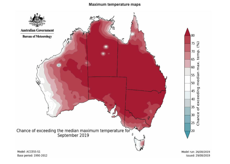
The warm, early spring conditions of northeast NSW and southeast Queensland will exacerbate fire dangers, with severe to extreme warnings in place.
Severe weather warnings are also in place for some areas of Victoria and Tasmania, but they are for damaging winds.
North NSW, Hunter set for total fire ban
Huge swathes of north NSW and the Hunter have been placed under a total fire ban, with hot and windy conditions set to make firefighters' lives a misery.
People in the Far North Coast, North Coast, Greater Hunter, Central Ranges, New England, Northern Slopes and North Western regions will on Friday be banned from lighting fires in the open.
Of those regions, the North Coast, New England and Northern Slopes regions - taking in towns such as Coffs Harbour, Port Macquarie, Armidale, Gunnedah and Tamworth - will be under extreme fire danger.
Hot, dry & windy conditions will exacerbate #fire dangers in northeast NSW and southeast Qld today, peaking Friday with severe to extreme fire dangers. Strong winds with this system will kick up a lot of raised dust through inland areas. Latest warnings at https://t.co/wdUcA3jLa8 pic.twitter.com/UYdxNh2YVi
— Bureau of Meteorology, Australia (@BOM_au) September 5, 2019
A "harvest safety alert" could also be issued, meaning farmers will need to take extra precautions when operating machinery.
The Bureau of Meteorology says very warm, windy and dry conditions forecast for Friday have created an elevated fire danger for northern NSW.
Warialda in the state's northwest is expected to reach 34 degrees on Friday, while the temperature is forecast to hit 33 in Wauchope and Scone is expecting 30.
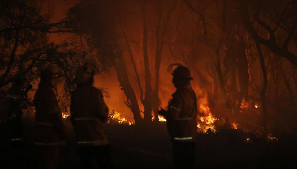
Queensland on alert as fires burn, one home lost
A fast-moving blaze destroyed a house in Far North Queensland on Thursday, as firefighters in the state's south brace for dire fire conditions.
Water-bombing aircraft are on standby with severe to extreme fire warnings issued for southern, southeast and central Queensland on Friday.
Authorities have warned conditions could reach the highest catastrophic rating in some inland areas in the state's south.
High temperatures, strong winds and low humidity mean firefighters will face an extremely challenging day, with drought-stricken communities in the south on edge as dams there are dry.
The Maranoa and Warrego and the Darling Downs and Granite Belt districts are facing extreme fire danger. Severe fire danger warnings are in place for the central highlands and coalfields district, Wide Bay and Burnett, and the southeast coast.

House destroyed by fire in Biboohra, near Cairns
Three grassfires have kept crews busy near Mareeba, west of Cairns, with one home lost at Biboohra on Thursday.
"The house was very close to where the fire started. It moved very quickly and before crews got there the house was lost," a fire service spokesman said. "The family is safe."
Two other grassfires in the Mareeba area continue to burn, one at Irvinebank, the other at Dimbulah.
A fire that has ravaged bushland near Sarabah, near Canungra, in the Scenic Rim region west of the Gold Coast, remains erratic and dangerous.
A watch and act warning remains current for residents near that blaze, which is spotting up to 1.5km ahead of the fire front.
Large trees have fallen across the Darlington Range Road and the Lamington National Park Road, blocking those routes in some places.
Crews also had to work hard to get on top of another fire that broke out near Canungra's Kokoda Barracks on Thursday afternoon.
Premier Annastacia Palaszczuk said emergency services were well prepared, and aircraft were on standby. But she pleaded with residents to listen to the advice of local fire crews, and to prepare for the worsening conditions.
Chilly air and wind coming for Victoria
Six days into spring, a cold front is coming for Victoria. The chilly air is expected to reach the state's southwest by Friday afternoon before making itself known to Victorians elsewhere.
The Bureau of Meteorology says wind is also on its way, with damaging gusts averaging up to 60km/hour likely to hit the northwest in the early afternoon.
Even stronger winds averaging up to 70km/hour are expected to lash Victoria's western coast in the following hours.
Severe weather warning for damaging winds has been updated and now includes most of the Gippsland coast as well as Alpine areas in the Northeast https://t.co/RgAMsVArXd pic.twitter.com/tY25nZZyav
— Bureau of Meteorology, Victoria (@BOM_Vic) September 5, 2019
The gales are due to die down overnight, before picking up in the state's east on Saturday.
Mildura, Ouyen, Walpeup, Warrnambool, Portland and Wonthaggi are all likely to feel the wind's brunt.
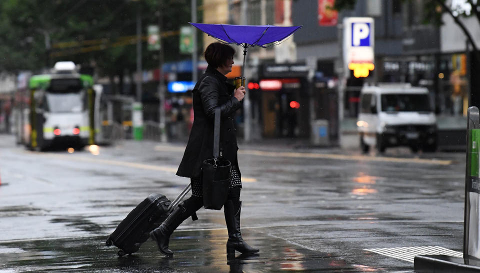
City-dwellers aren't off the hook either, with a very high chance of showers and the risk of hail and thunder in Melbourne on Friday.
The mercury is set to peak at 15, after hitting 21 on Thursday.
Heavy rain set to lash parts of Tasmania
Some Tasmanians have been told they are set to cop a drenching.
Flash flooding might even be on the cards when heavy rain lashes northern and eastern parts of the state on Friday, the Bureau of Meteorology believes.
⚠️ Severe Weather Warning issued for damaging #winds and heavy #rain over northern and eastern #Tasmania for Friday, continuing into Saturday about the east and southeast.
See https://t.co/V9LYfDAYDq for details and updates; follow advice from @SESTasmania pic.twitter.com/7A3vRFiqpL— Bureau of Meteorology, Tasmania (@BOM_Tas) September 5, 2019
With the approaching low pressure system bringing strong winds, heavy rainfall and gusty thunderstorms, please keep up to date with all the latest warnings over the next few days. They can be found here https://t.co/NHL3HY0zFO and please follow advice from @SESTasmania pic.twitter.com/jOY8OHTwTC
— Bureau of Meteorology, Tasmania (@BOM_Tas) September 5, 2019
The state's east is expected to face rainfall totals of up to 80mm, while totals of up to 40mm are likely in the northwest and central north.
Tasmania's entire eastern coast is also tipped to face damaging winds from Friday afternoon, averaging up to 60km/hour.
The gusts will move southeasterly on Saturday, with Devonport, Burnie, Launceston, St Helens, Swansea and Orford are all areas likely to feel them before they ease on Saturday.
with AAP
Do you have a story tip? Email: newsroomau@yahoonews.com.
You can also follow us on Facebook, download the Yahoo News app from the App Store or Google Play and stay up to date with the latest news with Yahoo’s daily newsletter. Sign up here.

