Damaging winds and alpine snow as wild weather hits east coast
Frosty conditions are sweeping across the south east coast, as the Bureau of Meteorology issued severe weather warnings for damaging winds across NSW, Victoria, SA and Tasmania this morning.
The winter chill will bring damaging winds of up to 120 km/h, gales and cold fronts, with bursts of snow are predicted for the Victorian alps on Thursday and Friday.
There have been multiple reports of trees down about the Mount Lofty Ranges in South Australia overnight.
New South Wales
The BOM issued a severe weather warning for damaging winds for people in parts of Illawarra, South Coast, Southern Tablelands and Snowy Mountains Forecast Districts.

Damaging winds averaging 90 km/h, with gusts in excess of 120 km/h, are likely for alpine areas above 1900 metres from this morning. While damaging wind gusts in excess of 90 km/h are possible in areas below 1900 metres this afternoon and evening, conditions are expected to gradually ease later tonight.
An approaching cold front will generate vigorous west to northwesterly winds today and the front is expected to cross the southeast of NSW later in the evening, or early Wednesday.
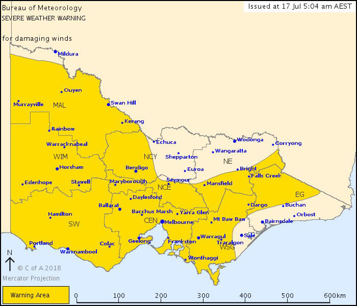
Victoria
7 news meteorologist and weather reporter Jane Bunn has forecast snow for the Victorian alps on Thursday and Friday.
“Bursts of snow coming to the alps later today and again later Thursday into Friday. I’m expecting 25 to 40 cm of #snow this week, best falls just before a dry weekend,” she tweeted.

This morning, the BOM forecast a cold front crossing Victoria on Tuesday, with damaging northerly winds averaging 50 to 60 km/h with peak gusts of 90 to 100 km/h developing in the morning and early afternoon.
Locations which may be affected include Horsham, Warrnambool, Bendigo, Seymour, Maryborough, Ballarat, Geelong, Melbourne and Traralgon and all Alpine Resorts.
South Australia
A BOM severe weather warning for damaging winds for South Australia. A fast moving front with damaging winds and squally showers is expected to affect Adelaide from 8:30 am.
South Australia should brace itself for strong to gale force northwesterly winds occurring ahead of a cold front over Yorke Peninsula at 8 am and moving rapidly east.
The front is expected to affect the Adelaide area from about 8:30 am, with the main front expected in Adelaide between 9 and 10 am, bringing squally winds and showers.
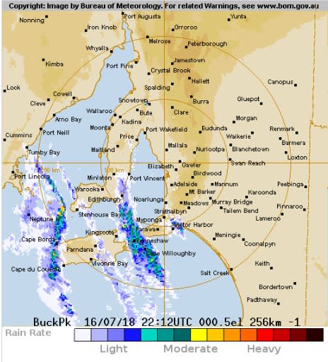
Gusts of 90 to 95 km/h have been recorded at Hindmarsh Island, Point Avoid, Cape Borda and Stenhouse Bay this morning. Winds are expected to ease over Eyre Peninsula around midday Tuesday, and in most other areas during the afternoon.
There have been multiple reports of trees down about the Mount Lofty Ranges overnight.
Locations which may be affected include the Adelaide, Victor Harbor, Port Lincoln, Kingscote, Maitland, Clare, Murray Bridge, Keith and Mount Gambier.
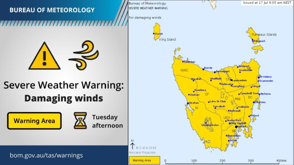
Tasmania
Tasmanians are being warned to brace for wild winds as a cold front hits the state. Damaging northwesterly winds, with gusts of more than 100km/h, are possible throughout Tasmania from around midday on Tuesday, the Bureau of Meteorology says.
Winds are forecast to ease slightly by Tuesday evening but another strong northwesterly front is tipped to develop on Wednesday afternoon.