
Winds 100km/h lash the coast as double cold front packs a punch

Strong winds and wild surf are set to stick around until late Friday in the southeast as a series of cold fronts push across parts of the country.
As of 11am AEST on Thursday, severe weather warnings for damaging winds were still in place for parts of Tasmania, Victoria and NSW.
In NSW on Thursday morning wind gusts exceeded 100km/h on the Far South Coast, 95km/h at Albion Park south of Wollongong and 93km/h at Goulburn in the southern tablelands.
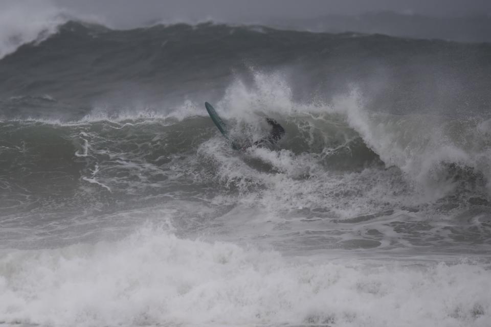
The wild weather will bring chilly temperatures, the threat of coastal erosion and waves reaching eight metres high off the NSW coast.

“A second cold front is now moving up the coast,” Bureau of Meteorology forecaster Stephen Stefanac told Yahoo News Australia.
A line of showers seen on the radar off the coast of Illawarra is associated with the new cold snap.
“It’s associated with these very windy conditions across the state and these high seas,” he explained.
In what’s been described as a wild swing, strong southernly winds will also sweep through Sydney around lunch time, Mr Stefanac said.
A cold front moving through the Bass Strait has seen damaging winds rip through southern parts of Australia overnight.
Wilsons Promontory in southern Victoria clocked wind gusts of 143km/h shortly before 2am on Thursday, Weatherzone reported.
As that front moves east, it will lose puff but strong winds are expected to continue through Thursday in NSW.
Showers likely to remain off NSW coast
Showers could also touch Sydney, Mr Stefanac said.
“Looks like the showers will stay offshore over the sea, they might just clip the Sydney coast in the next few hours and also parts of the Hunter coast and Mid-North Coast,” he said.
The cold front will move through today and by late Friday it will be closer to New Zealand when it will be replaced by a large high pressure system over NSW that will bring more settled weather conditions, Mr Stefanac said.
The bureau has issued a damaging surf warning for NSW. “By tomorrow morning we should still have some hazardous surf along parts of the NSW but that warning will likely be downgraded,” Mr Stefanac said.
Surfers were out in force along NSW beaches on Thursday morning enjoying the increase in swell.
But State Emergency Services are urging people to stay away from the beach.
Emergency crews dealing with strong winds
A strong cold front passed over Tasmania and Victoria on Wednesday night, producing wind gusts of close to 150km/h in some areas.
In Tasmania, gusts reached 132km/h at 10pm on Wednesday as snow fell to low levels in central and southern parts of the state, Weatherzone said.
The front will cause a blustery southerly change to sweep up the NSW coast and ranges on Thursday, reaching Sydney around midday and the Queensland border by the early evening.
Strong winds and big seas are developing as a cold front sweeps along the NSW coastline. Winds along the ranges are quickly easing and this, along with the deep dry air introduced by the front, should result in widespread frost tonight. pic.twitter.com/0Ef3JZqaDD
— Andrew Miskelly (@andrewmiskelly) August 22, 2019
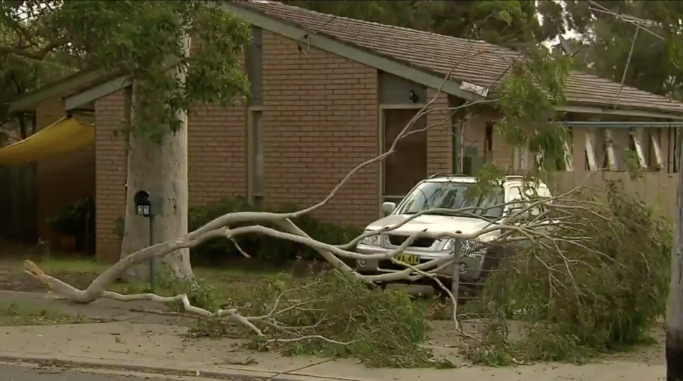
Emergency crews in NSW said they have already been dealing with the impact of the wild weather.
NSW SES spokesman Ashley Sullivan said there had been 80 calls for help in the Illawarra and the Southern Highlands overnight.
"We did see a trampoline picked up in the strong winds that ended four metres up in a tree," he told Today.
"We are asking people to be cautious, particularly in these winds."
Do you have a story tip? Email: newsroomau@yahoonews.com.
You can also follow us on Facebook, download the Yahoo News app from iTunes orGoogle Play and stay up to date with the latest news with Yahoo’s daily newsletter. Sign up here.
