
State bracing for damaging wind blasts

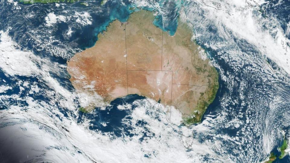
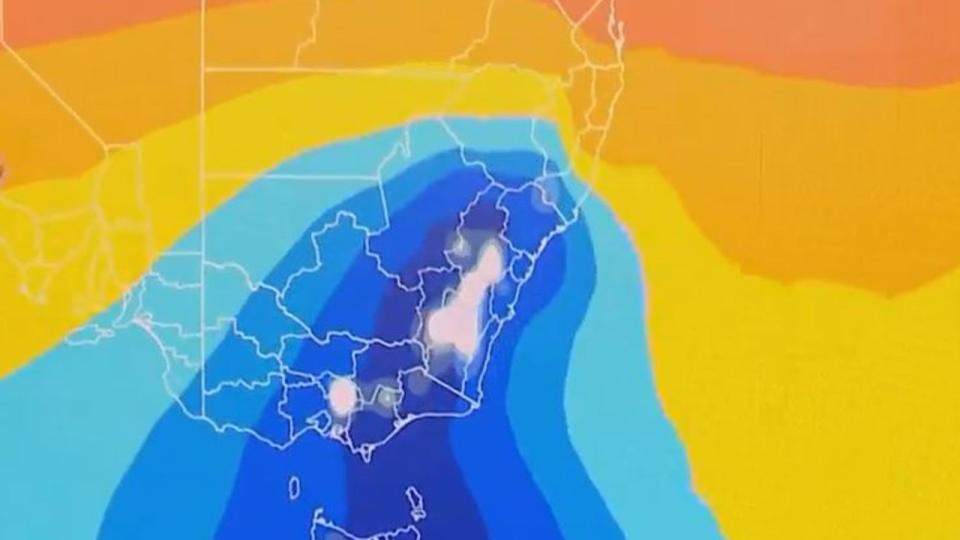
Tasmanians are being warned to expect damaging winds up to 120km per hour as Australia’s southeastern states continue to feel the blast of wild winter weather.
The Bureau of Meteorology forecasts damaging winds will hit Tasmania, ranging from 60km/h in the Western Highlands on Wednesday night to peak gusts reaching 120km/h on the east coast on Thursday morning.

“Vigorous northwesterly airstream ahead of a cold front will start to develop in parts of the western half of Tasmania on Wednesday evening and move eastwards during the night,” the Bureau stated on Wednesday.
“The front will contract to the east and northeast during Thursday morning, then clear later in the afternoon.
“Winds will shift more westerly behind the front.
“Damaging winds are expected to contract to the northeast of the state during late Thursday morning, then clear later on Thursday afternoon.”
Those areas impacted include Devonport, Burnie, Launceston, St Helens, Swansea, Strahan, New Norfolk and Hobart.
Damaging wind gusts to 100km/h are possible over much of #Tasmania overnight, contracting to the east later Thursday morning. Peak gusts of around 120 km/h are possible for a period during Thursday morning about the east coast, including Swansea.https://t.co/NHL3HY0zFOpic.twitter.com/5LH2sOWQV7
— Bureau of Meteorology, Tasmania (@BOM_Tas) May 24, 2023
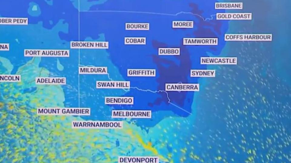
Meanwhile, the rest of the country continues to brace for more cold weather as the weekend nears.
Sky News Weather meteorologist Bradlyn Oakes said there continues to be a high pressure system across most of the county, which is causing a cold front to continue to blast the southeast.
“When we have clear conditions and high pressure, a lot of the warmth at the surface escapes into the atmosphere, dropping those temperatures,” Ms Oakes said
She said the winds in Tasmania will be the “main concern” as they push the cold front towards the mainland.
“Through the evening tonight, it will push through Tasmania and into western parts of Victoria, continuing to pass eastwards throughout the day tomorrow,” Ms Oakes said.

“Then overnight Thursday night into Friday morning, we’re going to see more precipitation into NSW. That is going to see snowfall as well.”
“Through the night tonight, over 110km/h winds will be recorded in Tasmania.
“This large area of high pressure will dominate the country for the last weekend of May, with a lot of below freezing temps through the southeast on the weekend.”
The air mass will push across the Great Australian Bight on Wednesday before bringing plummeting temperatures, blustery winds, rain, snow and hail in the coming days.
The cold snap will see average daytime temperatures drop by about 4 to 6C on Friday.
The temperature will likely feel as low as 10C below average in some places as wind chill brings an icy bite.

Snow is forecast to fall in four states as early as Thursday, with a decent dump due to hit the mainland alps in NSW and Victoria.
The polar blast could even see snowfall in the northern highlands of NSW on Friday morning when the cold air surges north.
It is welcome news for skiers and snowboarders who are hoping for a strong snow base ahead of the snow season start in the second week of June.
Snow is expected to fall around 600m elevation in Tasmania, 800m in Victoria and about 1000m in southern and central NSW and the ACT.
Damaging wind gusts are due to smash coastal areas and the ranges in most of the southeastern states before the end of the week.
Here’s what you can expect in each state.
NSW
The minimum temperature will fall to 8C in Sydney on Thursday with a chance of morning frost in the outer west.
Light winds of up to 25 km/h in the middle of the day will ease slightly to 20km/h but persist into the evening.


Friday is looking to bring showers for parts of the city with winds of up to 25 km/h.
VIC
Wet weather is forecast for Melbourne with a top of 15C on Friday.
A biting wind will arrive on Friday – on top of persistent showers – making a top of 13C feel much colder.
QLD
A sunny week ahead is forecast for Brisbane with the highest temperature of the week forecast for Friday at 25C.
There is a chance of morning fog on Thursday with a low of 9C.
Damaging winds are due to smash the city on Friday with up to gusts of up to 40km/h expected.
SA
A very high chance of showers are forecast for Adelaide each day between now and Monday.
On Thursday, a thunderstorm is possible about the hills and southern suburbs in the afternoon and evening.
Winds of up to 35 km/h are possible in the morning.
TAS
A maximum of 17C is forecast for Hobart on Thursday with a high chance of showers in the morning and afternoon.
Winds of between 25km/h and 35 km/h are forecast in the capital city throughout the day.
On Friday, the minimum temperature will plummet to 5C in the morning and will not exceed 14C at the warmest part of the day.
ACT
Canberrans can brace for an icy cold start to the day on Thursday with the minimum temperature set to plunge to just 1C.
Friday won’t be a big improvement with a minimum of 3C and a high chance of showers in the morning.
NT
A sunny week ahead for Darwin with a high of 31C each day for the next week.
Light winds will reach up to 20 km/h during the day on Friday but will lighten in the afternoon.
WA
Perth is also due to experience blue skies into the weekend but temperatures will drop as low as 7C on Thursday and Friday.
