
'Stay safe': Australia's southern states set to be lashed by two cold fronts
Australia’s southern states are set to be battered by heavy winds, rain and hail with two cold fronts approaching.
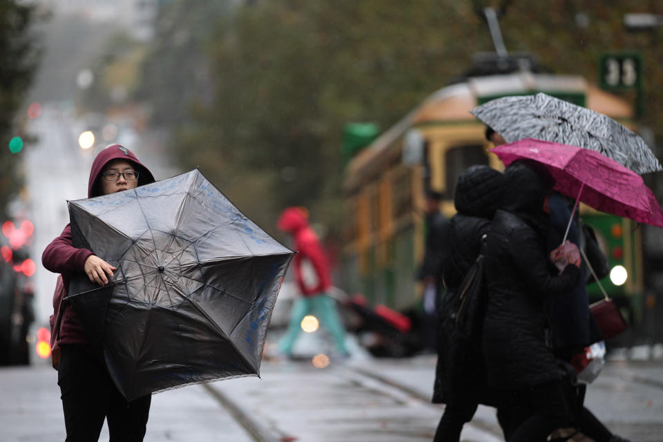
The Bureau of Meteorology has issued a weather warning for Victoria forecasting a windy Wednesday with the first of two cold fronts to hit the southern state later.
Winds averaging between 60 and 70km/h are forecast for elevated and coastal parts of Victoria’s west.
“Peak gusts of 120 km/h and blizzards are possible about the Alpine peaks in eastern Victoria from Wednesday evening,” BoM said.
Damaging wind gusts of up to 90 km/h are also expected in remaining parts of the state's southwest, likely associated with showers or thunderstorms.
Locations which may be affected include Hamilton, Warrnambool, Portland, Kyneton, Ballarat, Mt Buller, Mt Hotham and Falls Creek.
Melbourne’s CBD can also expect late showers and winds with a high of 16 before it cools to 15 on both Thursday and Friday.
Showers are expected across the weekend through to Monday.
South Australia
South Australians have also been warned to expect damaging winds, rain and hail when one of the biggest storms of the season so far hits the state.
BoM senior forecaster Matt Bass said the front was expected to cross the state from Wednesday and hit Adelaide's CBD later in the day.
"What we're looking at is quite a windy front coming through, one of the most significant fronts we've seen so far this winter," he said.
"There is a risk of damaging winds across a broad area of the state, roughly south of Streaky Bay to Port Pirie to Renmark – this includes the Adelaide metropolitan area.
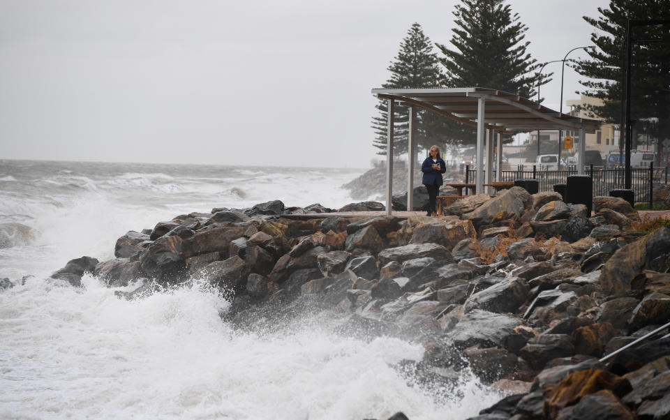
"The heaviest rainfall and strongest winds for Adelaide are likely to be from Wednesday mid-afternoon through to the evening, including the afternoon commute, so drive to the conditions and stay safe."
State Emergency Services chief of staff Trevor Arnold expected driving conditions and outdoor activities to become dangerous.
"We're asking communities to be aware this could cause minor street flooding," he said.
"We're urging motorists to not drive, ride or walk through floodwater and keep clear of creeks and storm drains and also check your gutters."
A cold front is sweeping across southeastern Australia, bringing wet and windy Wednesday. Wintry conditions are expected to persist throughout the week for SA, Vic, Tas and NSW. For the latest warnings: https://t.co/E1Sen9VjPe pic.twitter.com/Me76jVoXt1
— Bureau of Meteorology, Australia (@BOM_au) July 9, 2019
The Mount Lofty Ranges, parts of the lower southeast of the state and Kangaroo Island are expected to receive between 15 and 30mm of rainfall on Wednesday, with rainy conditions to continue to the end of the week.
Wave heights of more than five metres are expected along exposed southern coasts, while heights could increase to eight metres by Friday.
NSW and ACT
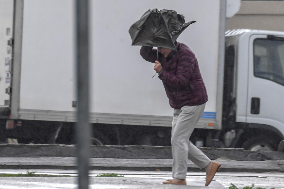
Southern parts of NSW will also be hit by “vigorous” heavy winds before the arrival of the first cold front on Thursday.
Damaging winds averaging 80 to 90 km/h, with peak gusts in excess of 120 km/h, are forecast for Thredbo, Perisher, Nowra, Bowral and Batemans Bay.
Blizzards are also forecast for areas above 1700 metres from Wednesday evening, with NSW National Parks and Wildlife Service recommending anyone planning back-country travel postpone it until conditions improve.
“Vigorous west to northwesterly winds are expected to develop ahead of an approaching cold front,” a BoM warning said.
“This front is forecast to cross southern New South Wales during Thursday.
“Another cold front is expected to cross the state between Friday and Saturday with winds only easing after the passage of the second front.”
Sydney’s weather will be far more forgiving with Wednesday to hit a high of 18.
Temperatures will remain mostly the same throughout the week before it cools to 16 on Saturday.
Mostly sunny conditions are expected.
Canberra’s temperatures are predicted to plummet. Showers are forecast up until the weekend before it drops to a low of -2 on Saturday and -4 on Sunday.
Tasmania
Tasmania will also experience a change in conditions from the cold front which is set to cross Wednesday evening.
Winds averaging 60 to 70km/h are expected to affect Tasmania’s north, central and east – including Launceston, Burnie and Scottsdale.
⚠️Warning for damaging #winds and #blizzard conditions issued for alpine peaks from tomorrow. Warning area likely to expand to include #Illawarra #CentralTablelands #SouthernTablelands and #SouthCoast on Thursday. See latest at https://t.co/DPBURwfVGM pic.twitter.com/VSNF71QWHr
— Bureau of Meteorology, New South Wales (@BOM_NSW) July 9, 2019
Western Australia
Perth will warm up through to next week.
Wednesday is forecast for a high of 19 with temperatures to rise as high as 22 by Monday.
In the state’s south, areas including Walpole and Denmark will have some showers with temperatures in the high teens before hitting the low 20s next week.
Queensland
Brisbane residents will enjoy temperatures in the low 20s for the rest of the week with mostly sunny days.
Far North Queensland will experience highs of up to 27 with possible showers.
Northern Territory
Darwin will have temperatures in the low 30s throughout the rest of the week.
Alice Springs can expect similar conditions with sunny days forecast across the weekend through to Tuesday.
With AAP
Do you have a story tip? Email: newsroomau@yahoonews.com.
You can also follow us on Facebook, download the Yahoo News app from iTunes or Google Play and stay up to date with the latest news with Yahoo’s daily newsletter. Sign up here.

