
Antarctic blast to hit Australia
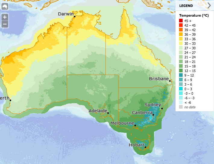
While many states in Australia have experienced unseasonably warm weather lately, it’s about to come to an end as a blast of Antarctic air is set to hit the country’s southeast at the end of this week.
Bureau of Meteorology forecasters say a pool of cold air sitting about 2000 kilometres from our shores is set to cross the southeast of the continent towards the end of this week.
Sydney
Sydney will see warm weather up until Friday when the predicted temperature will drop to just 12 degrees. It’s expected it will reach no more than 18 on both Friday and Saturday but will remain dry.
It’s likely to feel colder than that with the wind chill factor forecast to be at least 1 or 2 degrees across the city.
There’s a chance of a late shower on Saturday with a top of just 17.
Melbourne
While Melbourne will experience fairly cold weather all week, on Thursday it will drop to just 13 degrees on both Thursday and Friday, with a low of just 6 on Friday.
The weekend won’t get much warmer, jumping just two degrees to 15 on Saturday and 16 on Sunday.
Showers are also forecast and they could be heavy. Weatherzone is forecasting falls of up to 40mm on Friday.

Canberra
Canberra will see the coldest weather this weekend with a high of just nine on Friday. It will drop to 0 degrees on Saturday, with a 90 per cent chance of light rainfall.
Brisbane
If you’re looking for warmer weather, it might be worth heading north for the weekend.
Rental property trashed by 50 youths in out of control party
Boy, 16, fighting for life after suffering burns in fire pit explosion
While temperatures in Brisbane will drop slightly, the sunshine state will be spared the cold snap.
Friday will see a warm maximum of 26 degrees, dropping to a top of 22 degrees on Saturday.
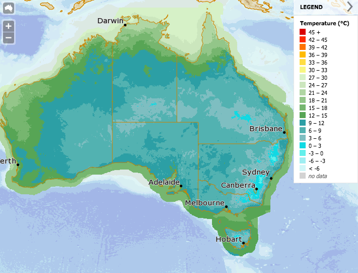
The low pressure system is from a polar vortex – a swirling mass of air that sits over Antarctica and the Southern Ocean. Occasionally, a small pool of that chilly air breaks away and makes a bee line for the north – towards Australia.
In terms of snow fall, 20cms of snow is likely to fall at Mount Hotham and Mount Buller in Victoria.
Ski resorts in NSW are forecast to get up to 40cms of snow on Friday and Saturday.
